Pinnacle Point Cave PP13B

Beez Neez now Chy Whella
Big Bear and Pepe Millard
Sat 11 Jan 2020 23:57
|
Pinnacle Point Cave PP13B – The Origins of
Man
 Larry in the front with Bear driving,
Allen, Patricia and me bundled in the back, we set off for something very
special – a cave visit with an amazing history. Soon we arrived at Pinnacle Point Golf Club, a very swanky
set-up.
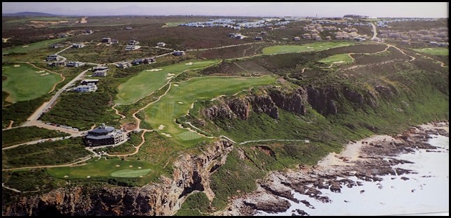 The photograph in the foyer shows the
Golf Club high above the cliffs, greens all around,
we were here to explore the bottom left of the picture. We met our guide,
Christopher who bade us enjoy a coffee while he rounded up the others who were
joining us for the tour.
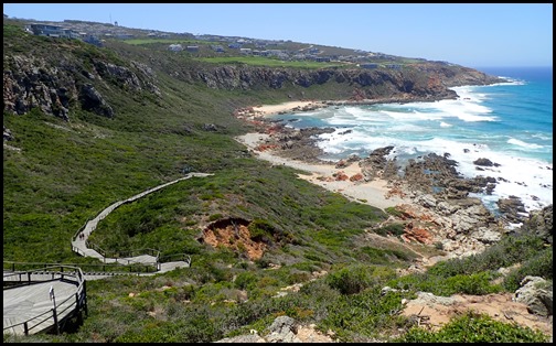 We enjoyed the
view and the coffee. Eleven of us bimbled out behind Christopher who took
us left along the cliff top to an area where marked coastal
walks begin, yay, information boards..... As I listened to our guide I
clicked away.
This cave is named Pinnacle Point
13B or PP13B. The excavations by archaeologists here have revealed findings of
enormous significance to our understanding of the origins of humanity. PP13B is
one of the most famous archaeological sites in human origins research anywhere
in the world – read on and discover why.
History of Investigation: This
cave was first recognised for its archaeological potential by Peter Nilssen and
Jonathan Kaplan in 1997 when they conducted a heritage impact study of the
Pinnacle Point area. This survey was in response to a hotel/casino/golf course
development proposal for the area above the cliffs. In 1999 Peter Nilssen and
Curtis Marean revisited Pinnacle Point to further investigate the potential of
the sites. They were impressed with the potential, and began a large
international scientific project that eventually grew to include scientists from
11 countries.
They selected four caves for
“test” archaeological excavation – PP9, PP13A, PP13B and PP13C. Test excavations
are small controlled excavations designed to reveal what is present below the
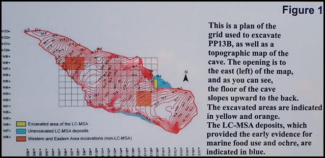
surface. Prior to excavation, they mapped the cave, and this map and the final
excavated areas are shown in Figure 1.
 The team had high hopes for PP13B
for several reasons. Some of the sediments were eroded and revealed layers rich
with stone artefacts and ancient fire places – these naturally eroded sediments
are still revealed on the south wall (right and facing the sea). Another
positive aspect of the cave was its height at 15 metres above sea level – this
is important because around 125,000 years ago there was a very high sea level,
as much as 6 metres higher than today, that washed the archaeology out of many
caves that were low-lying. The height of PP13B suggested it could preserve
layers older that that high sea level. The team arrived in 2000 and selected
three areas of the cave for excavation of that most of the cave was tested. The
first field season lasted three weeks and was very successful. Based on that
success, the team returned to PP13B in 2003 and excavated every year until
2008.
How do archaeologists
excavate?
Archaeological deposits are precious archives of
ancient lifeways, and typically take tens of thousands of years to accumulate.
They are a nonrenewable resource, and must be carefully conserved for the future
and not disturbed except for scientific investigation. When we excavate, we
destroy the sediments and materials that are removed, so excavation must be done
very carefully. Only trained archaeologists should excavate, and archaeological
sites protected under South African law.
The Scientific team at Pinnacle
Point has pioneered some of the most advanced field techniques used anywhere in
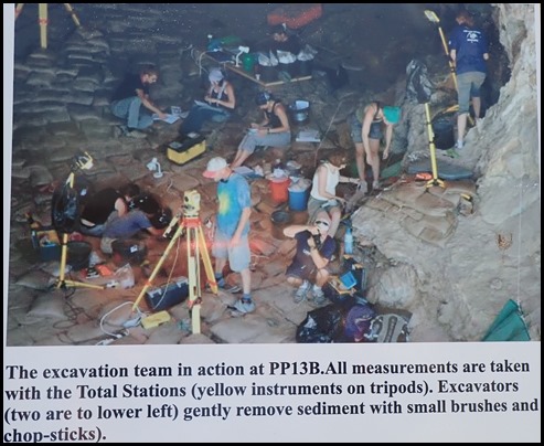
the world. Every artefact that is revealed (by carefully brushing away the
sediments) is measured with a device called a Total Station and its three
dimensional position is recorded directly to a computer with millimeter
accuracy! This allows us to reconstruct all the excavated materials on the
computer.
 The Life History of the Cave:
Archeologists typically work with large multidisciplinary scientific teams. The
excavations and study of the sediments revealed the life history of the cave and
the way people used it as a home. Caves, like people, have a time of birth
(cutting), life (when they are a cave), and death (when they
collapse).
PP13B, like all caves at Pinnacle
Point, was born when the ancient high sea level cut into weak layers of cliffs
carved out a cave. This event is dated to before 500,000 years ago, but we have
yet to discover how long ago. The first sediments in the cave date to about
400,000 years ago when the sea level was near the mouth of the cave, but people
did not live in the cave at that time.
People first began living in the
cave about 164,000 years ago. Between about 195,000 and 125,000 years ago the
world was in a cold glacial phase. Sea levels are typically lower during glacial
phases, but there was a short warm phase when sea levels rose that coincides
with this time of occupation, and the coastline came to within about 3
kilometres. People inhabited the cave regularly, probably as a home for their
families. They collected rocky intertidal one shellfish such as brown mussel and
alikreukel. There is even a barnacle of a species that lives only on the skin of
whales, so they were likely scavenging the remains of beached
whales.
The stone tools they made
included small flakes that may have been glued into hafts with resin, and points
used to butcher and hunt large animals. They hunted large antelope that are now
rare in the fynbos, such as wildebeest and eland that probably lived on the
exposed coastal platform in front of the cave that was revealed by the lower sea
levels. They collected red ochre and ground it to make powders, probably for
decorating their bodies or paint paintings (though we have not discovered cave
paintings this old).
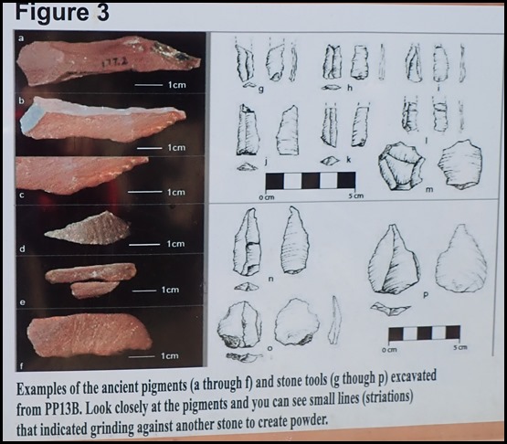 The
coastline retreated after 160,000 years ago as sea levels went down, and for
many thousands of years people rarely visited the cave. But at about 120,000
years ago, sea levels rose again as the world warmed, and the coast came within
a few kilometres of the cave once again. From that time until about 90,000 years
ago people inhabited the cave very regularly. Through this time they continued
to forage for rocky intertidal shellfish, hunt large mammals, and exploit
ochre. Around 110,000 years ago, they
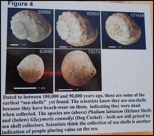
began to also collect shellfish from the sandy beaches. They collected sea
shells, including the helmet shell and the dog cockle. Scientists know there
were sea shells, because they have beach wear, indicating they were collected
after death. The science team thinks this represents a true “coastal adaptation”
when people’s lives became entwined with the sea.
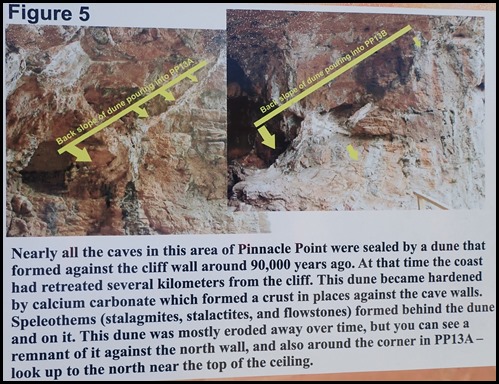
 At 90,000 years ago, the cave was
sealed by a large dune that formed against the cliff face. That dune drifted
into the cave, and remnants of its back slope can be seen cemented by calcium
carbonate against the north wall of the cave. The cave remained sealed between
90,000 and about 40,000 years ago, and so people could not use it. Sometime
after 40,000 years ago it opened again, perhaps due to erosion of the dune, or
even an earthquake.
 Why is PP13B Important? PP13B has
been featured in national and international newspapers and TV shows for its
findings – why? Archaeological sites that date to the long cold glacial phase
between 195,000 and 125,000 years are extremely rare throughout Africa, likely
because populations were very small. PP13B is one of only a handful of sites in
all of Africa that date to this crucial phase in human origins. PP13B documents
the earliest evidence we have for people exploiting the sea – 164,000 years ago
– and at the same time has the best dated early evidence for people using
pigments, in this case red ochre. Scientists think that the use of pigments
signals a complex mind capable of language and symbolic behaviour. And finally,
PP13B shows the earliest evidence for the origins of an advanced form of stone
tool manufacture called “heat treatment” – heating the tool in the fire to
make it stronger and more durable. PP13B was
the site that put Pinnacle Point on the world scientific map, and it did so with
a splash.
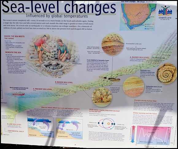 Changing global temperatures
through time have affected sea levels: Astronomers and marine-biologists have
shown that warm-cold-warm cycles, about 100,000 years long, have been a feature
of Earth’s history for at least the past 2-3 million years. During cold
(glacial) cycles the water is bound in continental ice sheets and sea level
drops about 130 metres below our present sea level, but, during warm
(interglacial) times, like those of the past 6,000 years, the ice melts and the
sea rises to levels within a few metres of that today. During the Cretaceous
period 140-80 million years ago temperatures and sea levels were highest and
lapped our coastal mountains. There was a great ice age during the Carboniferous
period and scratch marks made by an ice sheet are preserved in the underlying
bedrock about 290 million years ago near Kimberley.
A,B,C and D correspond to
different sea levels shown in the shore profile.
About 100 years ago Milankovich
discovered a long term, gradual variation of the Earth’s orbit around the sun
from nearly circular to highly elliptical over 100,000 years. When the orbit was
nearly circular, summers were cooler, and continental ice sheets that had
accumulated during winters did not melt and sea levels were low. In contrast,
when the Earth’s orbit is elliptical, it approaches closer to the sun, summers
are warmer, ice melts and sea levels rise. Time for us to actually see the
cave.
 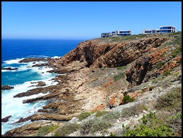 The path was so close to the edge that it upset Larry’s vertigo, he sadly
returned to the Club House to wait for us. We could just
make out the caves at the far end of the cliffs but had to stand for a
few minutes whilst a golfer teed off from the top to our
right......
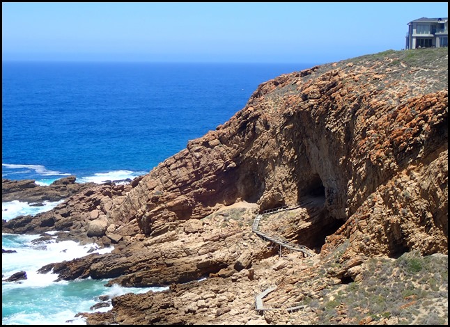 Going down the steps we saw the boardwalk zig-zagging to the cave.
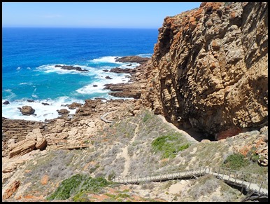 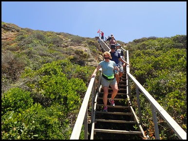 A few down
and looking back.
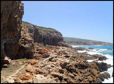 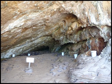 Down at the
bottom and finally up some steps to
PP13B.
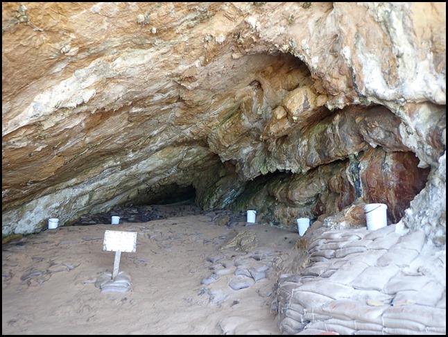 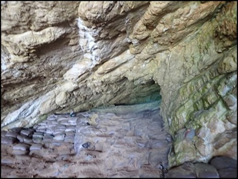 The back of the
cave, now protected with sandbags, where the camp fires were
found.
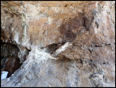 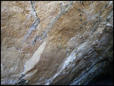 The left
wall showing where the line where the dune had filled to, bringing
different sediments with it. The well preserved ceiling.
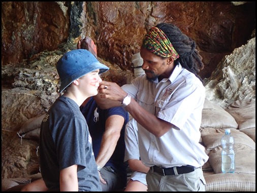 Christopher got hold of one of the
youngsters and gave an ochre face-painting lesson.
Allen was sad that there wasn’t a ‘Show and Tell
Bucket’ that we could hold or look at some of the artefacts, I guessed
they were all away in some laboratory being analysed.
 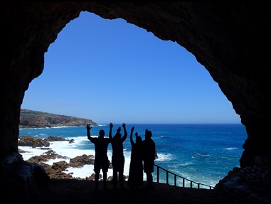 Four yachties pose at
the cave mouth.
 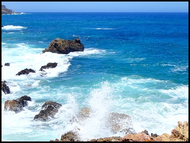 We began our way
back. Incredible to think that all we could see and beyond the horizon
was once grassland with antelope etc.
 One of the other
caves.
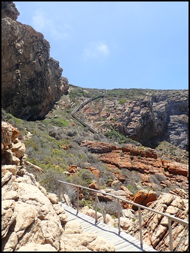 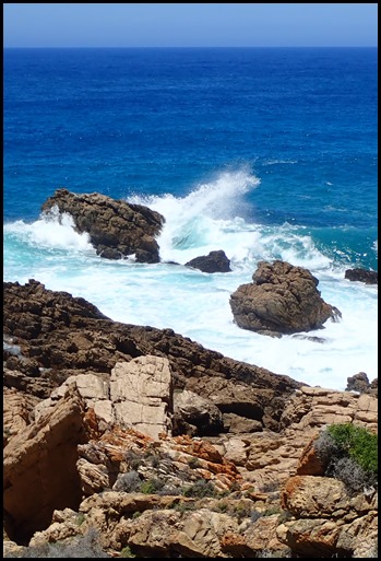 Back up the
steps and one final wave-watch.
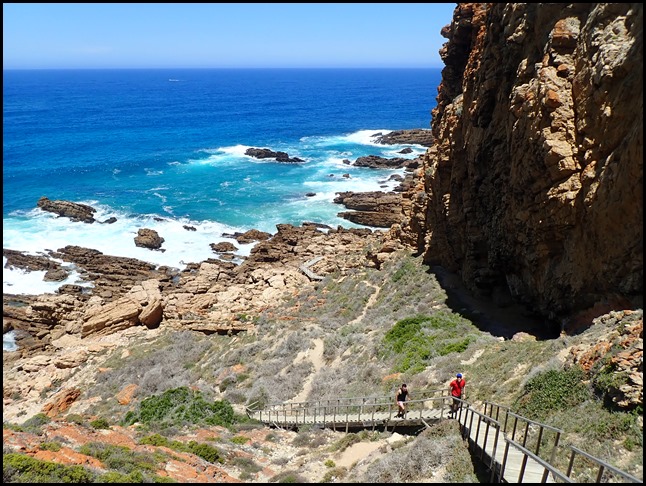 At the top. What an exceptional find
and the story fits in well with a documentary we have called ‘The First Eve’. A
wonderful, in-depth look at how from the first woman tribes moved away in search
of food and how pigment changed, dialects evolved and eventually became new
languages.
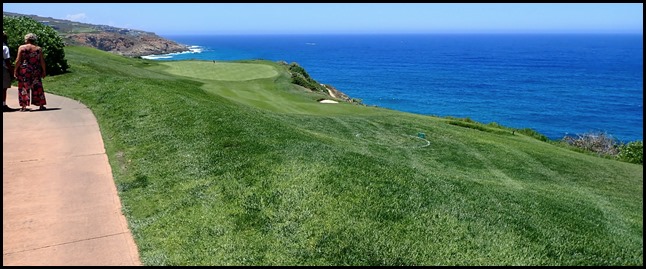 As we bimbled back to the club house
we all agreed this golf course has quite a view and
many a ball must have ‘plunked’ into the sea. We met up with Larry, enjoyed a
delicious snack lunch and Patty said she wanted to see ostriches. OK then. Larry
said the farms were about an hour away so we bundled back in the car and set
off.
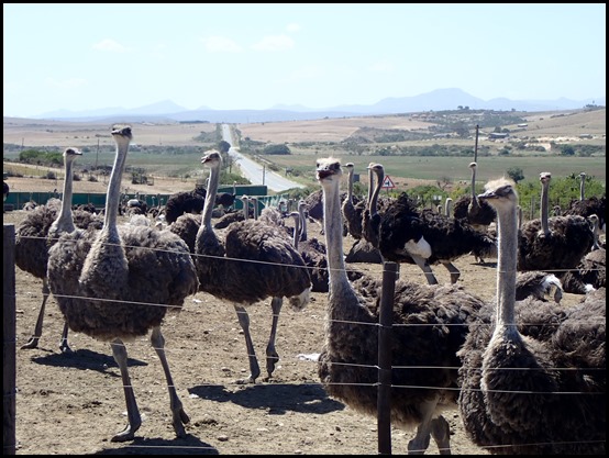 Twenty minutes along the road “Hey,
they’ll do.” Out we got and chatted to a
gang.
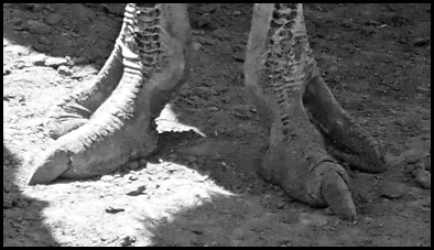 Their feet
are so incredible prehistoric.
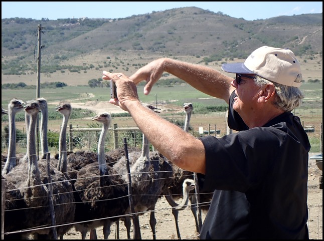 The laydees were
very taken with Allen. Larry told us the only meat yielding bits on these
huge birds comes from the thighs and neck, everything else is way too
bony.
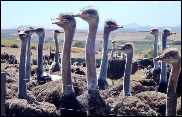 After Allen had received a good dose
of eyelash fluttering, back in the car, and, yes,
more partying like teenagers.....
ALL IN ALL A FASCINATING AND
IMPORTANT LOOK BACK
WHAT A UNIQUE FIND FOR THE HISTORY OF
MANKIND
|