To Buck Island
|
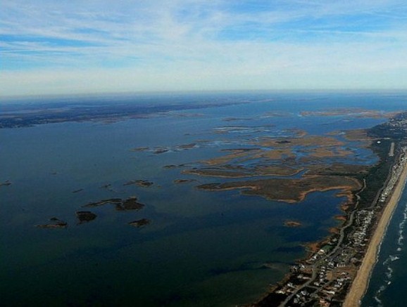
Crossing the Albemarle Sound
to Buck Island
  We
were off at ten to eight from this interesting anchorage with the small biting
hornets armed with the blunt cocktail stick stabbers; that for a change
terrorised Bear instead of me, thanks Bear. Your
welcome he says growlingly through gritted teeth - still
itching his ten or so bites on his feet. The
sunrise actually looked more like a sunset. Soon away we entered the
Alligator River. Bear's knee is unchanged, so with
painkillers to hand he sits beside me, facing my way with his leg up on a
pillow; his job to read anything of note from the guide book re: navigating,
depth, anything to look out for, upcoming bridges and
what type they are. You could say he has become my First Mate and another sort
of Beautiful Assistant to add to his portfolio (Photographers Beautiful
Assistants' mantle already worn - except he has been awarded several three
faults for refusing to carry Simon out and about). Too
bloody right - he does weigh 13 pounds.
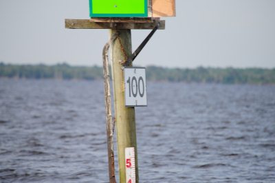   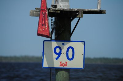 I was really chuffed to see the 100 mile marker to Norfolk,
the end of the ICW, as these are statute miles we seemed to get to the 95 and 90
quite quickly
  Away
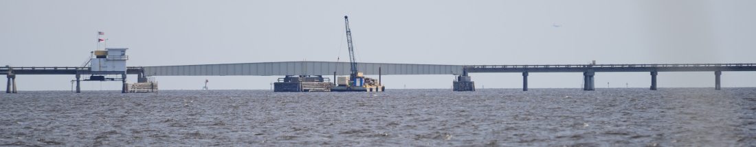
in the distance I saw the Alligator River Bridge.
A swing bridge, opens on
request. Thank you Bear. Some 2.34 nautical miles wide, seemingly in
the middle of nowhere.
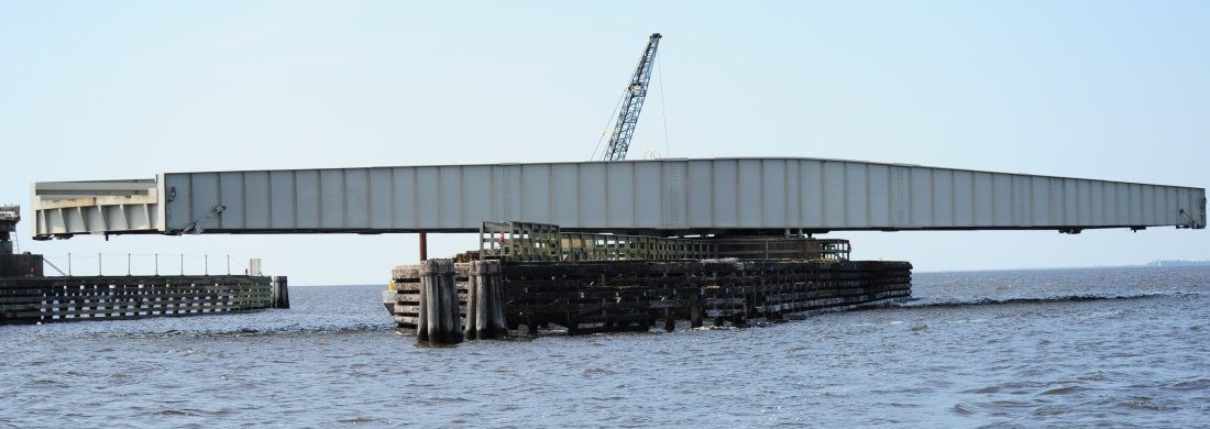 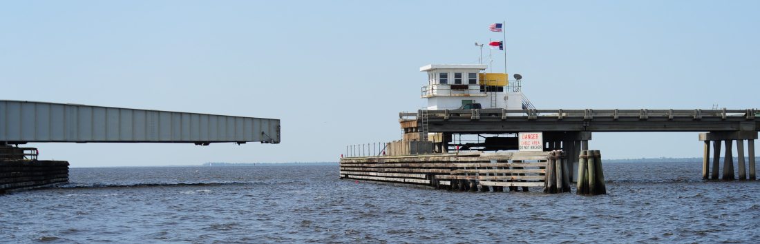 Safely through the bridge and wished "a safe onward journey
ma'am"
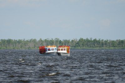 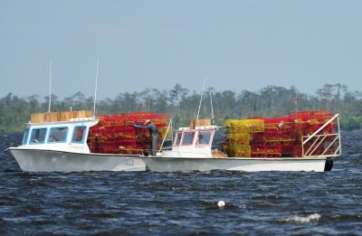 Onward to a
wiggly bit well marked with buoys and crab
fisherman hauling their many baskets
 Just
into the Albemarle Sound we saw a barge pushing a wood
chipping pile, still looks like a sand pit to me, just like the one
we met before. The wind was getting up at this point.
Albemarle
Sound is
a large estuary on the coast of
North
Carolina in the United
States located at the
confluence of a group of rivers, including the Chowan and Roanoke. It is separated
from the Atlantic
Ocean by the Outer
Banks, a long barrier
peninsula upon which the town of Kitty
Hawk
is located, at the eastern edge of the sound. Roanoke
Island is situated at the
southeastern corner of the sound, where it connects to Pamlico
Sound. Much of the water
in the Albemarle Sound is brackish or fresh, as opposed to the saltwater of the
ocean, as a result of river water pouring into the
sound.
Some small portions of the Albemarle have been given their own "sound" names to distinguish these bodies of water from other parts of the large estuary. The Croatan Sound, for instance, lies between mainland Dare County and Roanoke Island. The eastern shore of the island to the Outer Banks is commonly referred to as the Roanoke Sound. The long stretch of water from near the Virginia state line south to around the Currituck County southern boundary is known as the Currituck Sound. The sound forms part of the Atlantic Intracoastal Waterway. Its coast saw the first permanent English settlements in what became North Carolina, the Albemarle Settlements. Many inland tidewater communities along the Albemarle today are part of the Inner Banks region of the state.
Before Europeans came to the Albemarle Sound, the Algonquian Indians lived in the region. They traveled the sound in dugout canoes, and trapped fish. In 1586 the first European explorers sailed up the fifty-five mile length of the Albemarle Sound. Half a century later, the first European settlers came south from Virginia, establishing agricultural and trading colonies along the shores of the Sound. The Albemarle Sound soon became a very important thoroughfare, with small trading ships called Coasters carrying cargo to and from other colonies, and larger merchant ships bringing spices, silks, and sugars from the West Indies in exchange for products such as tobacco (a major export of the southern colonies), herring, and lumber. In 1663, Albemarle Sound was made part of the Province of Carolina by King Charles II of England and given to eight Lords Proprietors. One of these royal beneficiaries was George Monck, 1st Duke of Albemarle, for whom the sound is named.
 
Ferries were a common method of transportation through the swamps surrounding the Albemarle Sound throughout the history of the region. One ferry that linked the towns of Edenton and Mackeys, North Carolina, continued in service from 1734 to 1938, when a bridge was built across the Sound. Another longer bridge of more than 3 miles in length was built in 1990. Fishing was a major industry in the Albemarle Sound. In late spring, plantation farmers would fish for shad, striped bass, and herring. Nets used by these fishermen were sometimes enormous, with some more than a mile (1600 m) long, and were frequently manned 24 hours a day. Herring was cut and salted for export to Europe, while shad was packed in ice and shipped up the Chowan River to be sold in northern colonies. Regional striped bass tournaments attracted sport fishermen to the area, and it was considered by many to be the greatest striped bass fishery in the world. Overfishing in recent years has depleted the fisheries of the Albemarle Sound by seventy percent.

I had to hand steer across the eleven miles as the wind was gusting Force 6 to 7. I have said before that it is impossible to take decent pictures of rough water, but believe me we were thrown all over the place on six foot waves in their usual sets of three. The conditions were due to the northerly wind (not forecast to be from the north) over the shallow water of the sound - we had four metres below us - shallow for such an enormous stretch of water. There was a great deal of relief at the other side when we were soon into sheltered water, not far from days end. 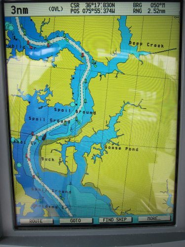 Just in case there was a repeat of blunt cocktail stick bearing hornets, as soon as we anchored up went the fly screens. A complete knob in a huge motor cruiser passed by at speed and we were once agin being tossed about. Thank Heavens for the gimble on the cooker - or else I would have had carbonara all over the kitchen ceiling. All over and playing backgammon.
ALL IN ALL AN EVENTFUL 40 NAUTICAL MILES |