Stewart Island Bus Tour

Beez Neez now Chy Whella
Big Bear and Pepe Millard
Wed 6 Aug 2014 22:47
|
Our Stewart Island Bus Tour
with Kylie
  We joined
Kylie at the Red Hut and loaded into the minibus, only four passengers – in the
summer bigger busses, on board Kylie gave us the formal Māori welcome. We looked
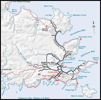
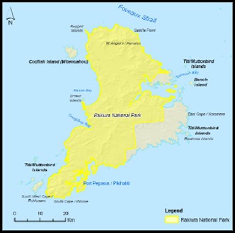
at a map of the island as Kylie explained that the island has just twenty four kilometres of road and most visitors think the
island is tiny, it is in fact twice the size of Singapore with just two per cent
of the island lived on, the rest is given over to National
Park. The island is in fact, forty five by seventy five kilometres. Off we went to our first stop a few minutes
away.
  The first islanders were Māori in the
13th Century, Kylies people came in the 1700’s. The first Europeans to arrive in
the 1800’s were a hardy lot from the Shetland and Orkney Islands. They tried
sealing, whaling, tin mining, merino sheep farming, fishing and logging. In its
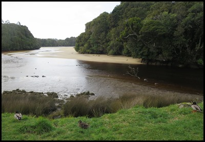
heyday there were seventeen mills sites on the island. Mill
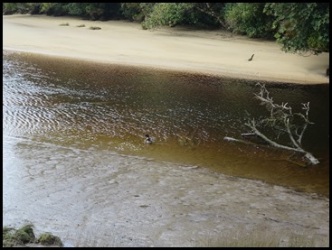
Creek was used to float the miru tree planks out to waiting vessels to
ship them over to the mainland. The water is red, peaty coloured with tannin, at low tide you can see planks that
failed quality control, lain here for over a hundred years. The ducks here are
all protected, as are most of the birds we have seen.
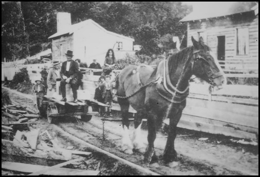 Sawmilling
families created a small community at Māori Beach, including a school
which operated between 1920 and 1935.
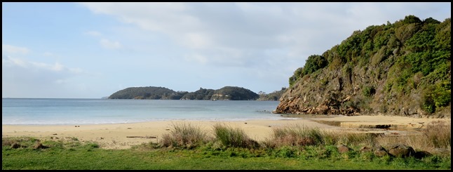
Our next stop was at Butterfields Beach, popular with locals and visitors, some
thirty thousand tourists come to the island every year, mostly between December
and March. Four ferries a day bring one hundred people at a time. South
westerlies are the prevailing winds straight off Antarctica, this particular
beach is nice and sheltered, but not for me, as in the height of summer the
water temperature only rises to between twelve and thirteen degrees Centigrade –
now a bone chilling six or seven. Visitors can come for the day or stay in
backpacker, bed & breakfast, self-catering accomodation right up to luxury
and pamper lodges.
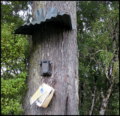 In 1902 party line telephones came to
the island connecting the locals to each other and Bluff. One was put on this
rimu tree so trampers could speak to people and not
feel isolated. In 1970 party lines ended with Telecom and later Vodaphone. To
age a rimu tree, non destructively is to hug it, if your fingers touch at full
stretch in the hug it will be around two hundred years old. This one takes three
men putting it at around six hundred years old. They are slow growing here near
the coast as the soil is of poor quality but the tree could live until it
reaches a thousand years.
  We stopped beside the massive
Horseshoe Bay. On the far side Kylie pointed out the crayfish holding building. The crayfisherman here go out in some of the roughest seas in
the world to lift their pots, strict rules apply on size. Two and a half to
three tons of crayfish can be delivered to the building from one boat. The
creatures are held in swim tanks to destress, if they stay upset they begin to
lose their limbs and antenna which renders them no good to go to market. To
comply to standards set for the mostly Asian – but some European markets, they
have to be exported within seventy two hours. Blue cod is the common fish to be
caught here. There are extensive oyster beds and the island is famous for its
clam chowder and green-lipped mussel dishes.
  Our next stop took us down a short
path to a curious object. The first telephone line
exhibit.
Until 1902 Stewart Island/Rakiura depended upon small sailing vessels for
communication with the mainland. That year, Member of Parliament for Awarua Sir
Joseph Ward was appointed Acting Prime Minister and he grasped the opportunity
to fulfil a long held promise to his island constituents. He secured sufficient
submarine cable to link Bluff and Lee Bay – and allowed just seven days to
complete the project. This included the challenging task of laying five
kilometres of line over bush-clad hills between here and the telephone exchange
at Halfmoon Bay.
The security that
telephone communication brought to the island was expensive. The initial cost of
four thousand pounds was hardly balanced by an estimated revenue of twenty five
pounds per annum. Repairing frequent breaks, especially where the cable came
ashore over rocks at Bluff’s Ocean Beach, was also frustrating and costly. In
1947 the submarine cable was replaced by microwave radio.
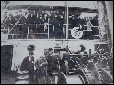 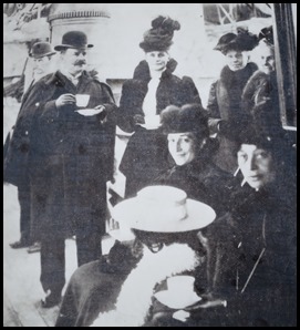 Officers and
guests on the bridge of the SS
Tutanekai.
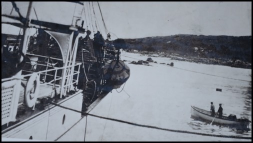 Approximately
thirty two kilometres of cable was paid out over the bows of
SS Tutanekai, weighing six tons to the mile. A six kilometre
detour skirted around the oyster beds.
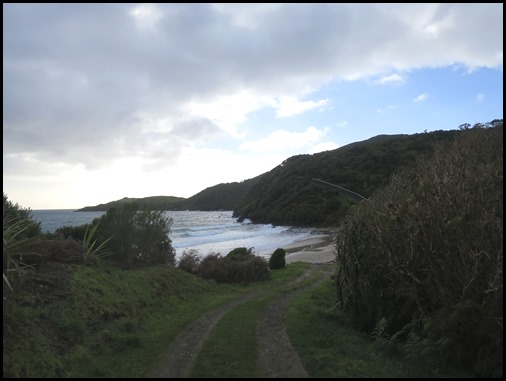 Looking down to
Lee Bay was enough for us. It had come over very grey
with a freezing cold wind and the big raindrops were not conducive for a stroll
along the beach. What was interesting was the very formal fence seen as a line
to the right of the bay. This is the two point one kilometre long,
state-of-the-art, ecologically engineered fence belonging to the Dancing Star
Foundation. This fully enclosed reserve belongs to this privately owned charity
, which has several reserves around the world. They have made this area pest
free and are maintaining a watchful eye as to how quickly they can render this
land, as was, the project here began in 2004. There are currently one hundred
and twenty six native plants and trees, seven invertebrates and eleven native
birds, the Stewart Island Robin and Rifleman are just two of the success
stories. There are between eighteen and twenty thousand Stewart Island kiwis –
Tokoeka, on the island, many islanders have never seen one in the
flesh.........
 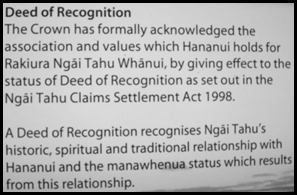 The information board here showed us what we were looking
out at. Also the Deed of Recognition that has “swept away from the island any
old niggles about the history of the ownership of the island and its spiritual
importance to the Māori people. The line in the sand was drawn with parties and
each year a friendly game of rugby takes place between the natives and the
whities........” Sounds like a lot of fun.
Sadly, the only
way to see this picture ‘in the flesh’ over Mount
Anglem, is from the air or after some serious tramping. The mountain’s
English name honours Captain William Andrew Robert Anglem, who lived at the Neck
with his high-born Māori wife Te Anau. The accuracy of Anglem’s 1846 Foveaux
Strait chart made a valuable contribution to Captain John L. Stokes’ survey of
southern coastal waters on HMS Acheron. Stokes named the mountain “in memorial
of great assistance” from the captain.
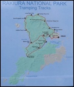 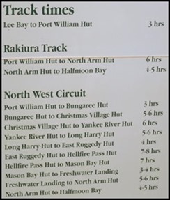 Tramping map and shorter route times.
Lee Bay is where the road ends and
the track to New Zealand’s southernmost national park begins. Access to Rakiura
National Park – 140,000 hectares or 80% of the total land area, is on foot or by
boat. Lee Bay is the entry point to more than 200 kilometres of walking tracks,
including the rugged wilderness experience of the ten to twelve day North West
Circuit and the easier, three day Rakiura Track.
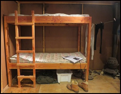 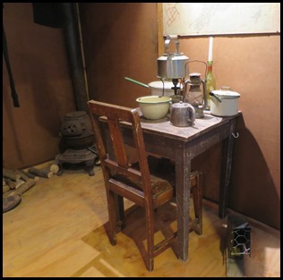 An example of a trampers hut, this
one we saw at the Visitors Centre is a replica of one found on Codfish Island –
Sealers Bay Hut. Some huts are for one, two and up to eight, they can be
pre-booked if have researched your route and know a bit about what you are
doing. There are some areas in the country, as in Fiordland, where you have to
let the authorities know and get permission – from a safety point of view.
Happily we won’t become trampers anytime soon. Neither of us are built for some
of the humungous backpacks we’ve seen and all those
dangly bits, shoes, boots, washing, bed rolls......... ugh. It’s
wonderful for the young and fit.
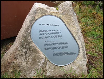  We walked a couple of minutes out of
sight and there was the anchorstone and anchor, the
other end of which we had seen on Bluff. Kylie made a
formal gesture to Bear as a pākehā or British European, he
had to be her “handsome Scottish man being welcomed by a native island girl.”
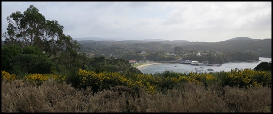 Back in the van, we journeyed to the
other side of the bay, all of ten minutes at slow speed........ we stopped to
look out over Halfmoon Bay.
 Kylie swung the minibus around to
visit this pretty little, simple new build. Anyone can buy land here, but even
the plainest of houses have noughts added to the estimate. Shipping, hiring the
car recovery unit to unload the delivery boat, shifting the raw materials,
laying the electricity supply to the site and building costs. Nothing here gets
wasted as everything is seen as a precious commodity. It costs two hundred and
thirty dollars to get a car delivered, extra to have it off-loaded. The car will
run until it dies, each year having to pass its MOT. At the end of its life a
notice will go up that the owners will take it to the tip. All islanders then a
week of amnesty where they can go and strip it bare of useful items. It is then
sold to a scrap man on the mainland, this recoups the cost of getting it here in
the first place. At the tip is a bottle crusher, when crushed the glass is then
added the gravel that is laid on driveways. Twelve hundred tons of re-cycling is
managed at the tip every year. There is even a worm farm.
We saw all kinds of poultry, chicken,
ducks, quail, however pigs are banned and no-one can keep a rabbit. There are
white-tailed deer on the island, which although seen partly as a pest, are what
brings hunters to the island, thereby helping the economy. Each household
collects rainwater. Everyone here seems to honour mother nature in the right
way.
Mail is flown in
on a daily basis, the ‘Post Office’ – one of the Council buildings, needs an
hour to load everyone's post boxes ready for collection.
There are two paramedics nurses that
tend to the day to day needs of the islanders in the clinic, open two hours
every day. Emergencies are dealt with in the home, if need be, air transport is
arranged for the twenty minute flight to Invercargill.
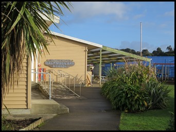 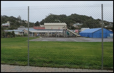 Back through Oban, we pass Halfmoon Bay School, twenty three pupils to two full-time
teachers with two classroom support staff. On their thirteenth birthday, these
youngsters will then go to the mainland for senior school and university, most
return for school holidays, some not at all. Female working opportunities has
opened up dramatically with science and research based degrees working for the
Department of Conservation. Many traditional homes, such as Kylie’s sees her
work all summer and her husband all winter.
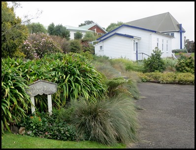
We drove past St. Andrew’s Catholic Church, the first church on the island. Whilst the Presbyterian Church dominates on the other side of Halfmoon Bay, we thought this little church was very sweet indeed.
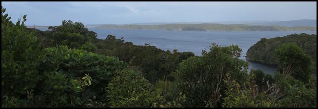
Our last stop was at the lookout over Ulva Island.
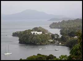
A few minutes walk took us to the lookout over Golden Bay, Iona Island, clearly named for my lovely cousin and then to her right, the last house in New Zealand.
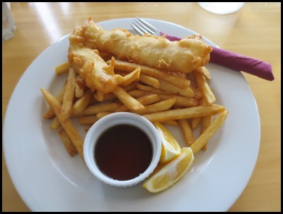
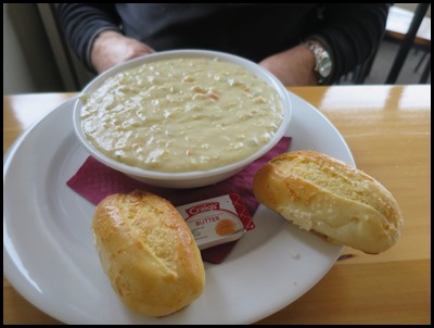
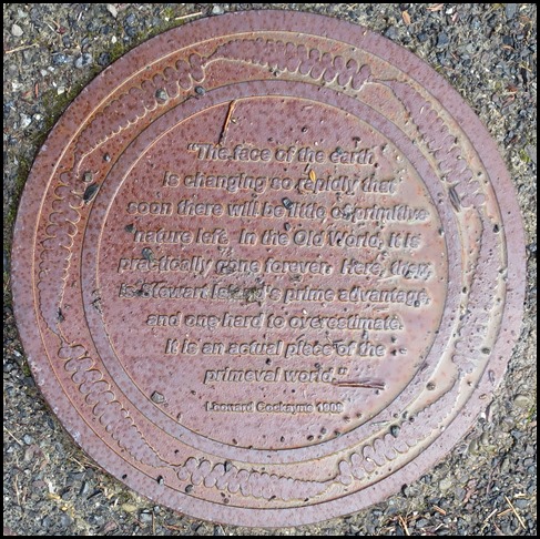
Wonderful tour over, nothing for it but to settle in the South Seas Hotel for me to sample blue cod and chips with lashings of vinegar and Bear to enjoy the ‘famous’ clam chowder before getting on the ferry for our lively trip back to Bluff. To end our visit to Stewart Island are the words we saw on a plaque by Leonard Cockayne in 1908:- “The face of the earth is changing so rapidly that soon there will be little of primitive nature left. In the Old World, it is practically gone forever. Here there is Stewart Island’s prime advantage, and one hard to overestimate. It is an actual piece of the primeval world.”
ALL IN ALL AN ISLAND COMMITTED TO
THE BEST OF ‘THE OLD WAYS’
VERY INTERESTING CULTURAL
EXPERIENCE |
