To Deltaville
|
To Deltaville Marina,
Virginia
 We
had a very quiet night, very different to the rockin' n' rollin' of New
York added to the wobbly jetty, clattering against the post, by comparison
the silence was deafening. Up and ready for the off at 8:30 with a good weather
forecast, Bear upped the anchor and rounded out from behind Sandy Hook breakwater.
 We
left behind the local fisherman, Bear tells me they
are fishing for shrimp. It is a strange thing to watch, the men looks like they
are hoovering - nice hip movements......
  So
close to Coney Island yet so different. As we neared Flynn
Point we saw a girl on route to New York.
A very uneventful day motor sailing. Bear pulled in a couple of mackerel, and then the Coast Guard chirped about a sweaty diabetic, which was less harrowing than the poor diver who died after coming up from a deep, mixed gas dive. We only heard the Coast Guard side of the transmissions that seemed to go on for hours - there is something quite awful about being over a hundred miles away from someone who is in trouble - the diver was given CPR for a very long time, he didn't have that on his mind as he cleaned his teeth this morning. RIP. I have often been heard to say to Big Bear, "No one out here but us kids", a line from some movie or other. Well this time we really were all alone when a storm warning sounded on our weather radio. Thunder and lightening due in twenty minutes, twenty miles north of New Jersey and in New York Bay, heading south east at twenty miles an hour, an associated tornado warning for the next couple of hours. With that the sky went very dark and at 17:30 it was as if it was midnight; with a bit of luck the storm front should slip past the back of Beez and out to sea. The weather reports we listen to have been very accurate and soon we were watching lightening off over our right shoulders. The front did indeed pass by and the second part of the storm. The radio said to take shelter if possible. Our nearest inlet was blocked by an anchored catamaran so we had no choice but to press on. We headed in a little toward the only bit of clear sky and crossed our fingers as the warning was now for Tom's River - just eight miles behind us, this one may well be a very close thing. The lightening began to pick up in speed and intensity and we could feel the thunder reverberate in our chests. The wind had been steady around twenty knots, now dropped to seven - indeed the calm before the storm - as the old saying goes. Just then the skies opened, the noise and light awesome. We got the main sail down, Bear put the computers in the oven, the small electrics in the microwave, then we waited. The rain came so hard it was painful, nothing for it but to go downstairs and shut the hatch behind us. A first for us. As I went down I looked at the wind speed, 53.6 knots from behind us. Force Ten. Downstairs Bear sat at the desk with the hand held steerer, I stood at the kitchen window keeping the best lookout that we could manage in the circumstances. Being alone we knew no matter what happened to visibility we had no-one to avoid, but there was a navigation buoy somewhere ahead to miss. Mind you, I did think if it all got too hairy we could always tie up to it, Bear didn't fancy that too much but at least we had options. The lightening now was all around us, I saw one bolt about three feet off our port side and the thunder sounded like we were taking cannon fire. Luckily enough the sea was kindly and the really heavy rain eased enough for me to go back to my post to continue my watch. After two hours all settled with the lightening passing us out to sea. I went to bed at ten, leaving Bear to his own lightening display - now out at sea - Beez Neez had not batted an eyelid throughout, her only damage was to lose the windex (wind direction arrow) from the top of the mast and her port navigation light, the starboard had gone too but a quick wiggle from the Captain and it leapt back into life. I had quite a good sleep and was perky for my two o'clock watch. Bear was soon in bed and soundo, all back to normal then.
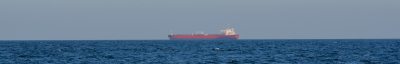 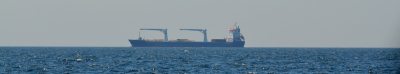
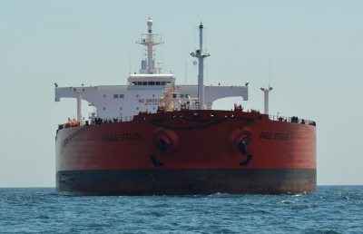
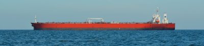
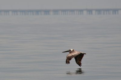
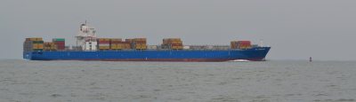
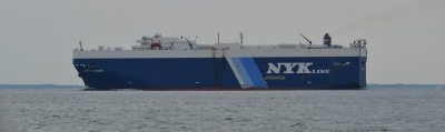
The second day at sea was just like being on a garden pond, we found it hard to believe we were actually on the Atlantic Ocean, especially after the nature’s personal firework show last evening. This is Eagle Stealth at anchor in sixty two feet of water, fifteen miles offshore. This massive tanker weighs in at 105,322 tons, her draught is forty six feet (won’t be seeing her up the Intracoastal Waterway then). Her length is seven hundred and eighty four and a bit feet and she is a hundred and thirty eight feet wide, we passed by and as she faded into the distance another young lady appeared in front of us. After that nothing but a few fishing girls.
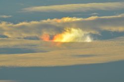
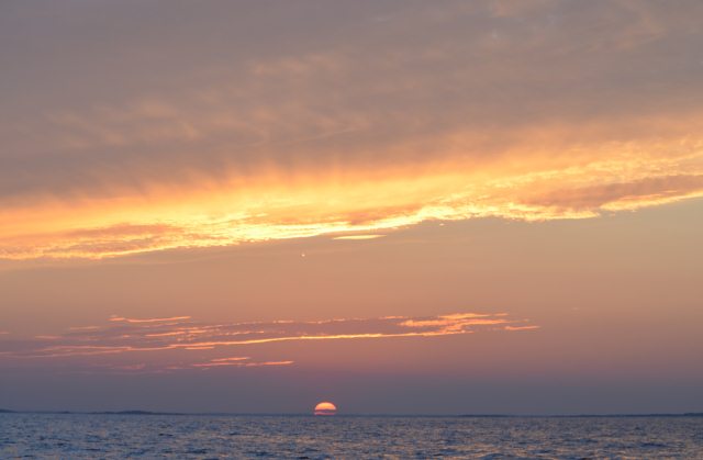
The thing I like after a good storm is the next sunset; which is often a very interesting one, this one did not disappoint
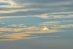
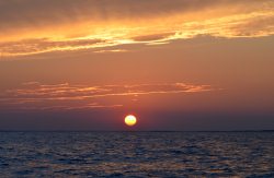
Sunrise on the 30th of July
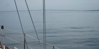    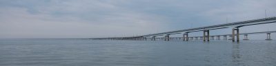 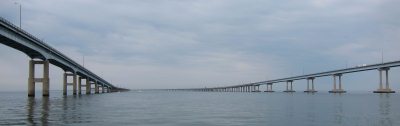  
Nothing then until we saw the CBBT (the Chesapeake Bay Bridge and Tunnel) in the distance, Mr and Mrs Pecalin - a really welcoming sight and under the bridge at 10:30
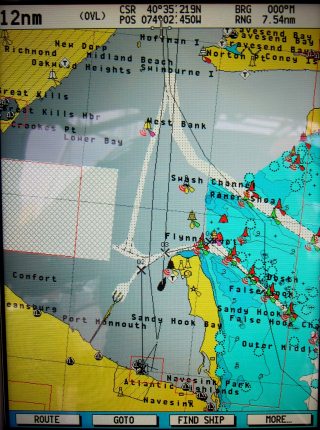
The Chesapeake Bay (Chess-a-peak) is the largest estuary in the USA. Impressive to see on the LandSat view. It lies off the Atlantic Ocean, surrounded by Maryland and Virginia. The Bay's drainage basin covers 64,299 square miles in the District of Columbia and parts of six states: New York, Pennsylvania, Delaware, Maryland, Virginia and West Virginia More than 150 rivers and streams drain into the Bay and it comprises 64,000 square miles of bays, marshes and rivers. Amazing to think the from the CBBT we still had a three hour journey, only going a short distance on the map on the right to Deltaville, seen just above Norview (in red), a tiny part of this massive estuary.
 
The Chesapeake Bay is approximately 200 miles long, from the Susquehanna
River in the north to the Atlantic Ocean in the south. At its
narrowest point between Kent
County's Plum Point (near Newtown) and the Harford
County shore near Romney Creek, the Bay is 2.8 miles wide; at its
widest point, just south of the mouth of the Potomac
River, it is 30 miles wide. Total shoreline for the Bay and its
tributaries is 11,684 miles and the surface area of the bay and its major
tributaries is 4,479 square miles. Average depth of the bay is 46 feet and the
maximum depth is 208 feet. The bay is spanned in two places. The Chesapeake Bay Bridge crosses the bay in Maryland from Sandy Point (near Annapolis) to Kent Island and the CBBT in Virginia connecting Virginia Beach to Cape Charles. It has environmental issues, but is noted for its beauty; in recent years, a pattern has been that it is becoming "emptier", with fewer crabs, oysters and watermen, as we entered we were welcomed by several little boats.......
.......and a couple of chums crossing the buoyed channel
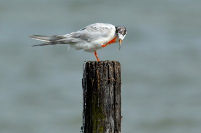
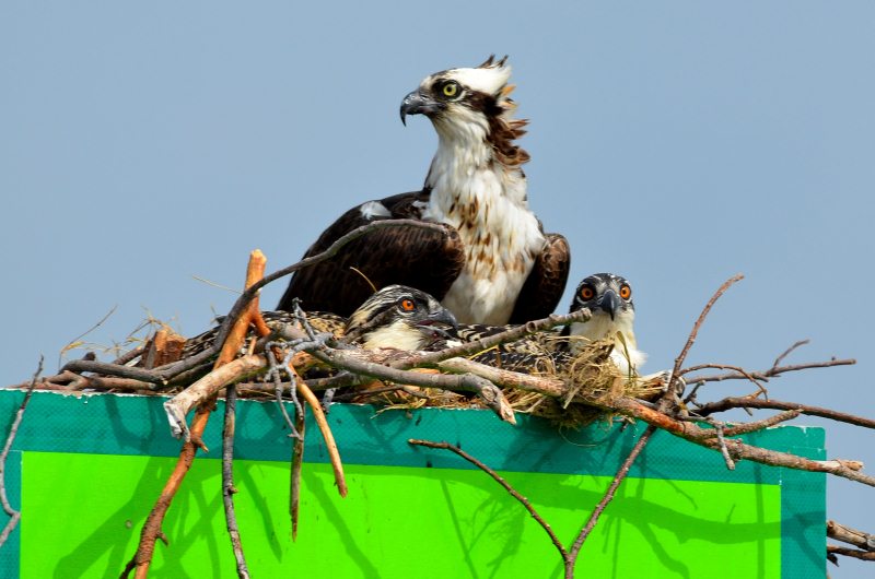
Bear had thought the osprey nests would be empty by now but I was thrilled to see them as we pulled into Deltaville marina, even a tiny sea bird who promptly scratched his head in unwilling welcome. Bear pointed out our slip - B19, a tiny gap with six inches each side of Beez - with no bow thruster the backs of my kneecaps were sweating.
All went well and we were soon settled, third boat along, you can just see Beez logo poking out, in front of her Kismet who overtook us on the ICW. So here we are after two nights at sea and 296.28 nautical miles at half past four. Now for some major maintenance work and minor repairs. The last picture of this blog has to be of our friends.
ALL IN ALL AN INTERESTING LIFE FULL OF 'WHO KNOWS WHAT'S NEXT' A VERY DIVERSE JOURNEY
. |