To T + C's
|
En Route to Grand Turk in the
Turks and Caicos Islands
 We enjoyed
the day (11th of March) playing games, checked the weather on wind guru and
stowed stuff in readiness. Everything quiet here as only a tiny cruise ship in.
Friday, our favourite day to set off on a 'biggy', our journey to Grand Turk on
the Turks and Caicos Islands will take anything up to four days. We got on the
fuel dock at twenty to five. Very amusing watching Bear fight with the nozzle
better designed for big chaps. The diesel was delivered so fast that Beez choked
on the bubbles, everything had to wait while Bear held the valve open as little
as possible. To fill her, he needed to give Beez eighty four litres that took
just over half an hour, half this time would see thousands of litres pumped into
a big girl. I sat and filled the water tanks "I'll give you it at half strength"
said a bored attendant. Diesel, water and a jerry can of petrol came to
$133.02. Off we set at twenty five past five. Soon as we cleared the
harbour and got into the bay, up went the main, out came the genoa and off we
went. Sunset was the strangest one we have ever
seen with the sky looking like an orange angel layer cake. A good night. Day
dawned on the 12th. We caught our first mahi-mahi in the afternoon (own blog). A
good day sailing. Night fell and at two in the morning we were in the Puerto Rico Trench.
 The Puerto Rico
Trench: The island of Puerto Rico lies immediately to
the south of the fault zone and the trench. The trench is five hundred miles
long, has a maximum depth of 8,605 metres or 28,232 feet at
Milwaukee Deep, which is the
deepest point in the Atlantic Ocean (the purple bit
on this cross section). Far too deep to show up on Beez depth
gauge....
Geology:
The
Puerto Rico Trench is located at a boundary between two plates
that pass each other along a transform boundary with only a small component of
subduction.
The Caribbean Plate
is moving to the east while the North American Plate
is moving to the west. The North American Plate is being subducted by the
Caribbean Plate to the southeast of the trench. This subduction zone explains
the presence of active volcanoes
over the southeastern part of the Caribbean Sea. Volcanic activity is frequent
along the island arc southeast from Puerto Rico to the coast of South
America.
Puerto Rico, the USVI's, BVI's and the Dominican Republic do not have active volcanoes; however they are at risk from earthquakes and tsunamis. The Puerto Rico Trench is capable of producing earthquakes higher than Magnitude 8.0.
Public
awareness: Knowledge
of the earthquake and tsunami risks has not been widespread among the general
public of the islands located near the trench. Since 1988, the Puerto Rican
Seismic Society has been trying to use the Puerto Rican
media to inform people about a future earthquake that could result in a
catastrophic tragedy. Following the 2004 tsunami that affected more than forty countries in the Indian Ocean, many more people now fear of the consequences that such an event would bring to the Caribbean. Local governments have begun emergency planning. In the case of Puerto Rico and the USVI’s, the US government has been studying the problem for years and is increasing its seismic investigations and developing tsunami warning systems. As of 2007 a recent study conducted by the US Geological Survey shows that the probability of a major temblor in the area is between 33-55%, in other words high.
 The Mona
Passage is a strait that separates the islands of Hispaniola and Puerto
Rico and connects the Atlantic
Ocean to the Caribbean
Sea, it is an important shipping route between the Atlantic and the
Panama
Canal. The eighty mile stretch of sea between the two islands is one
of the most difficult passages in the Caribbean. It is fraught with variable
tidal currents created by the large islands on either side of it, and by sand
banks that extend out for many miles from both coasts. It is the site of
frequent small earthquakes. The passage is underlain by a seismically active
rift zone that overprints an older partly eroded tilted
block structure. The Passage was the site of a devastating earthquake and
resulting tsunami that hit western Puerto Rico in 1918. We
passed the Mona Passage seventy miles north, it could have been local current
effects but it was odd that Beez slowed from six point eight knots to two point
five, then sped up when we had passed "the gap".
 Hair update - curls appearing
 
Day dawned,
nothing notable until we saw this chum. The sea was
nice and calm with huge undulations that rolled under us - we only noticed
when the hull of the chum on the horizon seemed to disappear and slowly
reappear. On the 14th the winds occasionally hit force eight and Beez got a
new four hour record covering thirty miles. We were going along well and instead
of going south of Grand Turk and anchoring on Salt Cay, we went all the way
along the coast, over the north end and down to anchor in South Bay. No flag
ceremony as no flag for Turks and Caicos, we have tried in every chandlers since
Trinidad.
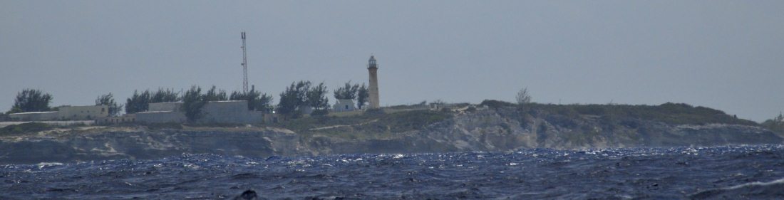 The famous Grand Turk
Lighthouse
 OK I got caught - body cut off as not to
frighten those with a shaky disposition.
 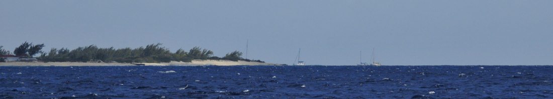 Along the coast
we saw new developments, rounding the corner we saw masses of yachts
!!!!
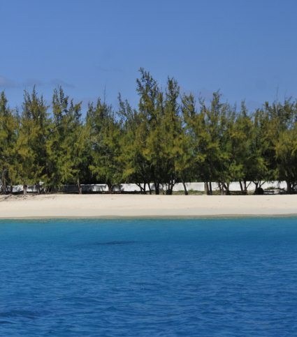 Anchored and
settled in a beautiful bay at a quarter to four in the afternoon of the
14th - four hundred and two miles later
ALL IN ALL A SAD
TO HAVE LEFT THE CARIBBEAN - BUT - TO NEW
ADVENTURES
A GOOD, STEADY, SOMEWHAT LIVELY
SAIL |