|
The
City of Huaraz
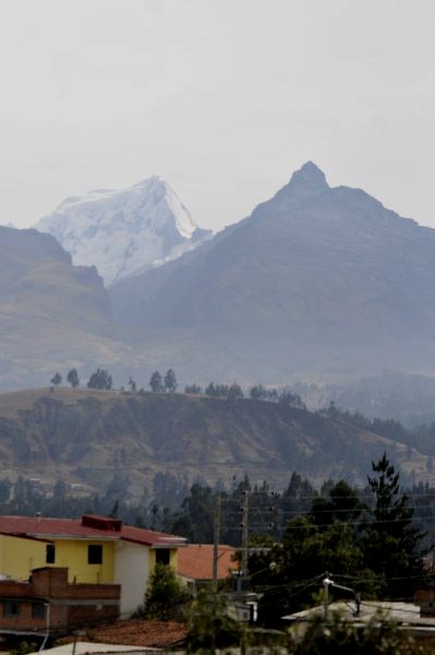 
Views from our hotel room, the same both nights we
were here - 30th of September and 4th of October
The
city of Huaraz is the capital of
the State of Ancash and the seat of government of the Province of Huaraz. The
urban population is distributed over the districts of Huaraz and Independencia. It was estimated in
2007 to exceed 120,000. Huaraz is headquarters of the province's Roman Catholic
Bishop and the site of his official cathedral.
The Cathedral and the small part of original street
left after the destruction of the town.
Location:
Huaraz
is in north-central Peru, about two hundred an sixty miles north of Lima,
and at an altitude of ten thousand and thirteen feet. It is the largest
population centre in the agriculturally important Callejón
de Huaylas
valley. The Callejon (in Spanish roughly meaning large valley or corridor) is a
north-south valley bounded on the east by the Cordillera
Blanca
(permanent white snowcaps and
glaciers) and on the west by the Cordillera
Negra
(no permanent snowcapped peaks or glaciers, hence black). The Cordillera Blanca
includes Huascaran,
the highest mountain in Peru at twenty two thousand, two hundred and five feet
and the third highest in the Western Hemisphere. Huascaran and the adjacent peak
Huandoy
in fair weather are clearly visible from Huaraz.
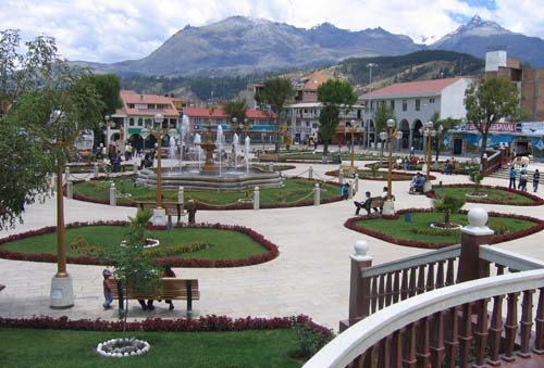
Huaraz Main Square.
History: In
1538, Fransisco Pizarro granted the right to collect taxes in Huaraz to the
conquistador Sebastian de Torres. In 1574 Alonso de Huaraz Santoyo founded the
village. From the beginning the Spaniards began exploiting the mineral wealth
of the region. Several deposits of metal ores were discovered: silver, lead, tin
and a small amount of gold. Availability of these metals for mining and smelting
locally was the primary attraction of the Callejon area to Spain. Hundreds of
the native Quechua-speakers by the 1570’s were labouring in the
mines.
Recent history:
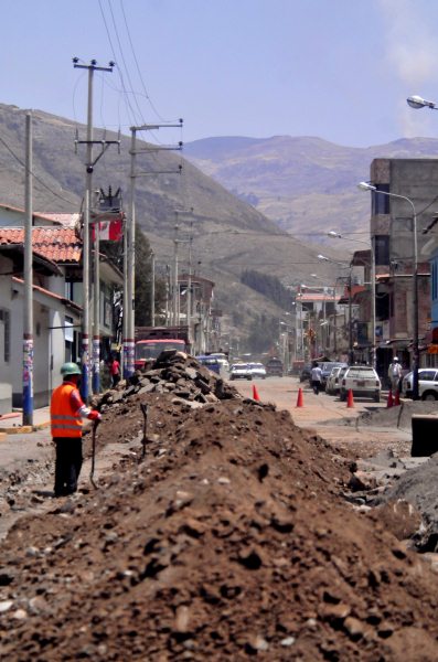
Much of the north side and a large part of the center of the city
were destroyed utterly in 1941 by floodwaters from a reservoir that was the
city's municipal water supply. The reservoir dam was about four miles east of
the town and six hundred feet in elevation above it. The dam burst from sudden
overflow pressure caused by a fall of glacier ice probably caused by a localised
tremor (earthquake). Within seconds the stream bed became an avalanche of water,
mud, boulders and associated debris whose crest by the time it reached the city
may have exceeded forty five feet above the stream bed. Four minutes after
the dam burst the avalanche obliterated and covered the city's most modern
suburb and destroyed most of the north half of the city. After the 1941 disaster
the old reservoir dam was repaired but not replaced. Doubts about the safety of
the dam were largely responsible for abandonment of that area for
redevelopment.
Much repair work is on going
On the 31st of May 1970 the Ancash earthquake
destroyed much of Huaraz, killing ten thousand people. Almost nothing was left
of the old city with its narrow streets and big adobe casonas, roofed with tiles. The main
square was the only major structure that survived the earthquake so the city was
rebuilt around it. The old and big casonas were replaced with smaller
houses while the old narrow streets were widened as they had proved to be
death-traps during the earthquake. The earthquake was seven point eight on the
Richter scale, duration of forty five seconds, as many as twenty thousand people
were killed, leaving only ninety one survivors.
Wash
day.
Communications: Huaraz is connected to the
rest of the country through the Pan-American Highway and can be reached from
Lima Casma or Chimbote in seven hours. A few miles to the north of Huaraz lies
the small Anta airport which serves small planes from the two largest mining
companies in the region as well as the regional airline LC
Busre.
Tourism: The peaks of the region have been for many
years the testing grounds for mountain climbers anticipating future expeditions
into the Himalayas. Huaraz is a
popular base for expeditions into the Cordillera
Blanca and the Huayhuash south of the Callejon del Huaylas. Huascaran
National Park is a popular destination for tourists, a UNESCO site since
1985. In the streets surrounding the farmers'
market, the paraditas
(street
markets) of local sellers offer craft products such as ponchos, alpaca textiles (carpets, sweaters, etc.); jewelry made of locally-mined
tin, copper, and silver; cuarteados (a typical dessert from
the nearby town of Caraz made by mixing manjarblanco and fruit cake); boxes of manjarblanco, butter, cheese, honey,
smoked and salty hams, jerky (Quechua charqui), etc. Huaraz is known as the 'Switzerland of the South' because of its
beautiful peaks that are visible from the city
centre.
Ladies repairing the mountain road, running welding repairs as the ladies sell oranges, a shopping street with the hillside
behind
.
ALL IN ALL A BEAUTIFUL BACKDROP TO AN UNSPOILT
AREA
|