Tullah

Beez Neez now Chy Whella
Big Bear and Pepe Millard
Tue 26 Jan 2016 23:47
|
Tullah, Farrell Mine, Trains and a Dam
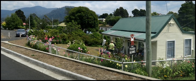 We had an
enjoyable time with Lyn, her bears and her blooms.
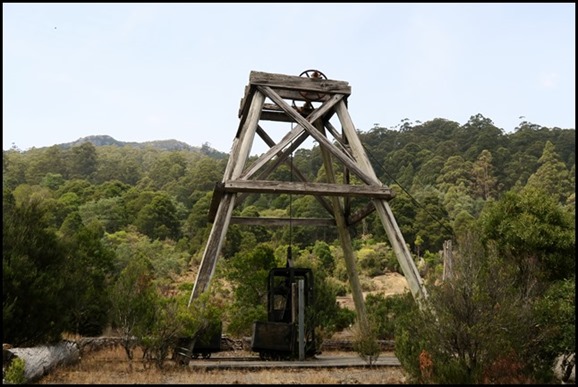 On the opposite side of the road was
an intriguing structure, a
poppet, so over we went.
  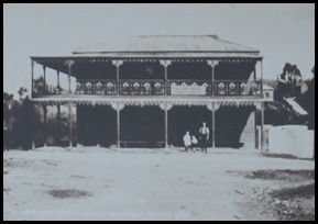 The township in
1905. St Andrew’s Church erected by volunteer
labour and opened in 1913. Tullah Hotel before it was
destroyed by fire in the 1930’s
The Town of Tullah: Many towns that
once existed on the West Coast have long disappeared back into the
forest,Magnet, Dundas, Williamsford and even recent settlements such as Luina,
Australia’s second largest tin mine in the 1960’s and 1970’s can now barely be
seen under a generation of forest regrowth. Although the settlement on the
slopes of Mt Farrell faltered in the depression years of the 1930’s and the mine
closed long ago, Tullah has survived.
Initially it was called Farrell,
after Tom Farrell. When the settlement was declared a township in 1901 it was
named Tullah, an Aboriginal word meaning ‘meeting of the waters’. Before the
hydro-electric schemes were built in the 1980’s, the township was near the
confluence of the Mackintosh and Murchison Rivers.
In 1908 the town was well established
with four hundred and seventeen people living in two ‘suburbs’ sharing two
hotels, two general stores, a cottage hospital, state school, post office, bank
and a public hall with the rather grand title of the Tullah Academy of Music.
With little competing for entertainment, Elsie Tole organised concerts there as
well as teaching music lessons.
The town had its own football and
cricket teams, brass band and like almost every other West Coast town, a homing
pigeon racing team.
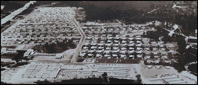 1982. That same year the state Hydro
Electric Commission [now Hydro Tasmania] began construction on the Pieman River
Power Development. Tullah’s population skyrocketed. By 1980 Tullah village had
more than two hundred and sixty houses, with separate accomodation for nearly a
thousand workers. The population soared to nearly two thousand.
When the Pieman River scheme was
completed in 1987, the town remained the base for the new King and Anthony
schemes. When these schemes were completed in 1994 Tullah
Village was put on the market. A house could be bought for as little as
ten thousand dollars. many were sold to redundant HEC workers or to anglers keen
to pick up a weekender, but the majority were bought by miners from the nearby
Hellyer or Henty mines.
The last chapter on Tullah has yet to
be written.
 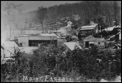 The Mines of Tullah: Circa 1904, an
early view of South Tullah looking at south Mount Murchison. Circa 1905, well established, the Mount Farrell Mining
Field was to be known as Tullah. The
settlement of Tullah, once a cameo frontier mining town which in the mid
1970’s became part of a major hydro-electric development.
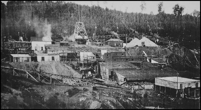 North Mt Farrell
mine workings looking south-easterly circa 1920.
Mount Farrell is
named after prospector Tom Farrell who discovered galena on its eastern slope in
1892. While he had some success mining copper, the lode was patchy and
unprofitable. Two years later he moved on.
Payable lodes at
Mount Farrell were found however, when the Innes brothers were surveying and
cutting the track from Liena near Mole Creek to the new mining fields at
Rosebery. The brothers did not publicise their find, but returned ten months
later to peg their their claim. In 1899 the North Mt Farrell Co. was formed and
very quickly consignments of ore were packed out by horses to the Emu Bay
Railway Line.
By 1906, the mine had
produced more than 430,000 ounces of silver and 4,000 tons of lead, and a
township was established.
The mine prospered and the community grew, but by the 1930’s the quality
of the ore had diminished. As the Great Depression took hold, metal prices fell
and for the fifty miners and their families the outlook was bleak. The mine
closed. Milling operations continued but only a few days before the scheduled
closure another, richer outcrop of galena was found just north of the old
mine.
The North Farrell Mine re-opened in 1934, producing 700,000 tonnes of
silver-lead ore by the time it closed in 1974.
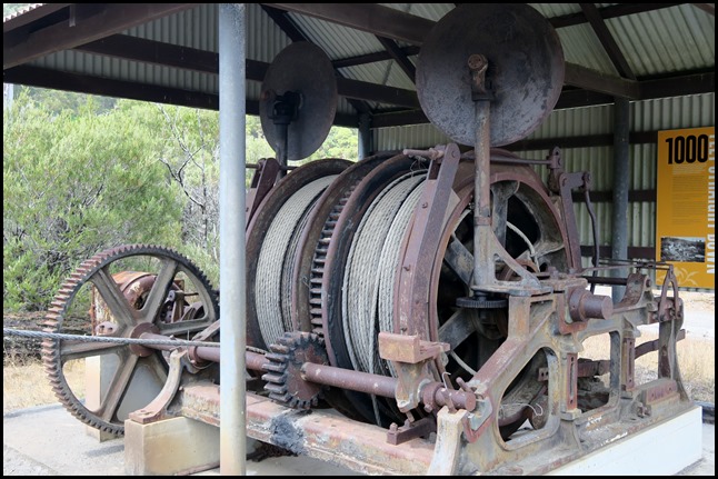 The winch
mechanism in this shed was used at both North Mt Farrell mines. It was
originally powered by steam and later by electric motor.
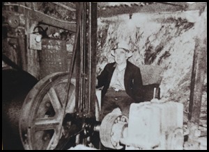 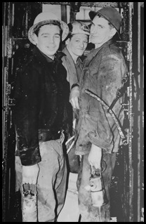  The winch driver, Rollie Anderson at the controls of the auxiliary
underground winder used to facilitate mine development. Going down. Miners Tony
Tyler, Kevin Roles and Sid Brookes in the cage of the
Farrell mine in 1962. At 1,000 feet [304 metres] the mine at that time was the
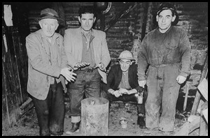
deepest on the West Coast. Some of the veterans of the
mine a few years before its takeover by the EZ Co. in 1964. From left:
Leo Powell, Alf Richardson, Bert Richardson and Mick Mahoney.
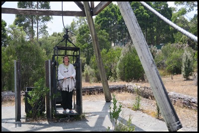 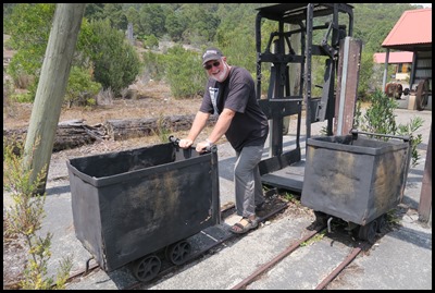 The cage
and the ore trucks under the poppet head are
originals that were used at the new North Mt Farrell shaft.
 All that glistens is not gold.
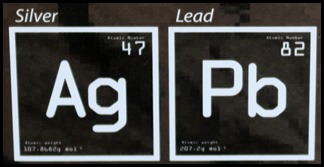
Although mostly humble lead, Galena can be a
beautiful mineral. Some galena crystals have been discovered as large as twenty
five centimetres across. The lustre is from the silver, the metal still most
prized for its unique reflective quality. The ore
mined at Mt Farrell was galena, commonly called silver lead, or more accurately,
lead sulphide. Galena [Latin for silver lead] is the most common form of lead
bearing ore around the world. At its height, the Farrell mine produced galena
that was 63% lead and 60 ounces of silver t the ton. Prior to both world wars,
there was an enormous demand for lead for bullets and before its toxic effects
became better understood it was commonly used as a performance booster in
petrol.
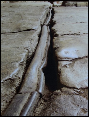  Two thousand year old Roman lead pipes unearthed in Bath, England.
Because it does not corrode, melts at
low temperatures and is easily beaten into any shape, the Romans used lead
extensively for plumbing [from the Latin plumbum, for lead]. Although now
treated warily, it still has many uses, notably fishing sinkers and, perhaps
more importantly, protective aprons to prevent excessive x-ray radiation to
medical staff and patients.
In Roman times it was widely accepted
that lead added an ‘agreeable flavour’ to many
dishes, despite suspicions that there was a connection between mysterious
maladies and the metal. The metal enhanced one-fifth of the four hundred and
fifty recipes in the Roman Apician Cookbook, a collection of recipes.
Some historians believe this practice may have contributed to the fall of
Rome.
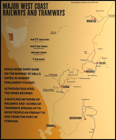 The Railway Links to Tullah: The only
access to all the mining fields on the West Coast was by crossing a long sand
bar that protected the narrow entrance to Macquarie Harbour. At low tide the
sand bar was only nine feet below water and at high tide only two feet
deeper.
Inside the bar was a channel less
than a hundred yards across and fourteen fathoms deep where a furious tidal ebb
and flow raced in and out of the harbour. Shipwrecks were frequent. Ships often waited, riding the southern
ocean swells for ten or twelve hours before venturing across the bar. Sometimes
they would have to sail south to Port Davey to wait for better
conditions.
In the 1890’s, seven ships were lost
in five years.
 Insurance and freight charges for the
trip to Burnie to Strahan were six times more expensive than from Burnie to
Sydney. The largest ships that could clear the bar were limited to six hundred
tons at a time when steamers were being built many thousands of tons
larger.
In 1896 the government engaged a
leading British maritime engineer, Napier Bell, who recommended deepening the
channel. However, for many state politicians, Hell’s
Gates was a ‘sacred’ barrier against the ships of Melbourne: reason for
inaction. “The removal of Macquarie Harbour bar would be one of the rashest
undertakings that could be proposed by any man that has the interests of
Tasmania at heart. It would be throwing trade into the hands of Victoria.”
Hon C.D. Hoggins MHA .
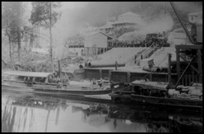 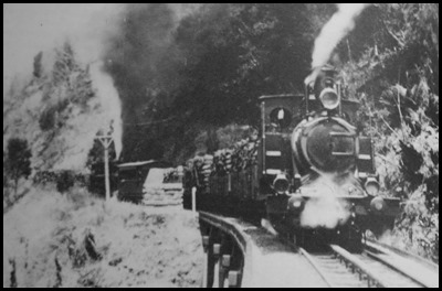 Between 1886 and 1889 the ‘budding
city’ of Teepookana on the King River was serviced by
thirteen barges ferrying coal, coke, timber, beef and stores to be loaded onto
the Abt trains bound for Queenstown and smelted copper to Strahan on their
return. Two engines working in tandem on the steepest
sections of the Abt line.
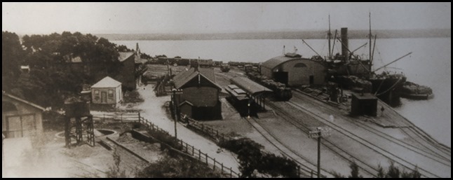 Regatta
Point, Strahan exported more wealth than any other port in Tasmania
1900-1901.
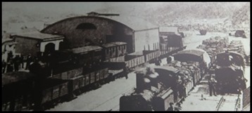 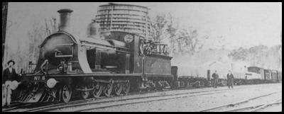 Queenstown
Station 1902. Dub No 6 at Guildford Junction,
circa 1902
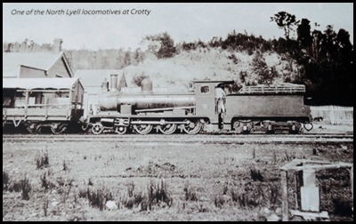
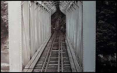
The region became home to a huge
assortment of trains and trams – a train spotters delight. They ranged from the
Abt locos that ran on a rack and pinion track to the impressive 86’ locomotives
that ran on the North Lyell line from Gormanston to Kelly Basin. They included
Tullah’s ‘Wee Georgie Wood’. Other lines were notable for introductions of new
technology – such as the Garrets with articulated axles that plied the notorious
“ Serpentine” North-East Dundas Line.
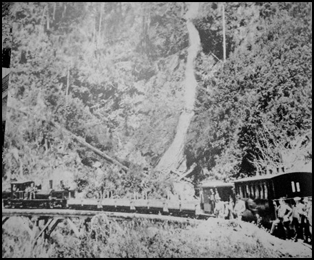 The west coast also became a
destination for adventurous tourists, looking to see for themselves exotic
sounding places such as Montezuma Falls [named after
the Aztec emperor who lost his gold and his empire to the Spanish
Conquistadors]. Travellers to the Falls were sprayed with mist from three
hundred feet above. To get a good view of the top they would lie across the
carriage seats on their backs craning their necks to look up.
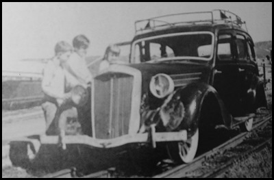 With petrol motors, railcars became
common for emergencies or the well-to-do. This 1947
Wolseley belonged to the manager of the EZ Co. mine at Rosebery and was
used on the Rosebery-Burnie line until 1964.
  The Railway War: In 1883, near where
Queenstown stands today, prospectors found gold at the ‘iron blow’. As well as
gold, there was a vast lode of copper. The discovery was to become one of the
richest mines in Australia’s history. The ensuing boom sparked an intense
railway war as competing syndicates from around the state lobbied the government
into building a railway from Hobart, Launceston and Burnie to the peaks of
Lyell.
As long as sand clogged the entrance
to Macquarie Harbour, any of the deepwater ports around the State could compete
for the West Coast trade. In the late 1890’s, eight competing syndicates had
formed to establish a rail route to the riches in the west. All of them
petitioned parliament, appeared before select committees and sent surveyors and
axemen into the wilderness. They also fought each other with propaganda, in the
local press, public halls and especially in the English newspapers. Most of them
denigrating the opposition while exaggerating the extraordinary benefits of
their own schemes.
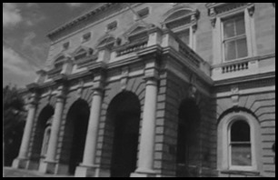  The Hobart - Launceston Feud: Then as now there was
intense competition between Hobart and Launceston. A Launceston syndicate had
funded the enormously rich tin mine at Mt Bischoff. In 1875 smelters were
established on the banks of the South Esk River, and the northern city embarked
on a period of great prosperity. This seeming advantage had provoked two rival
syndicates in Hobart to act, one of them even suggesting the unproven technology
of an electric railway that would run from the southern city to the western
mining fields. Both proposals, however were publically ridiculed. Through the
rugged terrain, rail routes could not be found from either Launceston or
Hobart.
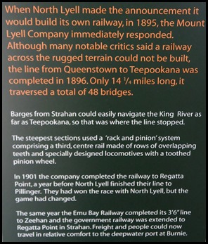
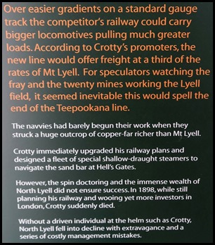
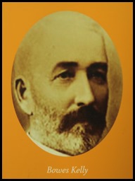 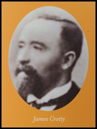 The Feud of the Irishmen: There was a
personal element to the war between the two Lyell mining companies. James Crotty
had been one of the original prospectors of ‘Iron Blow’ but the mine had
struggled until Bowes Kelly, one of Australia’s
wealthiest men after his investment in the Broken Hill silver mine, bought into
the Mt Lyell Mining Company. Later, when the company sought to raise finance for
its railway using London money rather than call on local shareholders, James Crotty found himself no longer on the Board of
Directors.
Crotty held Kelly responsible.
however, Crotty had retained the North Lyell mine and when it was discovered to
be far richer in copper than the ‘Iron Blow’ at Mt Lyell, it became Crotty’s
personal goal to wrest back control of Mt Lyell from Bowes Kelly.
It was not to be. After Crotty
suddenly died in 1898, copper prices plummeted and in 1903 the two companies
merged. The township of Crotty and Darwin disappeared as quickly as they had
sprung into existence, while Bowes Kelly remained on the new company board,
still in control.
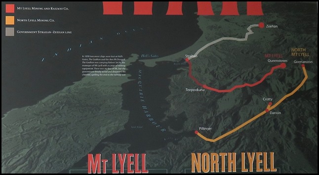   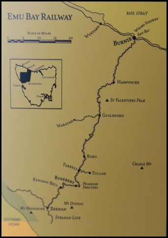 The EBR
prospectus published in national and British newspapers showed the EBR line as the only railway in the region. The version
published in Tasmania showed the competing railways.......
Greed, Gold Diggers and the Gullible:
In the atmosphere of a boom that lasted nearly two decades, speculation and
skulduggery were general practice. News of rich finds would create frenzies in
the Hobart and Launceston stock exchanges but all too frequently the mineral
samples that provoked such speculation were ‘salted’: samples underhandedly
taken from other mines that were of proven quality. On many occasions,
speculators were swindled. One of the most famous was the prospectus for the Emu
Bay Railway that showed only one railway [theirs] steaming into the Mt Lyell
fields.
Although a blatant lie, gullible
investors around Australia and in Britain subscribed four hundred thousand
pounds in a matter of days in one of the most hectic share rushes of the decade.
The directors, one of whom was Bowes Kelly, who also sat on the Mt Lyell board,
retained shares to the value of one hundred and fifty thousand pounds, rejected
applications for the other two hundred and fifty thousand shares and began
construction.
The dishonest publicity provoked
outcry, and when the Premier admitted in parliament he had privately given the
Emu Bay Railway the go ahead, his government almost fell. The scandal continued
to escalate when the shareholders were then told the railway would only go to
Zeehan, not to Queenstown. When Bowes Kelly was confronted, he calmly replied he
did not know about the misleading map.
 We next went up
the hill in search of the dam and a place to picnic lunch.
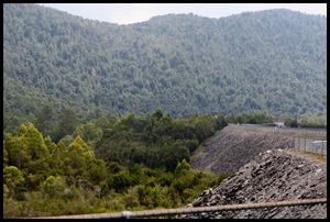 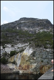 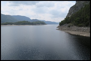 The Mackintosh
Dam. A rockfill face dam about seventy five metres high and a crest
length of eight hundred and seventy seven metres, containing some nine hundred
and forty thousand cubic metres of material on the Mackintosh River and
Tullabardine Dam – a subsidiary rockfill concrete faced dam twenty five metres
high with a crest length of two hundred and fourteen metres and some one hundred
and eighty six thousand cubic metres of material containing Lake Mackintosh,
with twenty nine square kilometres of area, two hundred and twenty five metres
above sea level.
 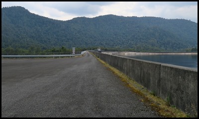 We read the
information board and had our picnic ‘in the bottom left hand corner’,
next to the access road. The Murchison Dam on the Murchison River is a rockfill concrete face
containing nine hundred and sixteen thousand cubic metres of material. Ninety
five metres high and a crest length of two hundred and twenty eight metres, two
hundred and forty metres above sea level. The two thousand metre Sophia Tunnel
diverts the flow of water from the Murchison to the Mackintosh catchment. The
rise and fall of Lake Murchison will be within ten metres, while the level of
lake Murchison will vary according to rainfall. Now, time to get back on the
road to Strahan.
 ALL IN ALL AMAZING WHAT YOU
FIND ALONG THE WAY
INCREDIBLY DETAILED
HISTORIES |