Freycinet Info

Beez Neez now Chy Whella
Big Bear and Pepe Millard
Sun 17 Jan 2016 23:37
|
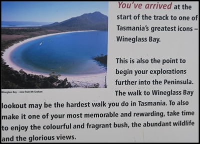
Information Boards at the
Beginning of the Track to Wineglass Lookout
 The first Information board. Finding social history so very
interesting we were amazed to find out so much about the people who have named
the areas and landmarks we have come to explore. Later at the Visitor Centre we
would find out more about some of the folk mentioned here. Wonderful that records, information and so much hand
written documentation has
survived.
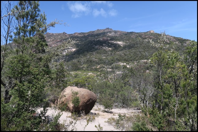 The
Aborigines. This area was once the homeland of the Toorernomairremener
Aborigines who hunted and lived along these shores. Every feature was known and
named. Today, very few places carry Aboriginal names as much of their language
was ‘lost’, forced aside, or inappropriately used. Today’s Tasmanian Aborigines
are reviving their language. Some European names along the coast are reminiscent
of Europeans’ early encounters with Aborigines. Friendly Beaches in the northern
section of the park describes the first friendly encounters between two vastly
different cultures.
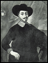 Anthony Van Diemen
The Dutch. The first known charting of the Tasmanian coastline was by Dutch explorer Abel Tasman in 1642. One of the landmarks named was Schouten Island, which lies to the south of Freycinet Peninsula. Justus Schouten was a member of the Council of the Dutch East India Company whose ships sailed the southern oceans in search of exotic spice for trade. Tasman’s explorations were acknowledged over two hundred years later when Tasmania was named after him in 1855 and the island’s former name – Van Diemen’s Land – was relinquished. 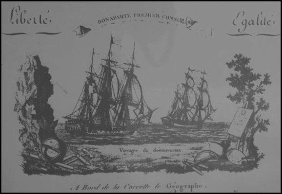 The
1800-1804 insignia of the French
Voyage of Discovery.
The French. Many features along the
East Coast of Tasmania carry French names, resulting from the Baudin Expedition
of 1802. napoleon Bonaparte directed Captain Nicholas Baudin – expedition leader
of two ships Le Geographe and Le Naturaliste – to
“chart the coast of the Great South Land, including Anthony Van Diemen’s
Land, for research of all kinds and to increase the mass of human
knowledge”. Freycinet Peninsula was named after Louis Freycinet,
sub-lieutenant on Le Geographe. Cape Baudin is on the eastern side of
Schouten Island and was named in 1959 to commemorate Baudin, while Mount Baudin,
one of the Hazards Peaks, was named in 2000 to commemorate the bicentenary of
the Baudin expedition.
Some other French place names within the park include Cape
Degerando on the south coast of the Peninsula [after a social anthropologist who
wrote a guide for the study of Aboriginal people encountered on the expedition],
Cape Faure on the south coast of Schouten Island [the expedition’s geographer],
Cape Forestier to the south of Wineglass Bay [one of Napoleon’s generals who
helped organise the expedition], Cape Sonnerat on the south-east tip of Schouten
Island [a French naturalist], and Cape Tourville east of Coles Bay [a famous
French Admiral].
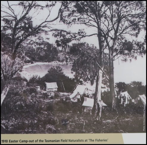
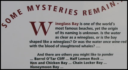
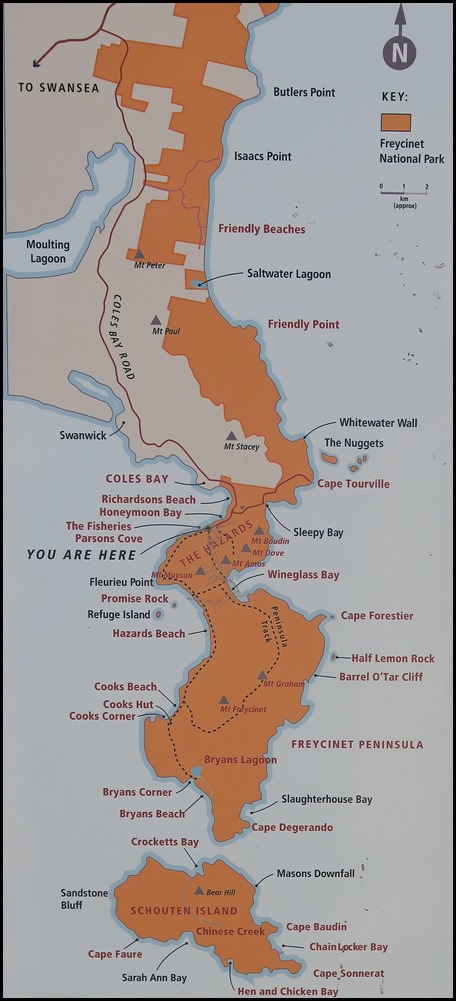 The Whalers. The crystal clear,
turquoise water of Wineglass Bay once ran red with the blood of slaughtered
whales. Shore-based whaling stations were scattered around the Peninsula,
including at the southern end of Wineglass Bay, Bryans Beach, Crocketts bay, Hen
and Chicken Bay, Refuge Island and Parsons Cove [The
Fisheries].
The Hazards – the line of mountains that define
Freycinet – is not, as you might expect, named after the hazardous nature of the
peaks, but rather, both it and Hazards Beach are named after American Albert
‘Black’ Hazard, captain of a whaling ship active in the area in the 1820’s. His
ship Promise, came aground on the rock that bears the name. Promise
Rock lies just off Hazards Beach. George Meredith, one of the first settlers at
Swansea, established a whale ‘fishery’ at Parsons Cove in 1824, which became
known as The Fisheries.
Shore-based whaling was on the decline by the 1840’s due
to years of ruthless exploitation. The southern right whale had been hunted to
the brink of extinction. These days, these magnificent creatures can be seen
during winter as they migrate north from the Antarctic to breed in warmer
waters, and return south in spring.
 Early Settlers. In the 1830’s, an early
settler named Silas Cole – after whom Coles Bay is named – burned shells from
the large Aboriginal middens on Richardsons Beach to make lime for use in
mortar.
A sealer named Joseph Stacey discovered coal in the mudstones
on the western part of Schouten Island after he was washed ashore in 1809. It
was first mined commercially [and quite unsuccessfully] from around 1840 to
1880. At one point, Edward Crockett was mine manager. Crocketts Bay on the north
coast of Schouten is named after him. At around the same time, Chinese tin miners arrived to briefly
work the alluvial deposits on Schouten Island. Chinese Creek on Schouten Island
is named after them.
Sheep and cattle grazing were carried out on parts of the
Peninsula as early as the 1850’s and continued on Schouten Island until the
1960’s. Bryans Beach, Bryans Corner and Bryans Lagoon are named after the three
generations of Bryans who lived and worked on the Peninsula. Cooks Hut, Cooks
Beach and Cooks Corner are named after Athol Cook who farmed in the area in
1910.
Mount Amos was named after Adam and John Amos – Swansea
district farmers for Lieutenant George Meredith, first settler of the East
Coast. Mount Graham – after one of the early respected citizens of Swansea.
Morris’ three storey warehouse in Swansea [still standing] was originally built
for Mr Graham. Mount Dove is named after a Scottish Reverend who had a diverse
career in the early colony, beginning with serving as a missionary to the
Aborigines on Flinders Island, before being Religious Instructor to the convicts
in the Probation Station at Darlington in 1842, and finally Presbyterian
Minister to the early settlers at Greater Swanport. Mount Mayson was named in
honour of Rev Joseph Mayson – rector of the Anglican Church at Swansea for many
years.
 Early Tourists. Coles bay and Freycinet
Peninsula have been popular holiday destinations for over 100 years, with early
visitors arriving by boat or steamer from Swansea. One of the first to promote
the tourist potential of the area was Harry parsons, after whom Parsons Cove is
named. He retired to Coles Bay in the 1920’s and established shacks at The
Fisheries.
A short time later, in 1934, Ron Richardson leased the Chateau
Holiday Units from the Government. This complex has since been redeveloped as
Freycinet Lodge. The beach between the Lodge and the Visitor Centre is
Richardson Beach.
  We moved to the natural history information board and read
about the Bennett’s wallaby and the hooded plover.
The hooded plover and the pied oystercatcher nest on
the soft sand, just above high tide from Spring to early Autumn in well
camouflaged nests.
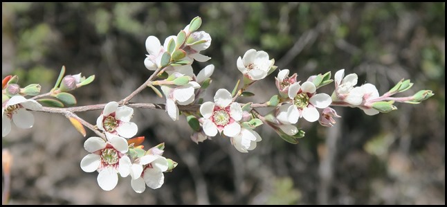 To our left we saw our first heath
myrtle, we were reading about it on the board. Thryptomene micrantha
borders much of the Wineglass Bay track; it is highly susceptible to root rot.
Pars of this park are infected with the soil disease ‘root rot’, caused by a
fungus – Phytopthora cinnamomi. Freycinet’s coastal heath plants are
particularly vulnerable. It attacks plant roots and causes dieback and death.
The fungus is carried in soil – on boots, tent pegs and vehicle tyres. We
were told to stay on the paths and avoid spreading to other
parks.
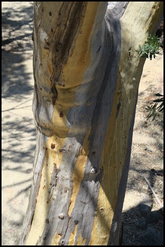 The bark of the silver peppermint -
eucalyptus tenuiramis occurs nowhere else in the
world.
 As
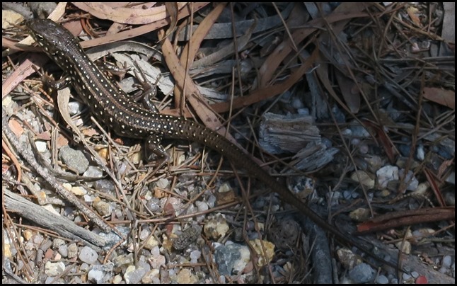
if on cue a little chap appeared by our feet. The spotted
skink (Niveoscincus ocellatus),
sometimes called the ocellated cool-skink or ocellated skink,
is a skink endemic to Tasmania.
It is a ground-dwelling, viviparous species,
usually found in rocky habitats, and widespread in the northern and eastern
parts of the state, as well as in the eastern Bass
Strait islands.
The N.
ocellatus is
often found at Arthurs Lake in the Central Highlands of
Tasmania.
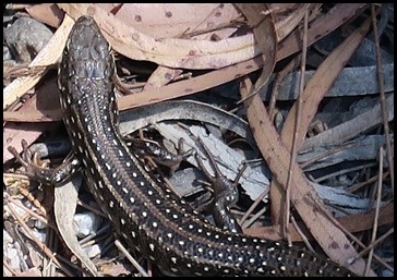 He was quite happy to pose, showing
off his handsome spots.
 A Bennett’s wallaby tells us time
to get going.
 ALL IN ALL GOOD TO LEARN ABOUT THE AREA
REALLY NICE TO KNOW THE PEOPLE BEHIND THE
NAMES |