Eketahuna Pt. 1

|
Eketahuna – Part One 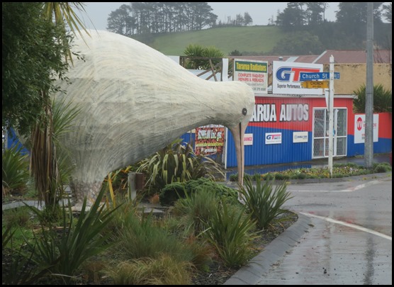 So, we round a corner and this is
what we see – a massive blond
kiwi.
 Just down the road, another chap hugs
the Eketahuna Kiwi Country Information Centre, this
needs further investigation.
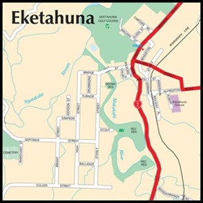
Eketahuna is a small rural service town, the most southerly in
the Tararua
District in the Manawatu-Wanganui region of the North
Island, but is considered to be in northern Wairarapa. It was called
Mellenskov, but was renamed soon after its founding. The town is
located at the foot of the Tararua
Ranges which lie to the west. It is 35
kilometres north of Masterton and a similar distance south of Palmerston
North. It is situated on State Highway
2 and the eastern bank of the Makakahi
River. Eketahuna is considered by some to be
the stereotypical rural New Zealand town, and is occasionally used in
conversation to represent "the real New Zealand". The 2013 census recorded
Eketahuna's population at 441; down from 456 in 2006. This little town gave us a
huge ‘welcome’, everyone we met was so friendly, jolly, warm and
chatty.
  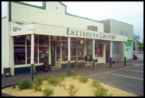 New Zealanders colloquially refer to the town of Eketahuna the way other English speakers refer to Timbuktu, i.e., the middle of nowhere, "the sticks", the end of the world. Likewise, Eketahuna is a booming metropolis compared to the mythical town of Waikikamukau (pronounced "Why-kick-a-moo-cow"). The name of the town, when spoken, sounds like a sentence in Afrikaans which translates to "I have a rooster". This is a source of amusement to immigrant Afrikaans-speaking South Africans in New Zealand.
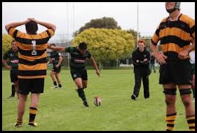
Well, as soon as we found out the rugby team dressed for Beez Neez, job done, our hearts were taken.
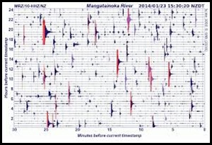
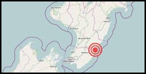
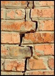
Sadly on the 20th of January 2014, the town was the epicentre of the 2014 Eketahuna Earthquake. Measuring 6.2 on the Richter Scale, the quake caused moderate damage all over the southern North Island.
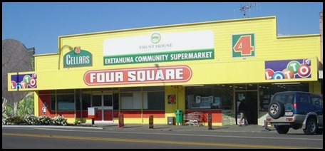
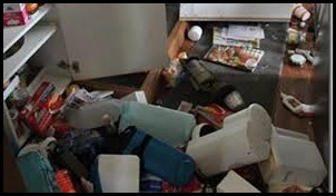
Our favourite store, Four Square suffered so much mess as a result of the earthquake.
There was damage to buildings, houses and roads.
History. The Kurahaupo canoe made landfall on the Mahia Peninsula, at the northern tip of Hawkes Bay, on board were three paramount chiefs Whatonga, Ruatea and Popot. Eketahuna is part of the district known as Te Taperenui a Whatonga – the great playground of Whatonga. Whatonga and Hotuwaipara had a son Tara whose descendants are the Ngai Tara. From Whatonga’s second marriage to Reretua, Tautoki was born, who was the father of Tane-nui-a-Rangi or Rangitane. The Ngai Tara and Rangitane people lived in many parts of the Central Hawkes Bay, Tararua and Wairarapa areas including Eketahuna. There was an established Māori trail that went right through where Main Street is now, linking Māori from Te Hawera – Hamua, and the north, with Pa – settlement or hill fort, at Maroa – Alfredton, and further east, and with Pa in the Wairarapa and further south. At Kakariki there was a track which led over the Tararuas to Tokomaru. The last known Māori village in Eketahuna was more of a summer camping ground at Te Waiwaka by the Makakahi River. There had been a Pa at O-tu-kirihua just by Newman Domain, but legend says there was a great battle there and the people took refuge in the Tararua Ranges, and Puketoi. The Pa and village were abandoned long before European settlement. This area between the old bridge and the Newman Domain was the best place to gather kakahi – fresh water mussels, right up until the 1970’s and 80’s – if you could beat the pukeko – bird..... Sadly even the pukeko are rare now. However the sweetest eels were in the Nga-taka-he River.
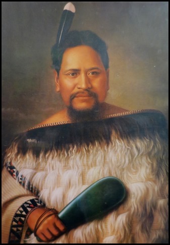
The very noble looking Chief Huru Te Hiaro and the gorgeous looking Chief Nireaha Tamaki. Huh. Shame on you, Bear.
The large Pa at Hamua, originally called Te Hawera, was one of the main Rangitane hapu in this area. The chief, in the late nineteenth century, Chief Nireaha – whom the district of Nireaha is named for, converted to Catholicism and donated land and was instrumental in funding the building of the Hamua Hall. Paramount Chief Huru Te Hiaro donated land for the building of The Lady of Carmel Church at Hamua, which Chief Nireaha was also involved with. It is told the Pa had a population of about eight hundred until the flu epidemic of 1918 killed about three quarters of the village. Those who survived mainly left the area to join whanau in Dannevirke, Tamaki-a-rua and Horowhenua. A lot of land around Hamua and Tu-Tae-Kara is still leased out.
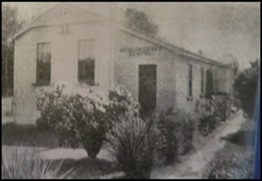
Eketahuna Timeline. 1842. Charles Henry Kettle, surveyor for the New Zealand Company, crossed the Tararua Ranges from the west and forged the Makakahi River to Mount Bruce. He then went on to the Wairarapa Plains and Wellington. 1846. Reverend William Colenso retraced Kettle’s route. “We passed through the most primeval forest of any I have seen in New Zealand.” 1870. Julius Vogel’s ‘Immigration and Public Works Act’. Under this act of Parliament Scandinavians were recruited to open up the New Zealand hinterland. 1871. The Eketahuna Block is surveyed. 1872. The ships Halcione and Hovding bring Scandinavians to Wellington. 1873. Trailblazers Anderson Lund, Olsen and Syversen arrive in Eketahuna. They build the road and name the settlement ‘Mellemskov’ meaning the Heart of the Forest. 1874. The Forfarshire brings more immigrants destined for Eketahuna. Samuel Begg the pioneer surveyor / artist arrive. 1875. Mrs Jacobsen establishes the first Boarding House. The first European is born, Annie Louisa Jacobsen, later Mrs Hardingham. The road to Woodville is completed. 1876. The road is metalled. The Cobb and Company coach service begins from Masterton to Woodville. The first Post Office opens. 1877. The first school is built in Bengston Street. The Education Act makes schooling compulsory. 1878. The school opens, twenty three Scandinavian children are enrolled. Mr. R.G. Williams must first teach them English.
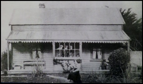
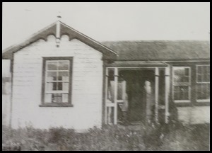
The Bayliss’ house on Allerton Road. Built in 1880, subsequently much improved. Photograph taken in 1900.
1880. Tom Bayliss, the first English settler arrives. The name of the town reverts to Eketahuna. There are now three coaches a week between Masterton and Eketahuna. 1882. Robert Stout, who would later become Prime Minister, visits Eketahuna as a school inspector. He awards the New Zealand arithmetic prize to local boy Albert Anderson. 1884. The second school is built next door to the first one, which is now too small. 1886. Parkville – area just to the west of the Makakahi River is settled. The Road Board is formed. Constable John Healey is stationed in Eketahuna, the Police Station is on Stanly Street. 1888. Newman is settled and boast a Post Office, sawmill and school. Serious bush fires occur.
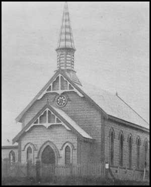
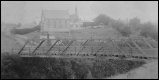
1889. The Eketahuna Rugby Football Team is formed. The Wellington to Woodville railway reaches the town. Eketahuna becomes a busy terminus and stopover for goods and people on the way to Hawkes Bay. J Macara runs coaches to Woodville. The Methodists build the first church on Herbert Street. Kaiparoro is settled. A wooden road bridge, across the Makakahi, is built on High Street, now Bridge Street. The Railway Station opens. 1890. The swing bridge is built over the Makakahi River to link Parkville with Eketahuna township. The first dairy factory in the district is opened at Mauriceville. The first doctor, Dr. W.G. McLennan, sets up practice. 1891. Ihuraua is settled. 1892. A murder outside the Anderson homestead on Alfredton Road. Township at Hawera – Hamua, established. 1893. Rongokokako is settled. 1894. The Eketahuna Express newspaper goes to print. Kaiparoro School opens. 1895. The Newman to Nireaha railway line is constructed. A.H.Herbert establishes a General Store on Main Street. The Hamua Dairy Factory opens. The sawmill at Nireaha commences operation. The first settlers arrive in Kakariki, named for the abundance of the parakeet. 1896. The Nireaha Dairy Factory opens. The Parkville Butter Factory opens. Chief Nireaha donates land for a hall at Hamua. The Eketahuna Minstrel Dramatic Society is formed. 1897. The railway line reaches Woodville. The Eketahuna branch of BNZ opens. Hukanui and Kakariki Schools open.
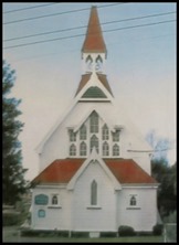
1898. The Roman Catholic Church is built in Bridge Street. The St. Cuthbert's Anglican Church is built in Church Street. 1899. Eketahuna County Council is formed. The Boer War begins. Rongokokako School opens as Parkville School. Iruraua School opens. 1900. The Eketahuna Mounted Rifles are formed, twenty five serve in the Boer War in South Africa. R.W. Morriss and H. Strawbridge are killed. A new Police Station is opened on the Main Street just north of the town.
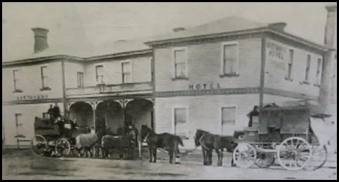

ALL IN ALL SIMPLY THE BEST INDEED
|
