To Greymouth

|
To Greymouth
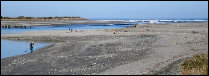 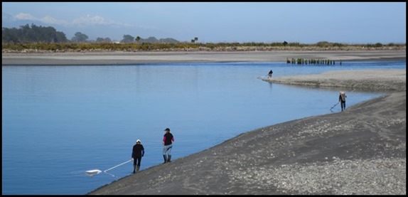 Our ‘farewell’ to Hokitika was
watching the whitebait fishermen this morning. The
first day of the season.
 Out of the town we crossed our first river of the day and then took the turn for our
first bimble of the day at Hokitika Gorge.
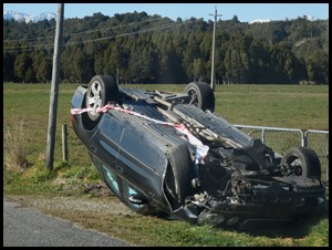 On a country road, absolutely
straight, we saw our first crashed car since we arrived in New Zealand. Hope no one
was hurt.
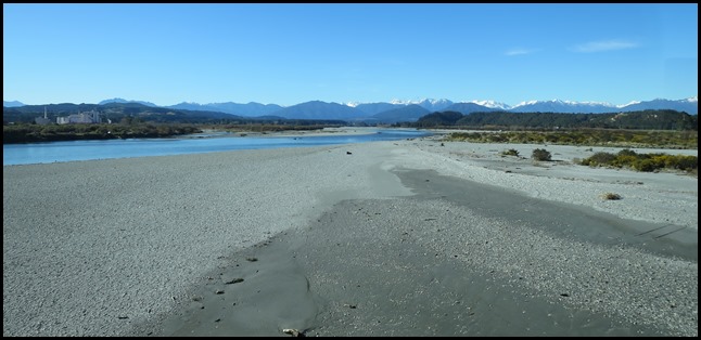
 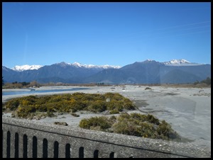 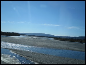 The gorge
had incredible blue water, sadly we are losing the snow
capped mountains but for now the rivers are still
glacial blue.
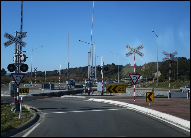 A complicated business, a roundabout with a railway line
going through it...........
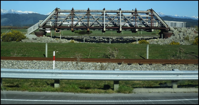 A few minutes after the roundabout we saw a random bridge.
Odd because we could see the main line between us and
it. This needed investigating.
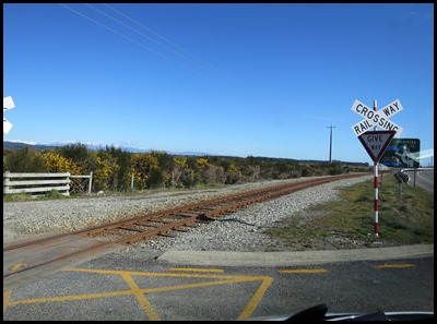 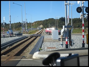  Uturn, back beside the track to the complicated
roundabout and turning left we saw the sign
for Arahura Bridge Heritage Park.
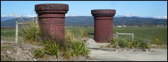 Into the car park
through some sturdy looking
posts.
 Information Boards, he was off like a ferret up a
trouser leg.
 In the early days
of European settlement the main transit route up New Zealand’s West Coast was
along the beaches and crossing rivers by direct fording or by ferry. An 1866
newspaper reports:
“In
consequence of the flooded stage of the Arahura, the Grey coach of Messrs. Cobb
and Co.’s line found it impossible to ford it, and although more than one
attempt was made, the stream proved so rapid and deep that a return to town
instead was reluctantly decided upon.” – West Coast Times, 7th of April
1866.
Since European
settlement the river has usually been bridged by at least two structures.
Bridges were located close to the river mouth near the current site and further
upstream to link the original road to Christchurch.
These timber
bridges struggled to survive the force of river floods so stopbanks and
riverbank protection have also been a feature on the Arahura River. An 1876
report in the West Coast Times describes the battle to retain a river crossing
in the face of flood
“At the
Arahura, Hungerford’s bridge is impassable, and every culvert and bridge between
the upper and lower crossing has been swept away.....the approach to the lower –
Thomson’s bridge is swept away with two large
culverts.”
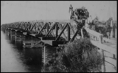 Stafford Tram
Bridge: From circa 1870 a wooden toll-bridge was located near the mouth
on the route of the tramline which ran between Hokitika and the gold mining
settlement of Stafford, run by the Hokitika and Greymouth Tramway Company
Limited. The tramline was still operating in 1915 but by 1930 only a few bridge
piles remained in the river.
Thomson’s toll bridge or the ‘lower
bridge’ was in use by 1873. It was in constant need of repair throughout the
1880’s though and by 1888 needed to be substantially strengthened to make it
safe for heavy traffic.
 Hungerford’s Suspension
Bridge, privately built by a Mr. T.W. Hungerford, was used as a toll
bridge for road traffic at the point known as Harcourt’s Ferry or the ‘Upper
Crossing’. The centre arch was one hundred foot span with a sixty foot arch on
either side. At the time of its opening in 1871 the bridge was called the
‘handsomest of its kind in the colony and most admirably adapted for New Zealand
river’. Unfortunately only six years later the bridge was described as ‘most
unsafe and discreditable to the district’ and the settlers were anxious for it
to be replaced.
In February 1908, Mr Richard
Harcourt, on behalf of a large number of settlers at Arahura, complained of
‘county maladministration’ in a letter to the editor of the West Coast
Times:
“This bridge had just been
repaired at a cost of some seven hundred pounds when a small flood had washed
out the piles, when on examination had only been driven three feet into the
loose gravel, and a further sum of six hundred pounds had to be spent on
renewing it again.”
The Hungerford Bridge was finally
abandoned in 1918, due to the high costs of repairs.
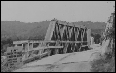 Malfoy’s
Bridge: When the
Hungerford Bridge was abandoned, locals turned to Malfoy’s Bridge, six
kilometres upstream. Malfoy’s was part of the tramline that linked the Hou Hou
sawmill with the bush at Gillams Gully, but was also for road
traffic.
Over the years the foundations of
Malfoy’s Bridge drifted downstream. In March 1967 flooding caused serious damage
to the bridge, with one pier moved five feet downstream and two eighty feet
spans under-scoured, with one swinging up six feet downstream. Consequently, the
bridge presented an s-bend appearance and its use was restricted. It was finally
demolished in 1975.
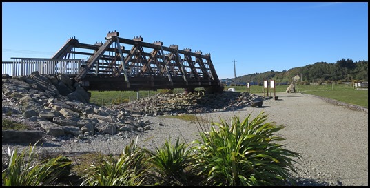
The Arahura bridge crosses the river within sixty metre-wide transport corridor originally secured by the Crown in 1886 for the purposes of building a railway. The current road and rail bridge was opened in 2009, to replace a one lane Howe Truss Span timber bridge which was built between 1886 and 1888.
Hokitika Branch Line: The railway line between Greymouth and Hokitika took four years to build, opening in 1893. An extension south to Ross was opened in 1909 but closed in 1980 when the Hokitika bridge was dismantled. Unlike other West Coast railways, the line traditionally carried timber rather than coal. Lime, fertiliser, livestock and whitebait were also carried. Passenger services ran until 1967 and the line now predominantly carries dairy products for export. 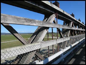 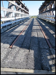 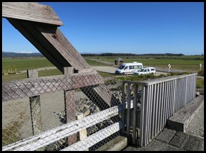 A bimble over the Howe Truss span bridge and back to Mabel. The Howe Truss span bridge was built at the site of the
current bridge. While built for rail only, it was used by road traffic as soon
as it opened. In 1891 the addition of road planking and four eleven foot spans
to the south marked its formal conversion to a road/rail bridge. The timber and
iron bridge consisted of seven Howe Truss spans and seven small timber spans.
The Howe Truss span in front of us was kept to show what the 1880’s bridge was
like.
The span is named for William Howe,
who patented the design in 1840, as the first patent truss to incorporate iron
into a timber structure. Developed in North America, the bridge design was
widely used both there and in Australia and New Zealand.
The Howe Truss span was an elegant
engineering solution to increase the strength of a structure without increasing
its mass. All forces within the structure are in tension or compression, making
the most out of the properties of the materials used; timber to resist
compression and iron to resist tension. Bending forces are avoided, preventing
the need for bulky beams. The design was also an economical response to the
demand for numerous bridges to be built at relatively low cost.
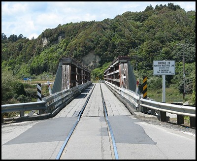 The basic design was adapted at Arahura to carry heavier rail loads by using iron and steel
components in the place of timber. Instead of timber piles, the Howe Truss spans
were supported by cast iron cylinder piles filled with concrete. The spans were
built of Australian hardwood timber with steel bottom chords and truss rods, and
swaybraces made of bent railway irons. The
overall design of the combined road/rail bridge was based on standard Public
Works Department plans drawn up under the aegis of John Blackett – 1818 to 1893.
Blackett was one of New Zealand’s leading nineteenth-century civil engineers and
the chief designer of many public works, including on the rail network. While
the Howe Truss bridge design was widely used in New Zealand over this period,
these bridges have been gradually replaced with more durable and stronger
materials.
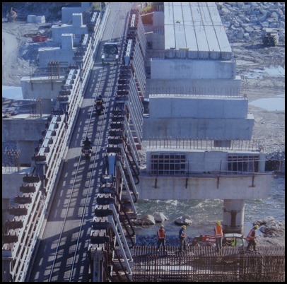
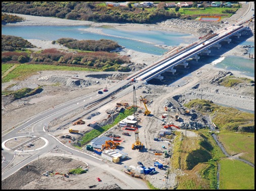 A bridge for the
new century. The modern reinforced concrete design of the new bridge
illustrates how engineering has changed over a century. Designed by Dr Robert
Park of Novare Design, the bridge has ten sets of twin-bored steel reinforced
concrete piles, supporting abutments and pier caps of post-tensioned concrete.
The foundations support a super-structure of concrete pedestals carrying nine
spans of concrete pre-tensioned hollow-core beams that form the
road/pedestrian/cycle carriageway. The rail bridge consists of steel
through-plate girders with an open steel floor and rail beam system, along with
railway hardware.
 Just one last peep at our roundabout. A definite when we build our model railway.
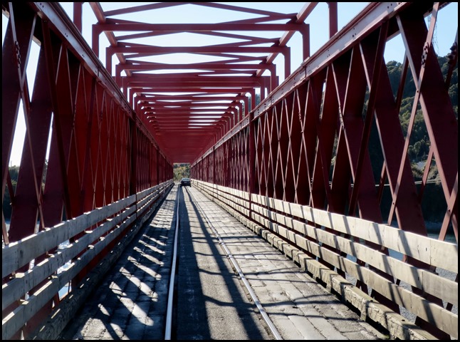 We loved this road
/ rail bridge over the Taramakau River.
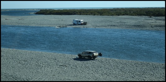 More whitebait
fishermen enjoying the afternoon sun.
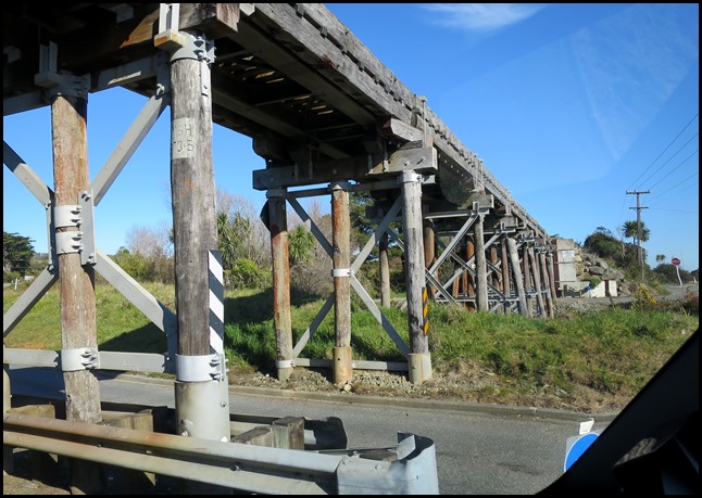 Under a working
rail bridge, Bear puffed up with all his bridge knowledge.
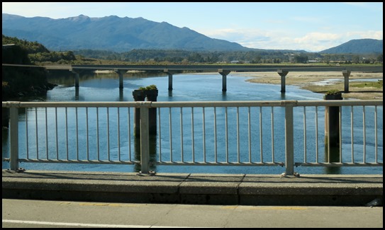 Not long after we were crossing the Grey River, seems a long time ago we came here on the
TranzAlpine Train. Now to campsite.
ALL IN ALL A REALLY COLOURFUL
DAY
SO MUCH TO SEE, DO AND LEARN
ABOUT |

