Wellington Bimble
|
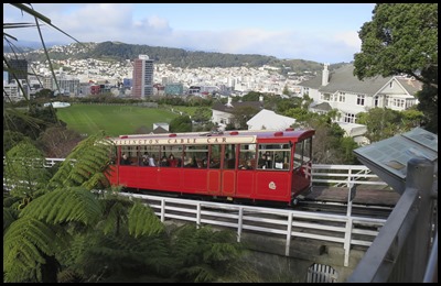
A Bimble Around Wellington  We got up, on the bus and waiting for
the cable car in Wellington by ten thirty, ready to be real tourists for the
day. Bear excitedly clutched our tickets, our first cable
car since Niagara three years ago.
  On the way
up.
  At the
top. The weather was nice so we thought we would bimble around the
Botanical Gardens before the Observatory and Cable Car Museum – own blogs.
Twenty five hectares and fairly steep, we would constrain ourselves to the Australian Garden.
The Garden was first established in 1868. It was
initially managed by the New Zealand
Institute,
who planted conifers as part of a programme to import plant species and assess
their potential for economic benefit to New Zealand. The Wellington City
Council began managing the garden in
1891.
   Nice to see eucalyptus trees with tui
and parrots playing in them. Banksia ‘lemon delicious’ was an odd
one, looked soft but rather like a brillo pad. Bear in a
bush, no comment.
   Next we saw Saw banksia looked like the brillo pad
ones, but with chocolate buttons sticking out. Others
without labels that we look forward to seeing when we visit Australia in
person.
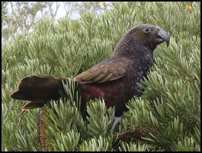  We watched the antics of the parrots for a while and listened to the
tui going through his impressive series of tweets, rolls, squawks and a
noise that sounded like a pedal bin opening and closing, anything to impress the
ladies.
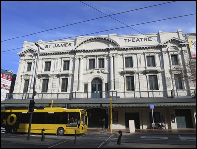
 Sun dial,
next to the Observatory, our next stop.
 Part of a painting by H.G. Robley,
1865. Haka party with guns.
During Kupe’s visit to this region he
named the harbour’s islands after his nieces or daughters: Matiu – Somes Island
and Makaro – Ward Island. Whatonga and his son, Tara, migrated from Hawkes Bay
in the 15th century. Their people were known as Ngāti Tara and the harbour Te
Whanganui-a-Tara. Ngāti Ira from Hawkes Bay also moved into the area,
intermarrying with the local people. By the 19th century most Ngāti Tara became
known as Ngāti Ira.
During the 1820’s waves of immigrants
from Kawhia and Taranaki mostly settled on the Kapati Coast but, in 1830, Ngāti
Tama and Ngāti Mutunga, along with some of their Te Atiawa kin, moved into the
harbour area. For a time all the tribes, old and new, co-existed. Then Ngāti
Mutunga attacked Ngati Ira and expelled them, and most of their affiliated iwi,
once and for all. Possibly the most significant outcome of the strife was the
decision of Ngāti Mutunga and many Ngāti Tama to seek a better life elsewhere.
Attracted by stories of a pacifist society on the Chatham Islands, they captured
a sailing ship, the Rodney and left Wellington.
After a decade of immigration to the
Wellington region, resources were becoming stretched and power struggles between
leaders were occurring. The old alliances were beginning to unwind. It led to
tribal battles in 1834.
1835: Matiu – Somes Island, was the
site of a transaction that played a momentous role in the future of Māori in
Wellington. Here, as members of Ngāti Mutunga awaited the return of the Rodney
for the second voyage to the Chatham Islands, they met with kin from Te Atiawa –
recently returned from the Wairarapa and needing a permanent home and gifted
them their land and rights. So , it was primarily Te Atiawa who dealt with the
next arrivals.
 The Colony: In a
race to purchase land for his immigration company before the British Government
claimed sovereignty over the settlement, Colonel William Wakefield sailed from
London to Wellington on the Tory. When he arrived in 1839, Wakefield
began buying vast tracts of Māori land very cheaply. His first British settlers
landed at Petone but shallow anchorages and floodable land soon forced them to
leave Wellington. Wakefield’s land dealing triggered years of protest from Māori
and bickering with the Government, which barred further land purchases in 1840
and, to Wakefield’s dismay, made Auckland the capital.
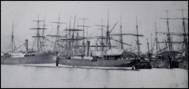
The Capital:
Wellington did not become the capital city until 1865. By then it was a strong
trading port. For several decades ships had been bringing new settlers and
leaving laden with whale oil, flax, wool and, when refrigeration was invented in
the 1880’s, butter and meat. As the port grew so did the finance sector. The
port quickly outgrew the flat land available and, between 1852 and 1880 alone,
28 new hectares of shoreline had been reclaimed from the sea. By 1900, all of
the natural 1840 shoreline around the port had gone. It was New Zealand’s
busiest port.
  1926 and
today.
At the beginning of the 20th century,
rapid growth coincided with technological advances – the
Cable Car was one outcome, built in 1902 to open up new hill suburbs.
Major earthworks were changing the face of the land. Although government
deregulation and the reforms of the 1980’s saw a number of corporate and bank
head offices move to Auckland and factories close, Welling ton continues to
thrive as a centre for government and cultural activities, such as the film
industry and tourism.
 The New Zealand Company, the
immigration company that established the colonial settlement of Wellington in
1839, made provision for a Town Belt, for which Wellingtonians remain forever
grateful. This public land encircling the city was intended to separate the town
from the country and provide recreation space – a new notion even in England at
the time.
However, it was thirty years before
the city took over ownership of the Town Belt from the Crown, and by then
inroads had been made into the original six hundred and twenty five hectares:
schools, churches, hospitals, even Government House – far right of photograph –
had been built on it. In 1844, 4.8 hectares of
Town Belt on this side of the city was reserved for the Botanical Garden. Some
years later, land alongside was added to the garden. The significance of this
addition was that, unlike most of the city and its surrounding hills, it was
still mostly forested. The Council and iwi – Māori tribes – jointly recognise
Wellington Town Belt as a taonga – treasure, of the city and its people. Only
two-thirds of the original Town Belt remains as reserve and the city continues
to seek reinstatement of land held by the Crown or by service companies when it
becomes available.
 Part of original
sections sold by ballot in London, 29th July 1939.
Kumutoto, the Lost
Stream: Over between Kelburn Park and the high rise buildings on the
Terrace, we could see trees. They indicate a deep gully formed by the Kumutoto
Stream. Like many north-south orientated gullies around Wellington, Kumutoto has
formed along a splinter fault of the larger Wellington Fault. When Ngāti Mutunga
migrated to this harbour in the 1820’s one of their kainga – villages, was
located at the mouth of the stream, near Woodward Street on Lambton Quay. The
stream, overhung by tall rimu and totara, nikai palms and tree ferns, supplied
them with eels and freshwater crayfish. Where is the Kumutoto Stream now
???
The map above, showing the one-acre
sections sold along The Terrace, Kumutoto Stream appears as the wriggly blue
line. The small tributary at its southern end, which is now underneath Kelburn
Park. In 1831, a boat landing site at the stream mouth near Kumutoto kainga –
called Native Reserve on the map, served as a collection point for the flax
fibre trade.
  A final look at
the view and down in the waiting cable
car.
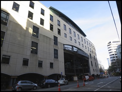  We crossed the road, bimbled by the
Library.
 An interesting wooden thingy.
   One of the Government buildings known
as the ‘Bee Hive’, Arty Bees Book
Shop. The Saatchi and Saatchi
offices.
 The Civic
Hall.
  Wellington is the capital city and second most populous urban area of New Zealand, with 397,900 residents. It is located at the southwestern tip of the North Island, between Cook Strait and the Rimutaka Range. It is the major population centre of the southern North Island, and is the administrative centre of the Wellington Region, which also includes the Kapiti Coast andWairarapa. Wellington is the world's southernmost capital city of a sovereign state. The Wellington urban area comprises four cities: Wellington city, on the peninsula between Cook Strait and Wellington Harbour, contains the central business district and about half the population; Porirua on Porirua Harbour to the north is notable for its large Māori and Pacific Island communities; Lower Hutt and Upper Hutt are largely suburban areas to the northeast, together known as the Hutt Valley. The 2014 Mercer Quality of Living Survey ranked Wellington 12th in the world. In 2011 Lonely Planet Best in Travel 2011 named Wellington as fourth in its Top 10 Cities to Visit in 2011, referring to it as the "coolest little capital in the world".   We walked past the
Royal Australasian College of Surgeons.
  Miss Fox, a
hairdressers had a great message in the window.
 KFC for late lunch.
 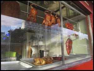  We bimbled past an interesting name and shops. We
stood at the bus stop, if the first one stopped near the station we would get
off at Old Saint Paul’s Church, if the next one was home to Mabel then so be it.
Well there we were chatting to the driver on our way back to Newlands. Mabel had a friend to her right.
ALL IN ALL A VERY HAPPY
CITY
|