Tongatapu

Beez Neez now Chy Whella
Big Bear and Pepe Millard
Fri 6 Dec 2013 23:57
|
Tongatapu
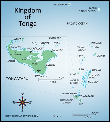 Tongatapu is the main island of the Kingdom of
Tonga and home to the capital - Nukuʻalofa (population 22,400). It is located in
Tonga's southern island group, to which it gives its name, and is the country's
most populous island, with approximately 71,260 residents (2006), 70.5% of the
national population. Tongatapu is Tonga's centre of government and the seat of
its monarchy. Tongatapu, as a commercial and
transport hub, has (led by Nukuʻalofa) experienced more rapid economic
development than, as well as attracting many internal migrants from, the other
islands of the Kingdom.
  Geography: The
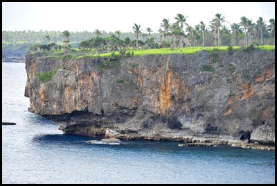
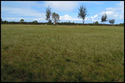
island is just shy of a hundred square miles and rather flat, as it is built of
coral limestone. The island is covered with a thick layer of good soil,
fertilised by ash from neighboring volcanoes. The steep
coast of the south, heights reach an average of one hundred and fifteen
feet gradually decreasing towards the north. The villages of Fua'amotu and
Nakolo reach a staggering height of two hundred and thirteen feet.... We drove
by many banana plantations, tarot, coconut and fields with good, healthy growth.
 North of the island are many small
isolated islands and coral reefs which extend up to four and a half miles from
Tongatapu's shores. The almost completely closed Fanga'uta and Fangakakau
Lagoons are an important breeding ground for birds and fish as they live within
the mangroves growing around the lagoon's shores. The government declared the
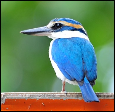
lagoons a Natural Reserve in 1974. On our hire car tour of the island, we
counted seven little chaps out and
about.
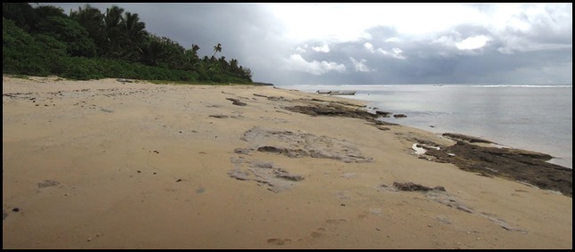 The island has only a few sandy beaches because of its raised coastlines apart from
the many small islands in the north boasting some of the best beaches.
Tongatapu has a cooler climate than the rest of
Tonga as it is the southernmost group of islands in Tonga.
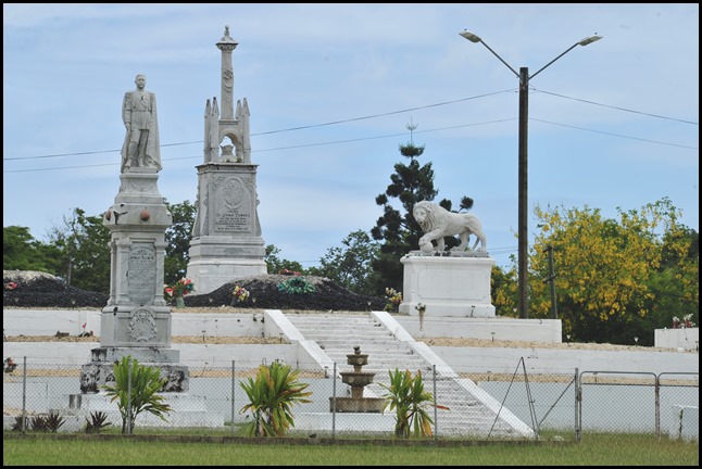 Tombs of Tongan kings.
History: People of
the Lapita culture: Tongatapu is known as having
one of the highest concentration of archaeological remains in the Pacific. The
earliest traces of Lapita pottery found in Tonga was from around 900-850 BC,
three hundred years after the first settlements in Tonga were established.
Archaeologist David Burley discovered the pottery around the Fanga'uta Lagoon,
one thousand, two hundred and forty two miles away from the Lapita pottery found
at Santa Cruz in the Solomon Islands.
Although Tonga was always the seat of
the Tongan Empire, in an area of distances up to six hundred miles, it was often
only a symbolic rule. From the first capital at Toloa, around a thousand years
ago, to the second capital at Heketā, the site of the Ha'amonga 'a Maui
Trilithon – known as the Stonehenge of the South Pacific. Archaeologists and
oral history credits its construction to Tu’itatui, the 11th Tu’i Tonga, this
mysterious structure was erected in 1200 AD and consists of two uprights about
fifteen feet high and a horizontal connecting stone, all cut from coral, each
weighing around forty tonnes. Vegetation in line with the arms of the double-V
between the trilithon and the sea was cleared in 1967, and on the winter
solstice the sun was seen to rise in perfect alignment with the clearings. On a
summer solstice, the sun rose and set along the two other arms.
The third capital at Mu'a (from
1220-1851) has more than twenty royal grave mounds.
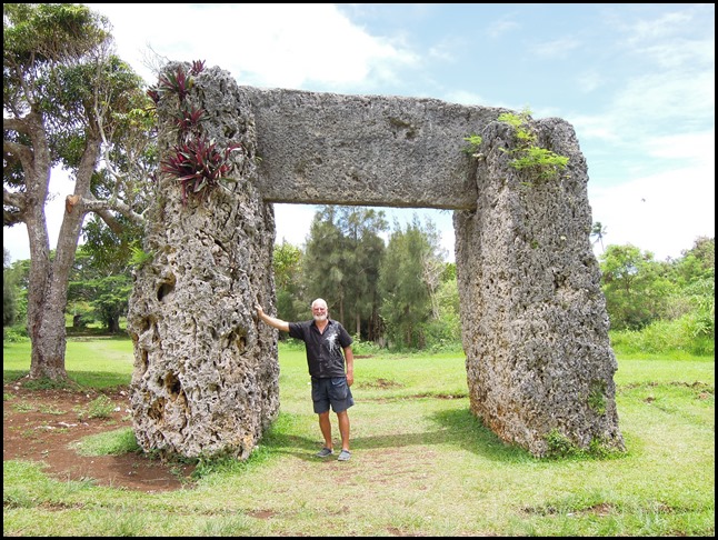 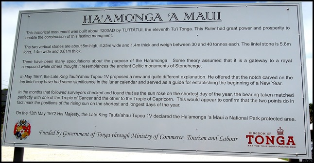 Ha'amonga 'a Maui Trilithon.
European discovery:
Tongatapu was discovered by Europeans on the 20th of January 1643 by Abel
Janszoon Tasman commanding two ships, the Heemskerck and the Zeehaen
commissioned by the Dutch East India Company of Batavia (Jakarta). The
expedition's goals were to chart the unknown southern and eastern seas and to
find a possible passage through the South Pacific and Indian Ocean providing a
faster route to Chile. The expedition set sail from Batavia on the 14th of
August 1642. Tasman named the island "t’ Eijlandt Amsterdam" (Amsterdam Island),
because of its abundance of supplies. This name is no longer used except by
historians.
 Bear poses in sleep,
stick at the ready.
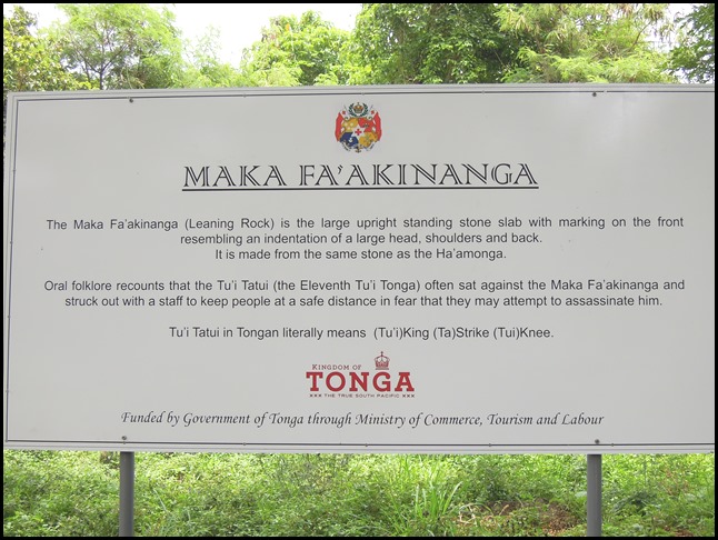 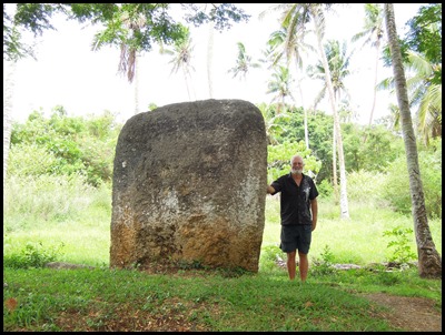
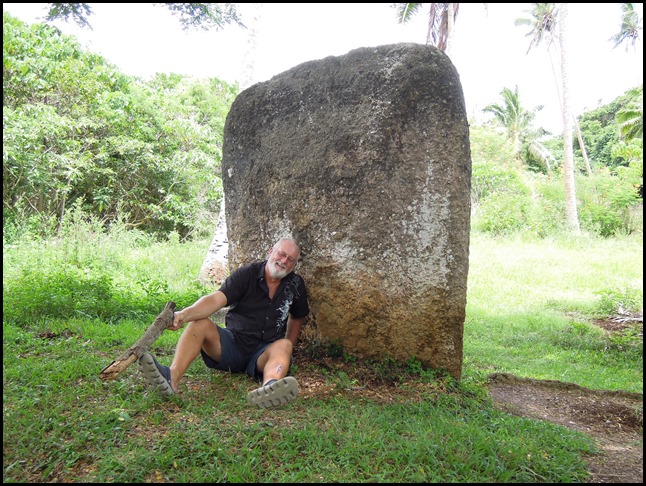
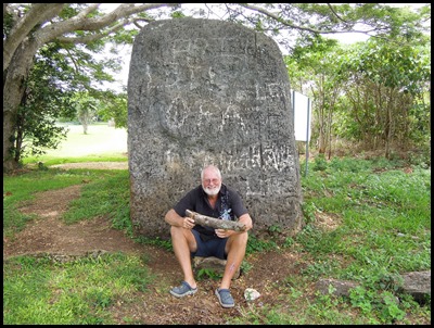 Behind the trilithon was a path, we
followed it and found a big stone. On searching both sides, neither of us saw
the indentation and all we did see was a bit of
graffiti. Mmmmm. The Tu’itatui supposedly rested here whilst watching his
men build the trilithon.
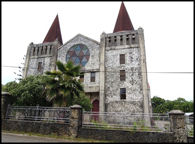 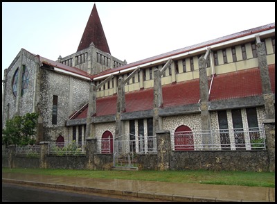 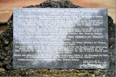 The plaque outside The Centennial Church of the Free Church of Tonga
1885-1985.
The plaque reads: His Majesty King
Siaosi Tupou I founded the Free Church of Tonga on January 6th
1885.
The foundation stone of this church
was laid by his Majesty King Taufa’ahau Tupou IV on July 7th 1983 and was
erected by the members of the Free Church of Tonga during the presidency of Rev.
K. Lelea Fonua and Rev. Semisi Fonua.
Opened and dedicated by His Majesty
King Taufa’Ahau Tupou IV on December 4th 1985 in commemoration of His Majesty
King Siaosi Tupou I.
Consecrated by the President Rev.
Semisi Fonua. Tablet donated by, Koe Maka Ni Koe Foaki Meia. Kull & Evank’a
Kaifa &Famili. Auckland, New Zealand.
Note on spelling and
Pronunciation: The earliest mention of Tongataboo was recorded by
Captain Cook in 1777 as he wrote his memoirs for the Three Voyages Around the
World, Volume 1. We all tend to say Ton-Ga, when in fact we should say
Tong-A.
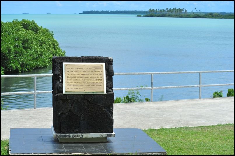 ‘Alaki. Landing site of Captain Cook.
The plaque
reads: Here stood formerly the great banyan “Malumalu- ‘O -Fulilangi” or Captain
Cook’s Tree under the branches of which the celebrated navigator came ashore on
his way to visit Pau. The Tu’I Tonga (Sacred King of Tonga) on the occasion of
the Inasi (presentation of the first fruits) in the year 1777. Queen Elizabeth
II, the Duke of Edinburgh and Princess Anne visited on the 7th of March 1970, we
did on Wednesday the 4th of December 2013.
Tonga is
called ‘The Friendly Islands’. On Captain James Cook’s third voyage, he spent
from April to July 1777 in the Tongan Islands. While visiting Lifuka in the
Ha’apai Group, Cook and his men were treated to lavish feasting and
entertainment by Chief Finau, inspiring Cook to name his South Seas paradise the
Friendly Islands.
Later it was
learned that the celebration had been part of a conspiracy to raid the two ships
Resolution and Discovery for their plainly visible wealth. The entertainment had
been planned in order to gather the visitors in one spot so that they could be
quickly murdered and their ships removed of their valuable items. There was,
thankfully, a last minute argument between Finau and his nobles, and the whole
plan was aborted. Captain Cook never knew of the kerfuffle or how close he and
his men came to never carrying on or how narrowly they had escaped, he may
indeed have changed his mind about naming the ‘friendly islands’.
How have we
found them. In our hire car we have (as per normal) ventured off the beaten
track, several times cars have stopped to ask if we were “OK”, “do you need
help”, “are you lost”. Passing people in the street, everyone says hello or
smiles, many stop to chat, “how long have you been here”, “are you enjoying your
stay”, and the children all say “Bye” – someone must have started them off and
they all now think this is the correct form of address – cute.
When we see
groups together they are always laughing and having fun. We have never seen a
parent smack a child, or ever seen a little one cry for that matter. We have
never seen a beggar and only one person soundo under a tree. Poor, many are in
the first world sense of the word – possessions are not important, but people
are always well dressed, clean and show a big ‘white’ smile. Our last picture
goes to a church painting crew who had laughed and
cheered as I strutted up and down a wall in the graveyard on the opposite side
of the road (we were getting up close and personal with bats at the
time).
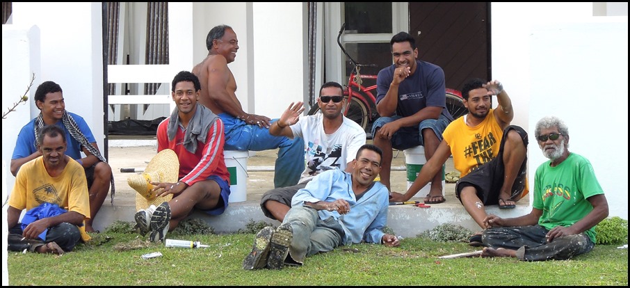 ALL IN ALL ARE THESE THE ‘FRIENDLY ISLANDS’
– A BIG YES
HAPPY SMILEY PEOPLE
|