Lost Villages
|
The Lost Villages
The Lost Villages are ten communities in the Canadian
province of Ontario,
in the former townships
of Cornwall
and Osnabruck
(now South
Stormont) near Cornwall,
which were permanently submerged by the creation of the Saint
Lawrence Seaway in 1958 - a cost of $460 million. The flooding was expected and planned for as the result of the
Moses-Saunders Power Dam construction that began in August 1954. In the weeks
and months leading up to the inundation, families and businesses in the affected
communities were moved to the new planned communities of Long
Sault and Ingleside.
These negotiations were controversial, however, as many residents of the
communities felt that market value compensation was insufficient since the
Seaway plan had already depressed property values in the region.
The town of Iroquois
was also flooded, but was relocated 1.5 kilometres
north rather than abandoned. Another community, Morrisburg,
was partially submerged as well, but the area to be flooded was moved to higher
ground within the same townsite. In all, approximately 6500 people were
displaced by the project,
530 buildings moved, and countless other homes, schools, and businesses
demolished. A portion of the provincial Highway
2 in the area was flooded; the highway was rebuilt along a Canadian
National Railway right-of-way in the area. At 8 a.m. on the 1st of July 1958, a large cofferdam was demolished using 30 tonnes of explosives, allowing the flooding to begin. Four days later, all of the former townsites were fully underwater. Parts of the New York shoreline were flooded by the project as well, but no communities were lost on the American side of the river.
 Lost Villages Museum near Long Sault
Entrance to Pioneer Memorial that contains headstones from cemeteries of the Lost Villages and mounted tombstones from St. John's Cemetery
A museum in Ault Park near Long Sault is devoted to the Lost Villages, including several historic buildings salvaged from the communities. Other buildings from the villages were moved to the site of Upper Canada Village in Morrisburg. The flooded area also includes Crysler's Farm, where a major battle was fought during the War of 1812. A monument commemorating the battle was also moved from Crysler's Farm to Upper Canada Village. In some locations, a few remnants of sidewalks and building foundations can still be seen under the water, or even on the shoreline when water levels are sufficiently low. Some high points of land in the flooded area remained above water as islands, and are connected by the Long Sault Parkway. Lock 21 of the former Cornwall Canal (since replaced by the St. Lawrence Seaway) is a popular scuba diving site, a few feet from the shore along the Parkway. The Lost Villages were Aultsville. Dickinson's Landing. Farran's Point. Maple Grove. Mille Roches. Moulinette. Santa Cruz. Sheek's Island. Wales. Woodlands.

Christ Church moved
At the time response to the news was mixed. When the pact finally was signed and construction began in 1954, many breathed a sigh of relief and began to celebrate. It was finally over. Quite a few residents looked forward to the thought of living in a new town site and enjoying the conveniences of running water, paved roads, street lighting, mall shopping and all the other amenities that people in larger towns took for granted. Others were heartbroken at the thought of losing riverside homes that had been in their families for generations. Initially many of the residents were not impressed with the relocation plans. It called for the formation of two new towns called Long Sault and Ingleside. Residents from the villages of Mille Roches and Moulinette would be offered comparable new homes in Long Sault and those from the communities of Wales, Dickinson’s Landing, Farran’s Point and Aultsville were offered homes in Ingleside. Farmers and business owners could obtain farms or businesses of similar size and quality. The alternative was cash at market value plus 10 per cent. However, since the seaway plans had been in the works for many years, property values were depressed and a number of people, particularly those living alongside the river, believed they were not receiving fair replacement value for their property. The area now is very beautiful, a wildlife haven and a lovely place to visit. 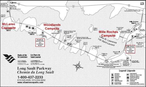  ALL IN ALL THE HAND OF PROGRESS
|


