Cal De Algayarens
Innamorata
Steve & Carol
Sun 22 May 2022 13:12
40:02.87N 003:55.246E With winds forecast from the south until early afternoon tomorrow when it drops before turning to blow from the north, we decided to head north and have a little look at the north coast and check out a potential anchorage and possible head to Mahon if no good before the blow starts on Wednesday. We had a bit of an intermittent slow sail from Ciudadela along the coast, some of the time there was enough wind to gently sail at 3-4 knots other times it either dropped off or went round from behind us and so wasn’t strong enough so there was a lot of sails out, engine off- engine on, sails in, but we had nothing better to do and it gave us a chance to look at the coast as we went by. It's Sunday and loads of small motorboats keep speeding past us heading to the lovely anchorages along this coast, we don’t want to get anywhere too early as we know it will be busy with day boats however they will go back to their marinas for the night and none will stay! Menorca from the sea looks like it is a giant jagged jigsaw piece which has been pushed out of the sea, the north of the west coast is low cliffs with flat land at the top, the cliffs are full of caves, cracks and small coves, some coves have small beaches at the head of them and they are buoyed off for swimmers so boats can’t get in very far if at all. The North coast is similar to the northwest coast of Mallorca but on a smaller scale, from a geological perspective Menorca is made up of two very different areas (Tramuntana/north and Migjorn/south) separated by a fracture line which, apparently, more or less follows the Mehon – Ciutadella road. The northern region is characterised for having the most ancient materials of the island. Its rocks are fractured and folded and make up a framework of heterogeneous land made up mainly of Palaeozoic conglomerates, sandstones and clays; and Mesozoic dolomites, loams and limestones( I looked it up😉😂).  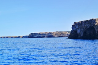 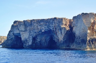 Its a shame that we haven’t got more time to explore some of the lovely looking anchorages! We head for Cala de Algayerens which is past of a 3 or 4 cove inle, its a wide bay with 2 beaches divided by a small river outlet and some rocky cliffs. As anticipated it was busy but most of the motorboats favoured the smaller anchorage off the beach on the north east side of the cove so we chose the less crowded anchorage in front of the fairly busy beach on the southside, the water was again crystal clear - though this time no fish! It looked very inviting but I decided to go for a kayak around the bay instead of swim - it's still a bit too chilly for me to enjoy it! I didn’t see a single fish but enjoyed the views and looking in the small caves, nooks and crannies around the edge. 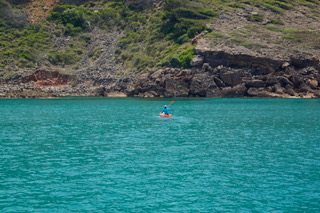 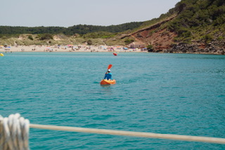 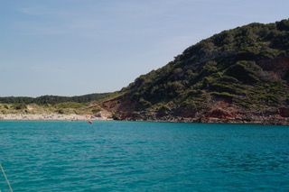 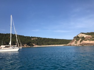 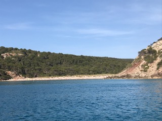 A lovely Cala which it would be great to spend more time exploring, in-between the 2 beaches there is a lagoon which you can walk around with lots of wildlife to see, however the weather forecast for Wednesday onwards is now looking fairly horrible so we need to move on again and seek shelter, with winds potentially forecast to reach gusts of over 40 knots a good anchorage on the south coast would be ideal however they are mainly shallow inlets which though sheltered from the wind allow the swell in and don’t really seem to offer a very secure option - to us it seems like its Cala Addaya a long thin inlet on the north coast - Jamie who we met when anchored at Cala Xinxell said it was good for a northerly blow and our old pilot book describes it as good all round shelter so it's where we’re off to next and if no good we have time to go to Mahon and either stay there if not too crowded or possibly round to the south! |