The top of Australia
|
10:35.911S 142:14.294E Tuesday 11th July 2017 Distance run: 109 nm After much deliberation and discussion with Bob and Sue over
distances, tides and more importantly the weather which was forecast to include
strengthening winds from Monday evening, we decided that as all would be
favourable to go straight to the Horn Island anchorage (opposite Thursday
Island which has no appropriate anchorage), we should abandon the plan to visit
Mount Adolphus Island and make straight for Horn Island. This raised the question of whether to use the Albany
Passage, a narrow stretch of water between the mainland and Albany Island which
shortens the distance and gives a quiet, calm passage through to the Torres
Strait – once inside, and if you get the tides right. The approach
can be unruly, however, so we decided to plan to use it and then assess it once
we get there, with the backup of going through the main Adolphus Channel
instead if necessary. We left the Margaret Bay anchorage at 1800 and kept an eye
on our speed as we didn’t want to arrive at Turtle Head Island, south of
the Escape River, before the tide changed in our favour at 0600. We
actually arrived 40 minutes after low water, and the very lumpy seas told us
that, even so, we had arrived before the turn of the tide. We most
definitely did not want to go through the Albany Passage on an ebb tide, but as
it was still two hours away, we depended on the tide turning in our favour
before we got there. Fortunately the tide gradually lessened its hold on us, and
by the time we approached the passage, we had a favourable half a knot tide and
the lumpy seas had smoothed out somewhat. The entry into the passage was
exciting, but once inside the seas were completely flat and we had a couple of
knots of tide pushing us through. Lovely. We popped out the other
end into the Torres Strait and got our first glimpse of Cape York, the very
northern tip of the Australian continent. The Aussie yachties all make a
stop there to take a selfie beside the sign, but we decided a photo from a
distance would do.
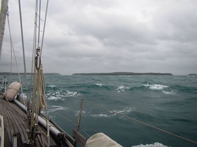
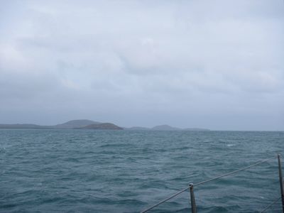
The Albany Passage is the left-hand gap, nearest the
boat. It
opened up as we approached.
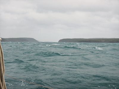
A visible line between the lumpy and smooth seas. Flat
and calm inside the passage.
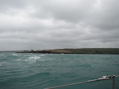
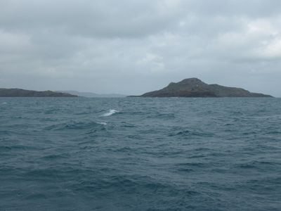
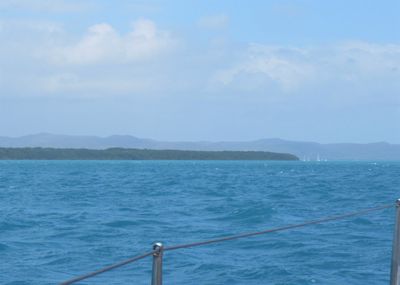
The islands around Cape York come into view to port. Cape
York is the low finger of land to the left of centre.
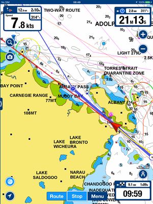
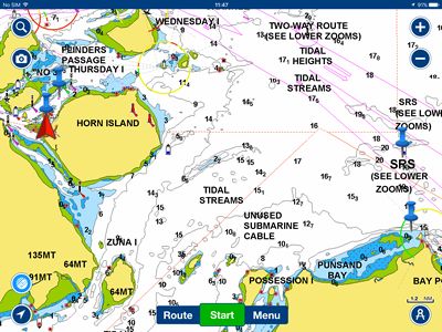
The chart shows us passing through Albany Passage. And then we were in the Torres Strait, the narrow passage of
water between Australia to the south and Papua New Guinea to the north. And
as we turned left around Eborac Island we were at last heading west again –
towards home. Almost as a sign, the clouds cleared and the sun came out
as we headed towards the Flinders Passage and then rounded Horn Island and into
the Ellis Channel towards the anchorage.
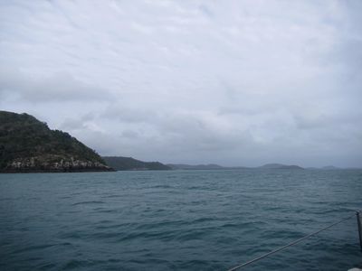
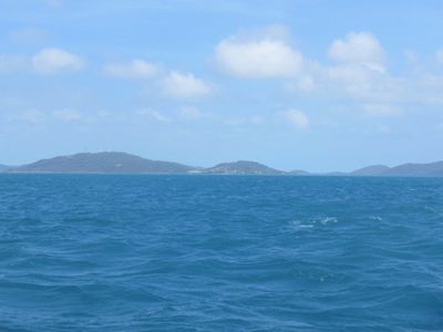
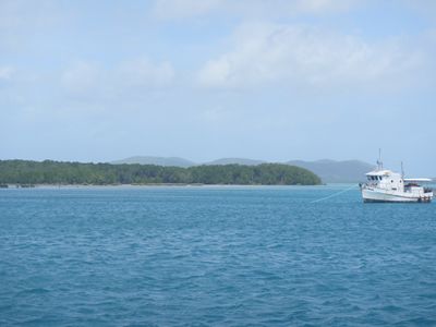
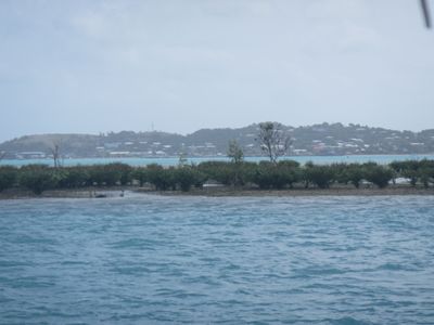
As we rounded Horn Island, our first glimpse of Thursday
Island. Heading
up the Ellis Channel – yachts visible in the anchorage.
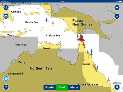
Cape York, bottom right. Our red arrow shows us anchored
off Horn Island. Our first impression was that the anchorage was not
particularly well protected – we had over 20 knots and lively seas until
quite close, but as we got further in the sea state went almost completely flat.
Can’t do much about the wind, but the surroundings are lovely, so as
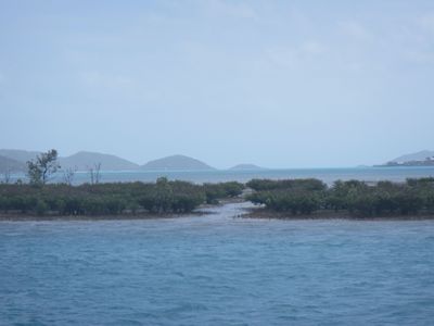
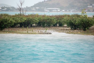
Meatloaf reminds us “Two out of three ain’t bad”! Mangroves
in front, sandspit behind and hilly islands all around – lovely.
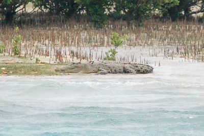
The sandspit and islands behind. Mangroves
in front.
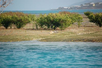
Our new neighbour – look carefully... Yep,
it’s a saltie. Won’t be going for a stroll over there then!
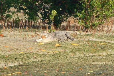
Where is he now?... Waiting
on the water’s edge for a yachtie to go for a swim...
Thursday Island, where we need to check out, across
Ellis Channel. So, here we will rest up and wait for a good weather window
for our 700 nmile passage to Debut in the Kei Islands, Indonesia.
The red arrow shows our position at the northern tip of
Australia. Next stop, the Kei Islands in eastern Indonesia, shown by
a blue thumbtack left of middle, top, to the right of ‘Banda Sea’.
Exciting! |