Lady Musgrave Island
|
23:54.22S 152:24.19E Sunday 21st May 2017 Distance run: 105nm The weather forecast for Thursday was very unattractive so
we delayed leaving Kingfisher Bay until Friday. We lifted the anchor
after lunch and set off on the 100 nm miles or so to Lady Musgrave Island to
time our entry into the pass through the reef with slack tide next
morning. We have plenty of experience of reef entries, having crossed the
pacific, but with all the time spent here in Oz we are seriously rusty and out
of practice, so getting the timing right is essential. We motored out of the remaining channel of the Great Sandy
Strait and into the calm waters of Hervey Bay just as the sun was dipping below
the horizon, hoisted sail and with a gentle 15 knots of south-easterly
behind us headed out to the islands at the very southern end of the Great
Barrier Reef. With no moon until much later on in the night, and with
lots of cloud cover, it was a very dark night. As we left the protected
waters of Hervey Bay the seas became lively and confused and the first of
several squalls hit, with extra wind and plenty of rain. It was not a
night for sleeping. Thankfully it all settled down eventually, and Saturday
morning dawned bright and sunny, though the sea was still unruly until we
passed into the water on Lady Musgrave’s western side protected by her
reef. We entered through the pass at 11:30 as planned, and it was a real
treat to have buoyage to guide us safely in before turning to starboard and picking
our way into the lagoon using Google Earth KAP files and mark one eyeball to
avoid coral bommies. We dropped the anchor in a sandy patch and settled
back into a spot with swinging room between bommies. After lunch and a
nap, Steve went ashore with Bob & Sue for a walk around the island, while I
stayed onboard and chilled in the cockpit.
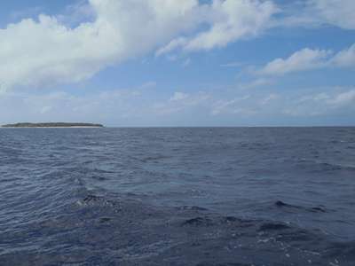
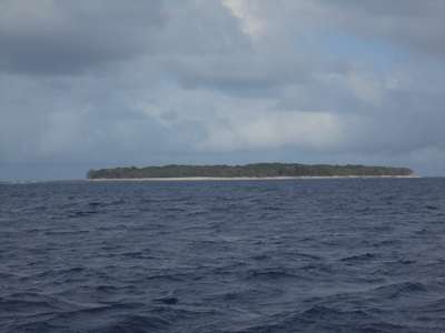
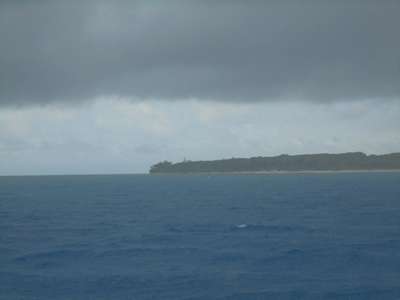
Lady Musgrave Island, as yet with no hint of the enormous
reef that surrounds her.
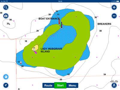
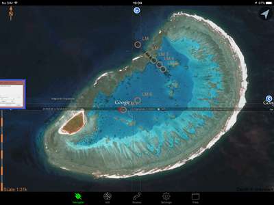
The electronic chart shows the island in yellow, reef in
green. The
Google Earth image shows the island reddish brown, the reef grey.
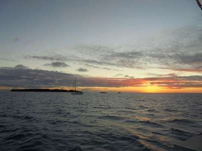
Too late to catch the green flash, but a lovely sunset. On Sunday we all went ashore with our snorkelling gear to
explore the calmer water on the lee side of the island which was reported to
have some interesting coral pools. It was just coming up from low water,
and too shallow for snorkelling, and we considered trying elsewhere, but the
current in the lagoon was very strong because of the sea state outside and the
wind wavelets on the surface quite big, so we went for a walk on the island
while the level rose. Once in the water, we found a few colourful fish,
some orange-tinted stingrays and hundreds of sea cucumbers, but hardly any
coral. A little disappointed, we decided to give up for now, and headed
back to the boat. As the afternoon wore on, dark clouds appeared and the wind
picked up, and after hearing the weather forecast for the next few days we came
to the conclusion that there was little point in staying here any longer.
We were glad we’d had a chance to see the island in the sunshine, but
this really wasn’t the weather for exploring the reef. We planned
our next passage to Port Clinton, about 120 nmiles away on the mainland, and
decided to leave with the slack tide tomorrow.
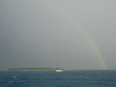
A rather unfriendly sky which very soon dumped wind and
rain all over us. Not the weather for snorkelling, sadly. |