Day 3 - Iron Knob to 50 km past Ceduna
|
Saturday 4th February 2017 Distance driven 566 km (Total – 1674
km) Iron Knob – Kimba – Kooma View Old Farmhouse –
Murphy’s Haystacks – Streaky Bay – Ceduna – White Well
Corner We drove out of Iron Knob at 06:30 after a very peaceful
night’s sleep. They were already at work in the quarry – or maybe
they had been all night? We wouldn’t have known if they had, we
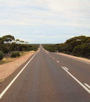
slept like logs. We turned back onto the Eyre Highway and the road stretched
out ahead of us, long and straight.
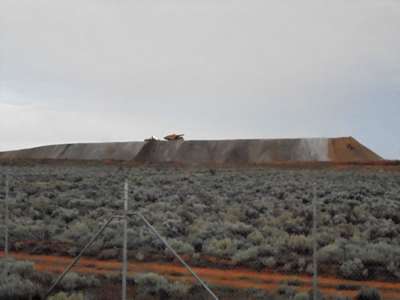
Big trucks on the move on top of Iron Knob this morning. On
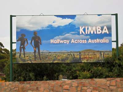
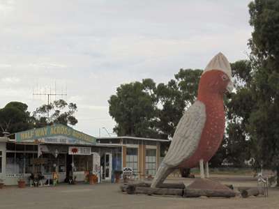
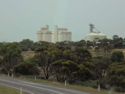
the road again – not a soul around, as far as the eye can see. Our first stop of the day was at Kimba, 90 km west of Iron
Knob and the town that likes to tell everyone it is halfway across
Australia. It is also the biggest grain centre for the Eyre Peninsula, as
it sits at the northern edge of the peninsula’s vast grain belt.
Across from the enormous grain silos in the centre of town is an eight metre
high model of a galah, which apparently marks the midpoint between the east and
the west coasts of Australia. We stopped for a quick look and a Kodak moment
– I invited Steve to go and stand next to it to give it perspective, but
for some reason he declined.
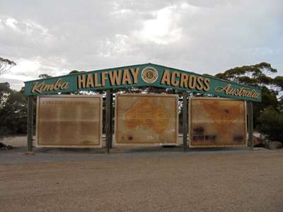
Kimba is clearly proud of its geographical position... ...but
this sign is in need of a little TLC.
A lonely 8m tall galah – Steve wouldn’t be its
friend. We decided to press on a bit before stopping for breakfast,
and after an hour or so consulted Wikicamps, an excellent app which pinpoints
your position by GPS and then gives details of possible stopping points coming
up along the road. There were a few, but the one that grabbed our
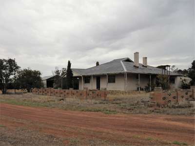
interest was a privately-owned free camping spot that was in the grounds of an uninhabited
wheat-farmer’s house. Apparently the house itself was left unlocked
for anyone to have a look around if they were interested. So we pulled off the road when we saw the hand-painted sign
and came to a halt beside the house and in front of some outbuildings. First
things first, as we had now been on the road for two hours, and the kettle went
on and the bacon into the frying pan. After breakfast of bacon rolls and
a mug of tea, we set off to explore the house. There was not a soul
around, but a sign on the back door invited us to let ourselves in, feel free
to look around but please to respect the house and its contents, and lock the
door when we leave to keep animals out. The house had belonged to Alan and Iris Matthews, wheat
farmers, who ran their farm and brought up four children here. The
eldest son built his own home 5 km along the road in 1973 and took over the
running of the farm when his parents got older. After a health scare they
moved to a new home in Kimba, but would still spend time here until Alan passed
away 9 years ago, followed by Iris 6 years later. Apart from their most
treasured possessions which were taken to the new house, this farmstead is
pretty much as it was when the family lived here.
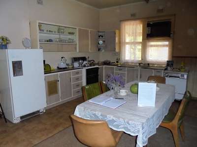
The Kooma View old farmhouse. A
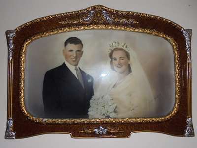
wedding photo of Alan & Iris Matthews still on the wall.
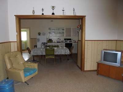
The lounge and kitchen, clean and undamaged, despite
being open to passers-by. Fairly modern appliances including a dishwasher
and air-conditioning. The farm had obviously done well.
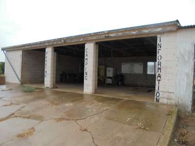
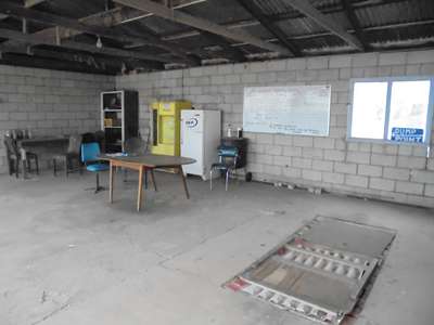
The outbuildings were in a state of disrepair, but had
been set up to give shelter to campers. There was a toilet and a dump
point for public use. We wrote a note of thanks in the visitors’ book, and
got back on the road, marvelling at the kindness of the family for providing
the facilities for travellers and allowing people to see the house. We
were pleased that it had not been taken advantage of, and wondered how it would
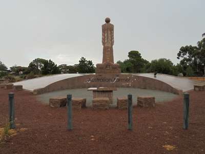
have fared in England. 40km along the road we came to the small town of Wudinna, where
our attention was drawn to an 8-metre granite sculpture at the side of the
road, called the “Australian Farmer”. The 70-tonne statue
took artist Marijan Bekic and his son David, two years to carve. It
represents the early settlers of the region, with carvings of sheep and
grain.
The granite sculpture of the “Australian Farmer”
at Wudinna. It began to rain as we got back in the van, and continued to
do so on and off for the rest of the day. We drove on through the wheat
belt, huge grain silos usually giving the first indication that a town was
coming up shortly.
Grain silos were a regular indication that we were
approaching a town. The Eyre Highway took us through a couple of very small
towns before arriving at Poochera, where we turned left off the road onto
Streaky Bay Road. The Eyre Highway would take us directly to Ceduna, the next
and last big town before we set off across the Nullarbor, but we were taking a
detour down to the west coast of the Eyre Peninsula to see some huge granite
outcrops called Murphy’s Haystacks. It was 60 km to Streaky Bay
where we turned south-east for a further 40 km before seeing the sign to the
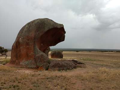
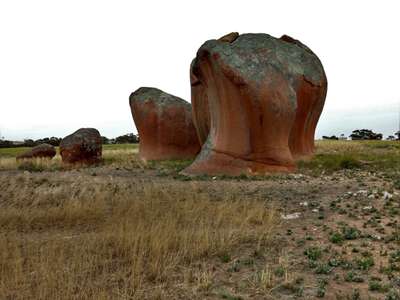
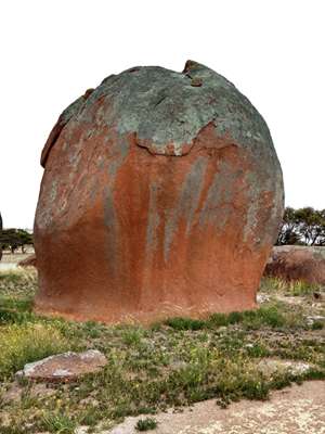
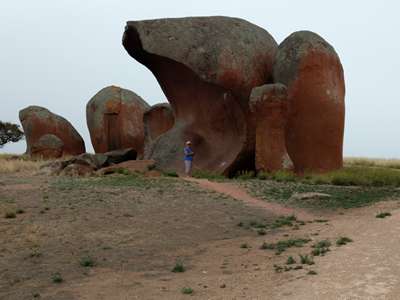
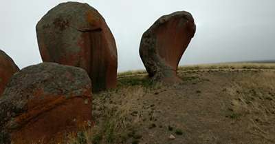
Haystacks. They were well worth the detour. The “Haystacks”
are in fact unusual rock formations called inselbergs, which actually
translates as “a hill that looks like a rocky island rising sharply from
the sea”. They are formed by the uneven weathering of crystalline
rock, in this case pink Hiltaba granite which is some 1500 million years
old. They have probably been in their present form for the last 100,000
years.
We wandered around marvelling at the curves and shapes of
the granite until the drizzly rain turned into big, wet blobs of rain and we
ran for cover. The rocks are actually on private land, on a farm which
used to be owned by a chap named Murphy. No surprise there, then!
They were mistaken for haystacks from a distance by a visiting agricultural
expert (hmmm...), and were thereafter nicknamed Murphy’s Haystacks.
The current farmer has provided a shelter for visitors, toilets and a car park,
and admission is just $2 each, into the honesty box. We bought some local
honey which was on sale at $5 a tub – it was good value and would support
a local farmer. Back on the road again, we traced our route back to Streaky
Bay, and this time drove into the town and down to the foreshore where we
parked overlooking the bay and had lunch. Before leaving we had some
housekeeping jobs to do, ready for our long drive across the Nullarbor, so we
visited the public dump site and emptied our waste tanks and filled up our
fresh water tank. Jobs done, we headed out of town towards Ceduna. We arrived in the late afternoon, and took a turn around the
small town before stopping at a supermarket just before closing time. We
had completely forgotten it was the weekend, so were lucky to catch it
open. We stocked up on a few essentials and made sure we had enough meals
in the fridge for the next five days. There are no towns between here and
Norseman, just small settlements, and only roadhouses and maybe a kiosk to buy
food. The roadhouses usually have takeaway or eat-in food available, but
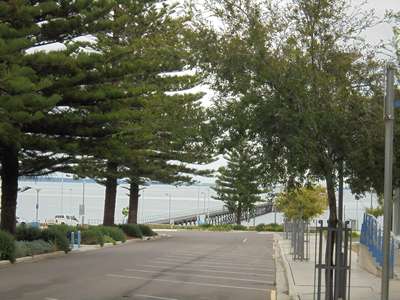
we would much prefer to cater for ourselves. We wandered down to the foreshore and back, remarking how
like the last town it was, and then got back on the road to find ourselves a
spot to stop for the night.
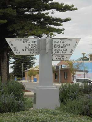
The road down to the foreshore at Ceduna. The
signpost told us it is still 1924 km to Perth. We set off again and consulted Wikicamps along the
way. 50km along the road we found a rest stop at White Well Corner.
Here the road passed between vast stretches of wheat fields, with not a
building in site. The rest stop was basically somewhere to park safely,
off the road. The only facilities were a couple of rubbish bins.
But we didn’t need anything, we had everything we needed on board.
The batteries were benefitting from the number of hours we were driving each
day, so we had no need to plug in to mains power. We were
self-sufficient. So we parked under the trees and enjoyed having the
whole place to ourselves. There was a low rumbling from time to time as
road trains rushed past, but nothing was going to disturb our sleep. It
had been another long and busy day.
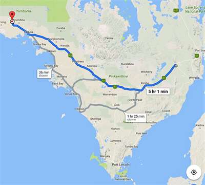
This Google map doesn’t show the detour to Murphy’s
Haystacks. They are South of Streaky Bay which is on the coast just near the “36
min slower” note.
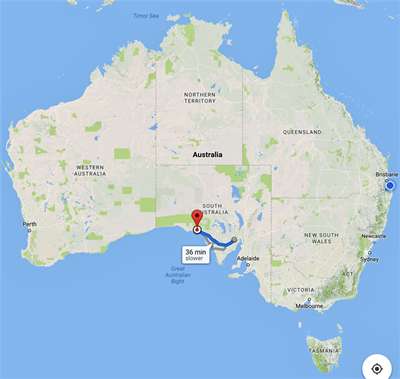
Today’s trip brings us to just under halfway
between Melbourne and Perth. |