Sawmill Bay, Cid Harbour
|
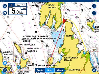
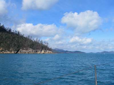
20:15.373S 148:56.719E Monday 29th May 2017 Distance run: 15 nm We set off from Tongue Bay after breakfast and headed around
the Northern tip of the island and through Hook Passage, the narrow gap between
Whitsunday Island and Hook Island. From there we needed to stay close to
the shore of Hook Island to avoid a large area of shoals before turning to port
and making our way into Cid Harbour.
The yellow line shows our track from Tongue Bay to Hook
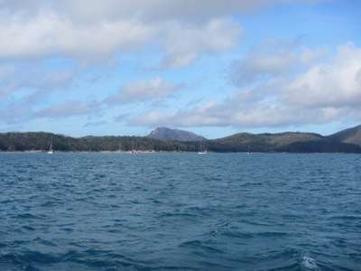
Passage. A look back into
Tongue Bay as we head off towards Hook Passage. The blue patch below our red arrow is the shallow area to
avoid. Sawmill Bay is to the left of the words “Whitsunday
Island”. Having carefully checked the direction of the tidal flow, we
were certain we would have the assistance of a fair current as we passed
through the narrows. What happened was completely the opposite, and we
were slowed quite a bit by the tide rushing against us. We later found a
note on the chart that advised that this particular passage has a contrary tide,
but it either wasn’t mentioned in the pilot books, or we, and the guys on
Mawari, had missed it.
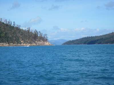
Approaching Hook Passage, the gap between the islands
opens up... and grows wider. The hills of the
mainland can be seen in the distance.
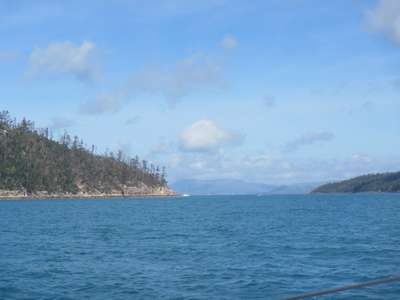
Passing through Hook Passage. The upshot was that we didn’t arrive in Sawmill Bay
until after midday, so once again it was a case of getting anchored, grabbing a
bite of lunch, getting the dinghy down and getting ashore in time for our walk
to the top of Whitsunday Peak and back before dark. Personally I was in
favour of chilling out for the afternoon and tackling the Peak tomorrow
morning, but I was outnumbered 3-1, so off we went. The reason I would
have preferred to go in the morning was that it was one of those walks where a
lot of stopping “to admire the view” would be needed.
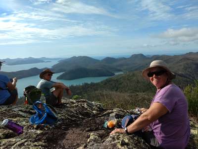
Although only 2km to the top, it was all uphill as the Peak is some 430 metres
above sea level. The guide book gave a walking time of 4 hours return,
but I suspected I would take longer with all my view-admiring
stops. In the end I made it to the top with 10 minutes to
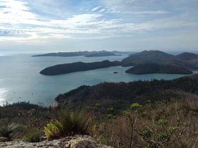
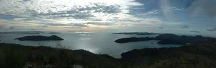
spare, and the views were definitely worth the effort, although I could not
speak to admit as much for at least that ten minutes! We sat on the rocks
at the top and took in the views of the islands and the mainland – so
beautiful.
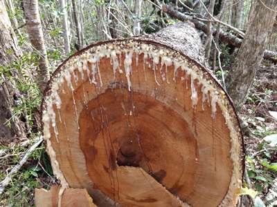
Resin had seeped out of this felled tree. And
was seeping out of the other cut end too.
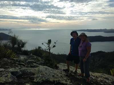
Happy to be at the top of Whitsunday Peak! The
anchorage and beach we had come from on the left.
Time to head back down before we lose the daylight.
Cid Island to the left, Hook Island to the right (top),
Cid Harbour centre and Dugong Bay centre right. Beautiful. Eventually we reluctantly set off back down to the beach,
reaching it in a much quicker time, and stopped to rest on James Cook’s
memorial which was sadly looking a little neglected. This time there was
no shallow water or coral garden to negotiate, and we made it back to the boats
in plenty of time to enjoy sunset from the cockpit. |