Day 5 - Mundrabilla Roadhouse to Salmon Gums
|
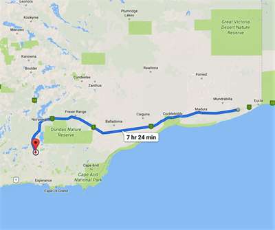
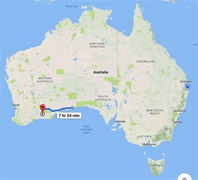
Monday 6th February 2017 Distance driven 718 km (Total – 2926
km) Mundrabilla Roadhouse –Madura - Caiguna –
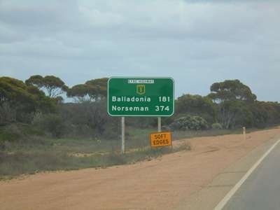
Balladonia – Norseman – Salmon Gums We set the alarm for an early start, but then had to wait
for daylight in order to set off. We probably should have asked what time
the sun rises as well as the clock time! Never mind, we had time for tea
and raisin toast before setting off.
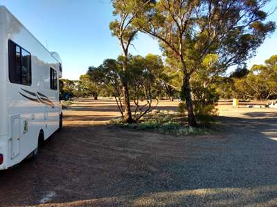
The campsite at Mundrabilla Roadhouse. Back
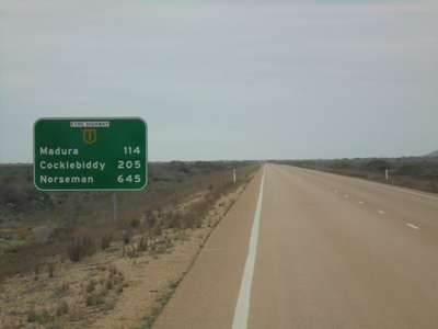
on the road with 645km to Norseman, our turning point.
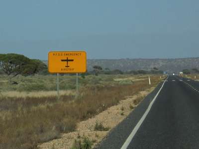
A zebra crossing in the middle of nowhere? No, an
emergency landing strip for the Royal Flying Doctor Service. Expected the
Beatles to cross! Before long we found we were heading downhill quite steeply
in the Madura Pass, where the highway descends from the Hampton Tablelands down
to the coastal plain.
Heading downhill fast in the Madura Pass. The
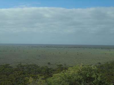
view from Madura across the plains.
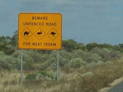
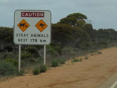
Now we had to look out for emus as well as camels and
kangaroos. We were now in very flat
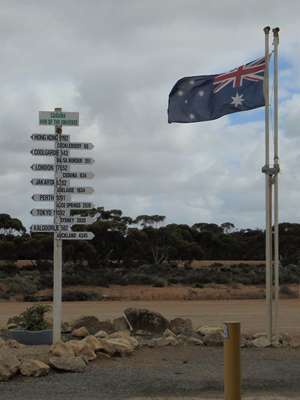
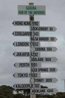
country again – even had some traffic! We arrived in Caiguna mid-morning, and were interested to
find that we were in the “hub of the universe”, according to the
signpost, and 17,652 km from London. Glad we were not driving
there! Perth, on the other hand, was a mere 1091 km away. Getting
closer.
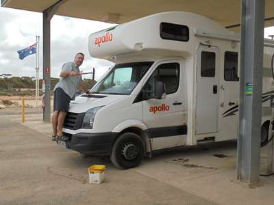
The signpost in Caiguna. We stopped to fuel up and while I paid, Steve did his
routine washing of dead bodies from the windscreen. The wipers did a
reasonable job, but would sometimes smear the creatures’ insides across
the screen instead of washing them away, which was sad for them and unpleasant
for us.
Could I put him to work at the next set of traffic
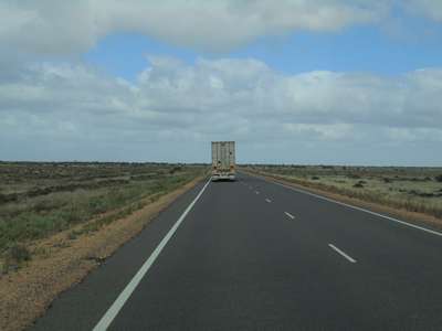
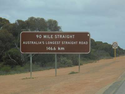
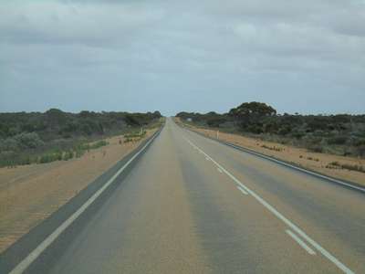
lights? When we set off again, we started on the “90 mile
straight” (obviously named in old money), which the sign informed us is Australia’s
longest straight road. Overtaking should be easy here, then, should the
need ever arise...
I suppose “146.6 kilometre straight” doesn’t
have quite the same ring to it.
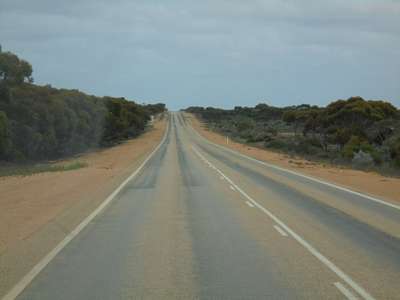
Yep, it’s definitely straight. Though not
flat. So care still needed when overtaking. Now only 374 km to
Norseman, and not lunchtime yet.
My Gawd, now there’s cows and calves wandering
around too... And
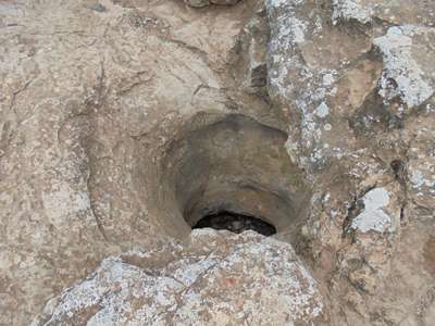
yep, it is still straight. A short drive out of Caiguna we stopped at the
blowholes. These have been formed by weathering of rock through to
cavities below. The cave below here had clearance heights of 0.5-1.5
metres. Apparently it breathes out when the pressure falls and in when it
rises. Makes sense. Clearly the pressure was fairly constant today as we
heard not a sigh. Just to add to our disappointment, the sign told us
that some of the caves on the Nullarbor breathe at 72km per hour. Bet you
can hear those!
One of the Caiguna Blowholes. Didn’t hear a
thing. We reached the end of the 90-mile straight and shortly after
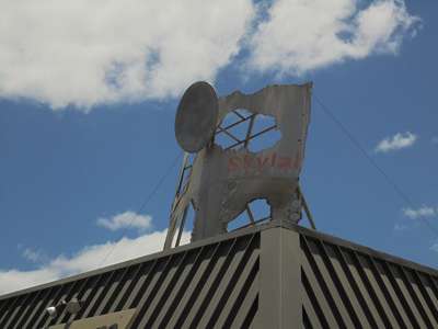
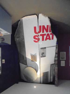
arrived at Balladonia. This tiny town made world headlines in 1979 when
it was showered with pieces of the US Skylab space station as it re-entered the
earth’s atmosphere. At the roadhouse there was a small museum with
a collection of the parts that fell from the sky.
Parts of Skylab on the roof of the roadhouse and in the
museum next door. We arrived in Norseman mid-afternoon, and were a little
surprised to find it a tiny and very sleepy town. Considering its
position at the end of the Eyre Highway, where one must turn either north towards
Kalgoorlie or south towards Esperance, we somehow expected it to be bigger.
Norseman was established as a mining town in 1892, and today combines mining
with serving the needs of travellers for its upkeep. As we entered the
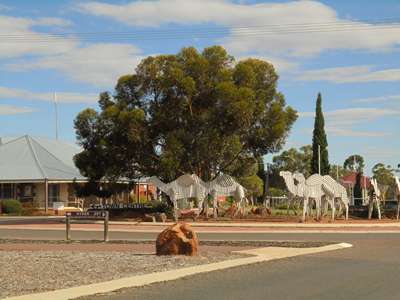
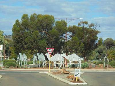
town we were met by corrugated iron camels on the roundabout. They
commemorate the role played by camels in the development of the town. They
were a common sight in and around the town at the turn of the 20th century,
a team able to collectively carry between 16 and 20 tons on their backs. The
wide main road in town owes its size to the turning circle needed for a camel
train.
The corrugated iron camels on the roundabout in the
centre of Norseman.
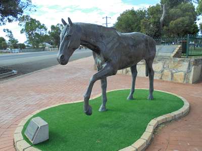
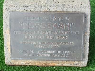
The town was named after Norseman the horse, who
apparently unearthed the first gold nugget when pawing (hoofing?) at the
ground. We had a look around town, which did have a few shops, the
first since the border, and we were able to buy some fruit and vegetables,
albeit not very fresh ones. We visited the small visitors’ centre, then
borrowed the key for the dump station. At this point the plan involved making a decision whether to
go north to Kalgoorlie and then along the inland route to Perth, or to go south
to Esperance and explore the south west corner of the country. This was
an easy call, as we had made good enough time to allow ourselves our preferred
route south. We still had four days left so there was no rush to get to
Perth, and when we set off again we turned left onto the Coolgardie-Esperance
Highway and left the Eyre Highway behind as we headed south towards Esperance. We drove for an hour alongside a railway line and between
wheat fields, and then found a delightful rest stop just before Salmon Gums.
It was a little after 5 p.m. according to our watches, but we should have put
them back at Caiguna, so it was in fact 45 minutes earlier. With the
place to ourselves, we could relax and enjoy the peace and quiet. We
might even see some wildlife – something that has been distinctly lacking
so far, in spite of all the warning signs on the roadside. We thought we
might have seen some at dusk in many of the places we have stopped, but
nothing, which has been rather disappointing.
A delightful place to park for the night – a free
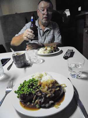
rest stop just off the road. Now we had some potatoes, we were able to have the bangers
and mash we’d been looking forward to since before they WA
checkpoint! And it was well worth the wait. Cheers.
Bangers & mash for dinner. Yum.
Google maps of today’s drive. |