Day 7 - Albany to Alexandra Bridge
|
Wednesday 8th February 2017 Distance driven 402 km Total
- 3927 Albany – Pemberton – Alexandra Bridge We had a bit of a lie-in this morning as we have covered the
bulk of the miles to Perth already, leaving ourselves a bit of time to see some
of the south-west corner of the country. So we didn’t get up until
7, then had breakfast and long, leisurely showers in the camp amenities which
were very clean and had lashings of hot water. Before leaving, we emptied
the grey tank and filled up with fresh water.
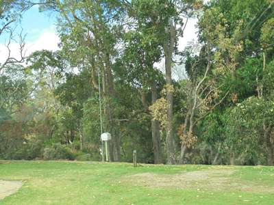
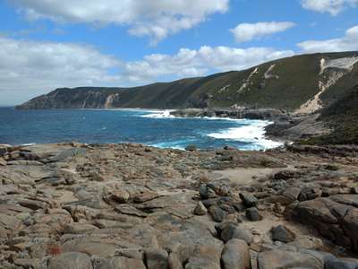
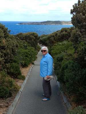
Our stop beside the King River (behind the trees!) We headed south from the campsite to the peninsula
south-west of Albany to Tondirrup National Park. Some 1350 million years
ago, Australia and Antarctica collided, joining together for almost 1300
million years. This is recorded in the rocks in the Torndirrup NP, which
were formed as a consequence of the collision. The rock, Granodiorite and
Gneiss, were formed many kilometres below the surface under extreme
temperatures and pressures. The collision caused the Earth’s crust
to crumple, causing an extensive mountain belt to form. Weathering and
erosion have long removed its lofty peaks, but its mountain ‘roots’
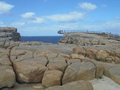
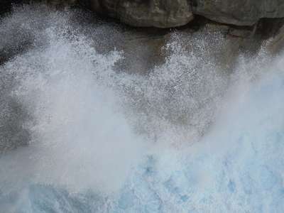
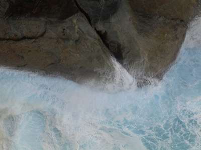
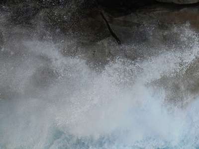
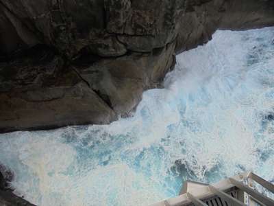
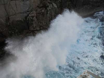
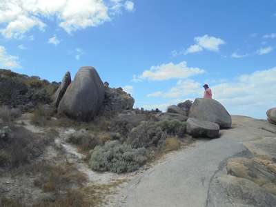
remain and today form the geological foundations of most of the south coast. We went first to The Gap, a spot where the ocean thunders
into a gap in the cliffside, which can be viewed from a recently
constructed platform jutting out from the cliff edge. People have visited
this spot for a long time, but the rocks at the cliff edge are unstable making
it dangerous to get a good view. So the platform was designed so that it
sits on a fulcrum base back from the edge on the stable rock, and extends on
five stainless steel arms out over the water. It can apparently take the
weight of four fully grown African elephants – though why the designer
thought elephants would be using it is a mystery!
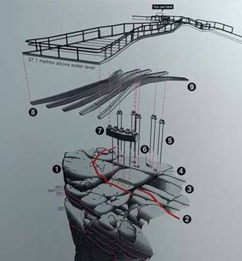
The platform is 37.1 metres above sea level and extends
almost 11 metres from the fulcrum out over the sea. No elephants here today.
30mm diameter rock anchors hold the beams in place and
are fixed up to 9 metres down into stable rock. It was scary! The platform moves up and down as you
walk on it, and the wind was blowing quite hard into the bargain. Steve
had a quick look and then found something far more interesting to look at back
on terra firma... I loved watching the waves crashing and breaking
against the rocks, and could have stayed there all day, but eventually the wind
got the better of me and I retreated into the sunshine to warm up.
Looking down into The Gap at the forces of nature.
Awesome.
Presumably this was once a fault or crack in the cliff
face which has widened as the action of the waves erodes the sides.
Still pictures cannot convey the roaring sounds that
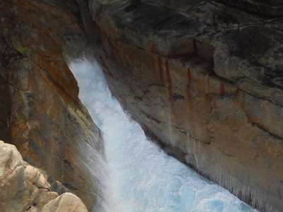
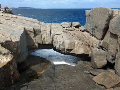
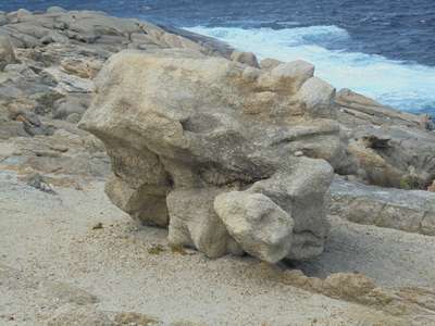
accompanied the waves as they broke onto the rocks. It was exhilarating. Not far from The Gap was Natural Bridge, an example of the
waves cutting into the cliffs and leaving a natural arch.
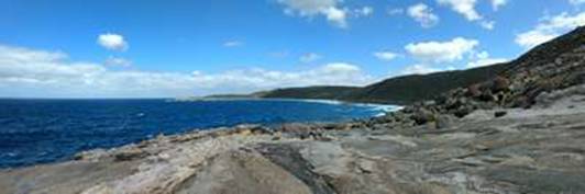
The view along the coast to the west. Natural
Bridge. We then drove a little further onto the peninsula to see and
hear the blowholes. We followed the signs downhill to the end of a long
made-up path which deposited us on a rocky foreshore. We looked around
for signs of blowholes, but nothing was obvious. Certainly no wet rocks
to show where the sea erupted from the rock. We stood a while and as we
were about to make our way back to the van, assuming they were not blowing
today, a tremendous roar nearly knocked us off our feet! We were standing
right beside a blowhole without realising, all our previous experience of
blowholes involving a spray of water as well as a gust of air. It roared
a few times more, a hollow and somehow eerie sound, before settling back into
silence – no doubt ready to catch the next visitors by surprise too.
On the path down to the blowholes. The
view from the peninsula towards the west.
The blowholes – we weren’t sure of their
actual location, until they blew – made us jump a mile in the air!
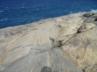
Going back up the path, it was interesting to see these
smooth boulders on one side, and this rough one on the other. Back at the van it was time to head into town for a look
round. Albany is a good-sized town, probably the biggest we have seen
since leaving Adelaide and it was very busy. Like Esperance, it was clean
and pleasant with a prosperous and looked-after feel to it, with older
buildings that spoke of its history. The British Government ordered a settlement to be founded
here in 1826, in part to prevent the French establishing a hold on the
Australian Continent, but mainly because of growing dissatisfaction with the
convict settlement at Port Macquarie in New South Wales. In November of
that year, the brig Amity sailed from Sydney with a party of 23 convicts,
mostly tradesmen, 18 rank and file soldiers, 3 officers, a surgeon and a
storekeeper, with stores for six months, including sheep and pigs. This
was the first European settlement of Western Australia. From 1834 new
settlers began to arrive and develop agricultural and pastoral holdings.
For 178 years of its history, whaling was important for the town, and its
whaling station was the last one in Australia to close in 1978.
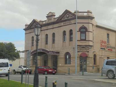
The London Hotel, built in 1909. Albany
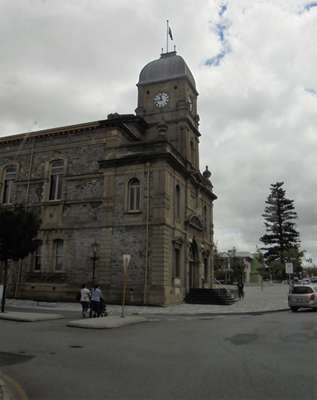
Town Hall, 1888, the first civic building built.
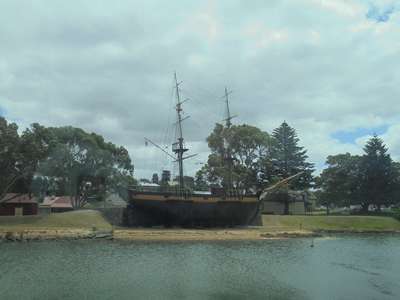
Replica of the brig Amity which brought convicts here
from Sydney in 1826. There was so much to see in this history-rich town that it
deserved a good few days to do it justice, and we just didn’t have the
time. It is said you should always leave a place with a reason to come
back, and exploring Albany is certainly on that list. Another time. We headed off out of town, stopping for a cheeky burger –
early lunch - at Macca’s on the way. We were now driving into the
south-west wilderness, an area of tall Karri trees, and were making our way
through the forest towards Pemberton and the Gloucester Tree. During
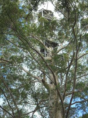
the 1930’s and 40’s, a series of fire lookouts were constructed in
the top of a few very tall Karri trees. They were a way of spotting forest
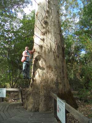
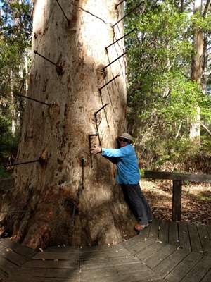
fires. The Gloucester Tree was chosen as a fire lookout in 1947, and was
named after the then Governor-General of Australia, HRH the Duke of Gloucester,
who was visiting Pemberton as the lookout was being built. Today visitors
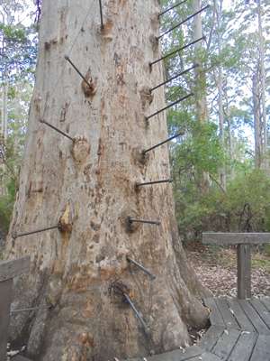
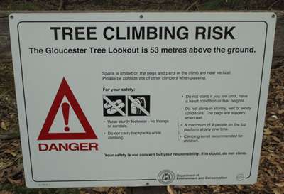
can climb the 53 meters to the lookout at the top via 153 pegs, which were
originally wooden, but are now metal.
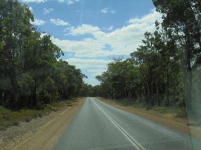
A very different outlook from the road now as it wound
its way through Karri forest.
The lookout in the top of the Gloucester Tree. The
first 8 pegs, another 145 to go to the top.
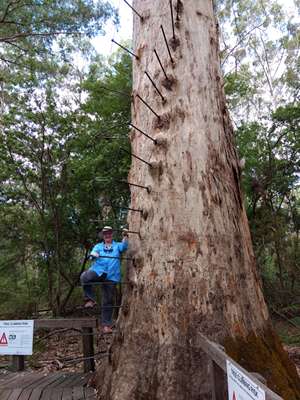
We both climbed the first few pegs, and decided that was
probably high enough! We were surprised to discover that the tree could be climbed
by anybody, and without safety lines. Officially one is meant to buy a
climbing permit, but the tree is just there, in the forest, unattended.
The pegs spiral around the tree trunk.
Steve
gives some idea of the height of the tree.
I just had to give it a hug! Be
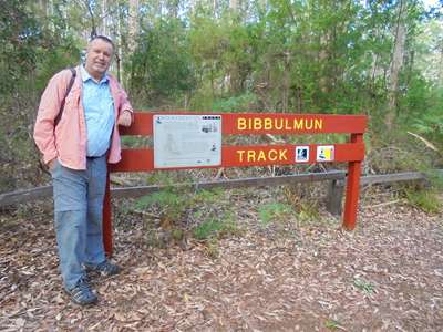
warned! There were several walks of varying lengths into the
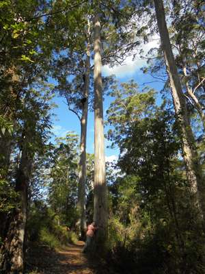
surrounding forest, so we chose a short one and went for a tramp in the
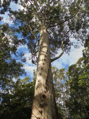
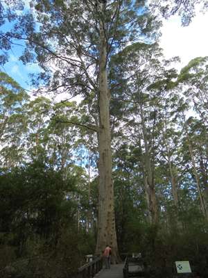
woods. Karri trees are a variety of eucalypt native to the wetter regions
of this south-west corner of Australia. Proper name Eucalyptus
diversicolor, the karri grows to 90 metres in height and has a very
straight trunk that has no branches until high up in the tree. For most
of the year the bark is pale grey, but at the start of winter the bark is shed
revealing shades of orange and pink for a few months.
Deciding which track to walk. Always
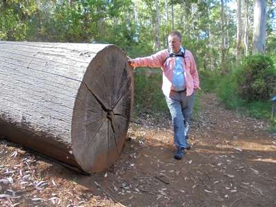
sad to see a tree that’s been felled. We wondered why.
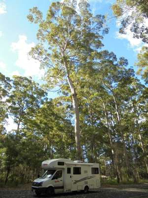
I asked Steve to give it perspective - he hugged
it! The
camper van dwarfed by karri trees. By the time we got back to the van it was almost 5 o’clock,
so we had a quick cuppa and then got back on the road to cover a few more
kilometres towards Margaret River before finding somewhere to spend the
night. Wikicamps showed a campsite beside a river at Alexandra
Bridge, just over an hour’s drive away, and we enjoyed an early evening
drive through the forest, arriving at the campground around 6.30. There
were plenty of spaces available, and we chose one with plenty of room for the
van. A council-run campsite, the facilities were very limited, with just
two toilets (which were at least flushing!) and one outdoor cold shower.
We could see no rubbish bins anywhere, and there was no power. So it wasn’t
as good as the free rest stops we had stayed at, but there was a charge of $10
per adult per night. We left our $20 in the honesty box, but thought it
over-priced for what was basically somewhere to park for the night.
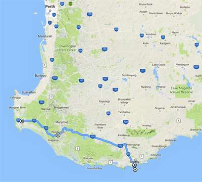
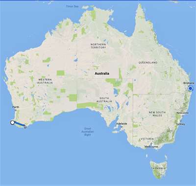
Google maps to show today’s drive. |