Matei, Taveuni
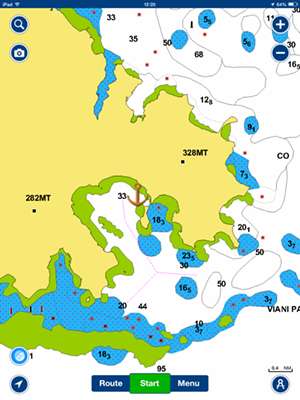
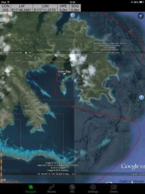
16:40.926S 179:52.51W Sunday 5th July 2015 Distance run: 26 nmiles We retraced our way through the gap in the reef this morning and left Albert Cove behind us as we headed back down the west coast of Rabi, past Katherine Bay towards the island of Taveuni. As we headed towards a gap in the outer reef surrounding Rabi, we had a call from Bear. “Er, have you seen the light blue bit?” Thinking he was referring to the area shaded light blue on the chart (to show shallow water) we assured him that, yes, we had seen it thanks, and were a good half a nmile away from it. Then, a minute or two later, knowing the charts here are not very accurate, I started to wonder if he had meant the chart or an actual patch of light blue water on the water, so I had a good look around. Whoops! Sure enough, over on our port side there was a long line of light blue water which stretched right out in front of us. Uh oh, right hand down a bit – now! Thanks Bear! We may well have sailed safely over it, as it was light blue and not green or yellow as the really shallow stuff is, but would rather not have tested it to see! It served as a reminder that you cannot relax and sit back in these waters, you must always be looking out and checking the water. The charts are fairly accurate in some places – particularly around big ports – but are also quite inaccurate in others. That’s where modern technology now helps people cruising places like Fiji as we have radar and, believe it or not, Google Earth to help. Radar is very useful in checking the position of land masses, particularly if passing between two islands. We can overlay the radar display on our chart plotter to check that the hard bits are where the chart says they are. Or we can simply measure the distances on the radar display and check them with distances on the chart. Where reefs are concerned, however, radar doesn’t always pick them up, or doesn’t pick the whole reef up, as they are by nature low-lying or indeed submersed. Even though we only need 7’ of water to clear the keel, and we may be sailing in otherwise deep water, it is still possible to come a cropper in this part of the world. This is where Google Earth comes in. It is possible to pinpoint reef positions from GE images using lat/long, and to mark them on our chart as an area to avoid. A clever yachtie has actually written a program which can capture the GE image of an area and place it on an electronic chart. With this system, it is possible to toggle between the chart and the GE image to check the position of the boat in relation to the reef. The only downside of this system is that some of the GE images are not always clear enough to see the reef area clearly, so again, mark one eyeball is necessary. Night sailing demands particular care and attention to planning of routes, and is only undertaken where clear areas of deep water are visible and with a carefully charted route.
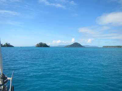
Chart showing land- yellow, reefs- green, shallow water- blue. GE image showing reefs in white/light blue. We completed the rest of our 26nmile passage without incident, both of us keeping an eagle eye out as we entered the reef surrounding Taveuni and crept into the anchorage mid-afternoon at low water between two very visible reefs. We dropped the anchor and settled back to enjoy the surroundings. This anchorage is at the very northern tip of the third largest island in Fiji, sold to tourists as the ‘Garden Isle’ because its frequent rainfall makes it very lush and green. There are a few small islets in the area, but otherwise no protection at all from the trade winds. The water, however, is flat calm because it is protected by both an outer and an inner reef. So it is very comfortable but a little noisy. The wind generator will earn its keep!
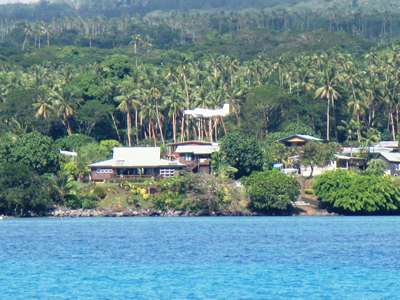
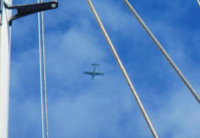
The anchorage is completely open to the wind. Taveuni has a small airport which brings in tourists for its handful of resorts, mostly specialising in diving. The runway is in the village of Matei, not far from the anchorage, and it was amusing to see the small planes taking off and landing from what looked like someone’s back garden!
The planes look like they might touch the roof of this house! Then they turn and pass over the anchorage. Pepe has already been in touch with the Chief of a village 5km from Matei whom we have heard does day tours of the island, and we are all set up to take a tour tomorrow and hopefully catch a glimpse of the rare orange dove. |