Kumai to Belitung Day 1
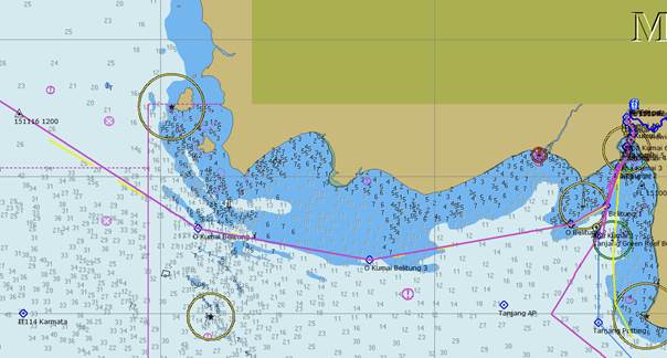
Position 02:46.26 S 109:29.06 E Date 1200 (UTC+8) Monday 16 November 2015 Distance run In 26hrs 45mins 164nm over the ground, 155nm though the water Trip total 164nm over the ground, 155nm through the water We got away at 0900 as the tide peaked and the ebb started to run. Thus was a reverse of our trip in and once again we saw a minimum depth of 1.5m under the keel (3.6m total). We are not at all sure how the ships get in and out and we tracked a couple which appeared to more or less follow our route. There are reports on various blogs of yachts following ships, because they must know the best route, and the ship going aground. There was again little or no wind which meant calm seas which enabled us to take an inshore route inside some of the sand banks and this cut some 25nm off the longer more deep water route.
Our track using the inshore route With no wind it was a very hot day, perhaps it is because we are nearing the equator. |