The show goes on - Musket Cove for the World ARC party
Position 017:46.34S 177:11.33E Date 1645 Thursday 3 July 2014 Distance run Vuda Marina to Musket Cove – 15.6nm Dusk - 1730 “As you were”, picking up from the last entry, let us start out for Musket Cove again. I was let out of Lautoka Hospital at 1300 and after a taxi ride back to Vuda Point Marina and a round of thank you’s to the staff who had helped me the previous day we made ready to have another attempt to leave. Folie a Deux loaned us their son Brian for the passage in case I keeled over en-route. Brian is a great 16 year old and an excellent hand on a boat. This was his first proper sail on a monohull which added to the excitement. We arrived at Musket Cove and took up their only remaining mooring, having decided that getting into the marina, stern to, would be a step too far. This in hindsight was a mistake as when we went ashore for the party it was pitch black, the wind was 15 knots, we had to wear full waterproofs over our party frocks and we did not know where we were going.
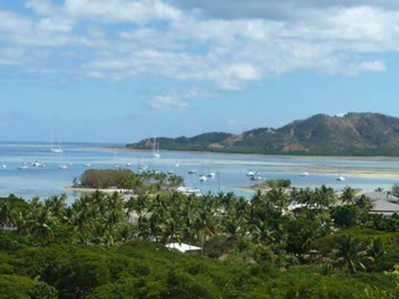
Musket Cove – the marina is in the channel at the centre of the picture Our mooring was at the left hand edge of the photograph above and the route around the reef and island.
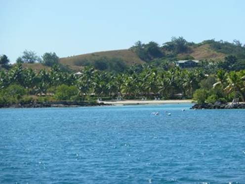
The entrance to Musket Cove Marina. The previous photograph was taken from the hill behind on a later visit. Still it was all very worthwhile, the party was good and it enabled is to catch up with the main World ARC fleet who had left Tonga three weeks before us and say farewell before they set off for Vanuatu and Australia. We will be visiting Musket Cove on a number of occasions over the next two months. It is on the island of Malolo Lai Lai, bottom left, Vuda is just right of centre and Lautoka top right.
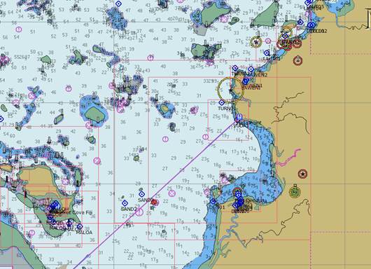
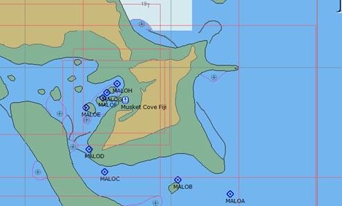
Musket Cove and the waypoints we used to negotiate the reefs. The island has three resorts and a good amount of space. A walk around the perimeter is almost 4 miles. The charts are taken from OpenCPN a planning system that runs on our PC. They are somewhat out of date and in Fiji they are often put reefs and land some distance from where it actually is. Reefs also tend to be not quite in the place or of the size that the chart would indicate. The waypoints however have been taken from a reliable source and are indicative of where the safe water actually is. You can understand why night navigation here is not a good idea. Our main chart plotter systems are better but by no means good or to be trusted. In this part of the world the C-Map system seems better than Navionics but neither are particularly reliable. The mark 1 human eyeball provides the best information at close quarters. |