Kupang to Rinca Island, Komodo Park Day 2 - Lehok Uwadi
Position 08:46.54 S 119:39.34 E Date 1045 (UTC+8) Saturday 24 October 2015 Distance run in 22hrs 45mins 150nm over the ground, 144nm through the water Trip total 249nm over the ground, 234nm through the water Arrived at Lehok Uwadi, Rinca Island, Indonesia This was a day of motoring with for most of the time zero wind. Fortunately there is a good west going current which helped us along. We did manage a couple of hours sailing as we approached the destination, once again the land breeze effect.
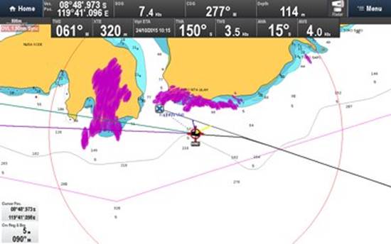
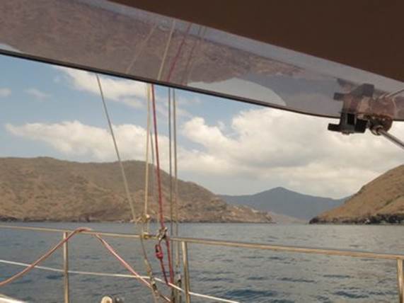
Dawn and first sight of land through the haze was beautiful Charts are going to be entertaining. Compare the yellow land per the chart with the radar image in purple of where the land actually is and you can see that our original waypoint (blue cross) would have been aground
and our track into Lehok Uwadi is over the marked land.
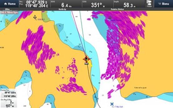
Definitely the time for eyeball navigation
We have the entrance to Lehok Uwadi visual
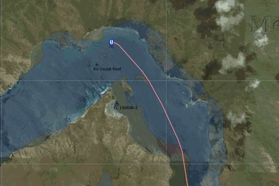
Google Earth overlay on OpenCPN. Safe and sound at anchor Using downloaded Google Earth overlays on the PC based charting software OpenCPN shows the world as it actually is with the chart shadowed under the overlay |