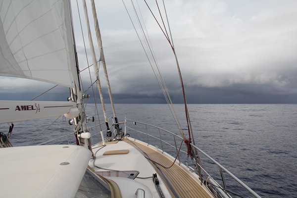
Gan to Chagos Day 3 - A day of squalls, rain wind and arri val at Peros Banhos
Position 05:15.501 S 071:45.940 E Date 1140 (UTC+5) Wednesday 20 April 2016 Distance run in 23hrs 40mins 137nm over the ground, 141nm through the water Trip total 295nm over the ground, 308nm through the water Arrived Ile Diamant, Peros Banhos, Chagos - 291nm total route distance File the GRIB weather forecast under fiction, most of the 24 hours it blew and generally in a helpful direction. For each 2-hour period the log records, squalls, rain and even violent squalls when the wind topped 30 knots. In the dark we resorted to engine and enough sail to gain some benefit and steadying effect but not so much that when the squalls went through we had too much sail set. All of this meant that we arrived at the Pass into the Peros Banhos Atoll, Chagos Archipelago (or as the FCO would wish us to term it, British Indian Ocean Territory - BIOT) just after 1100. The theory is that by so doing we could see the reefs and any shallow patches caused by coral, bommies and the like. With very overcast conditions tis goes out of the window and we rely on Google Earth overlays on OpenCPN, the electroic charts, the latest versions appear to have the land mnmore or less in the correct place, and the Mark 1 Human Eyeball.
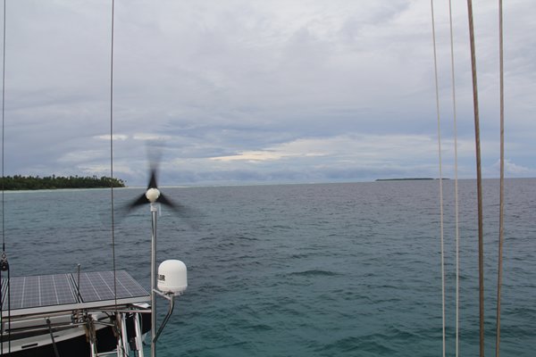
It is 0815 and Peros Banhos is out there in the gloom, under the squall clouds at about 20nm BIOT prescribe four anchorages in the whole of the Chagos Archipelago, and police them. Two are on the west side of Peros Banhos, about 12nm apart and two are in the Salomon Islands some 25nm to the west of Peros Banhos and or second destination. It was great to drop the anchor off the reef at the Ile Diamant, it seems a very long two and a bit days, probably exacerbated by the constant risk of squalls. However on a very positive note we have sailed 75% of the trip, which was unexpected and we arrived well within our planning window. The northern Pass onto the Peros Banhos Atoll is wide and both Navionics and C-Map have the land and reef in more or less the correct places. We saw no less than 12m total depth. Our anchor went down in 11.5m on what we think is a sandy patch. The wind of course instead of being in the west as forecast is in the south east and we are lying parallel to the reef with a small swell. It will do overnight whilst we rest and then consider what to do next.
Looking north east from our anchorage back at the Pass between Ile Diamant and Ile de la Passe Once we left Gan we saw only two merchant ships and those were only on AIS and at 20nm range; there was no evidence of fishing boats. Here there are no villages, no resorts, no local boats, no people and for the time being no other cruisers; in fact, nothing other sky, sea and land. This is indeed a rare luxury. All we now require is some sunshine and I am sure that that will reappear in force when this period of unsettled weather passes through. We definitely feel that we made the correct call on our weather window despite the squalls, |