What navigation marks - well we were warned
|
Date 1520 Saturday 17 March 2012 Some time after 0100 we crossed out of the Florida Channel and the Heading on over the Bahamas Bank was a little scary when the depth
under the keel goes down to about 50 cms. We also had to head directly into
the wind for the next leg to Mackie Shoal so on with the iron topsail to keep
moving and on a very precise track; not a great deal of room for manoeuvre
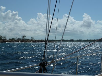
here. Dawn came up at 0700 and as we passed Mackie Shoal and were able to bear
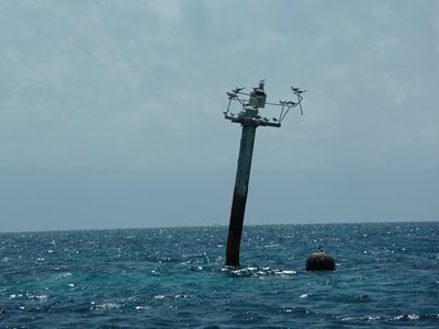
away, set full sail and dispense with the engine. Mike and Jean on Sestina had described the interesting state of the
next marker at North West Channel and for the record here it is:
It has certainly received attention from passing boat heeling at an
even jauntier angle than the Freeing off further for
the run down to Morgan’s Bluff and finished the trip with great reach
passing into the harbour at 1500.
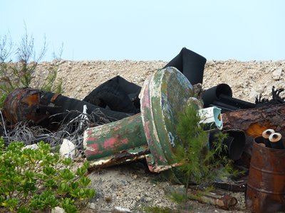
We finally come to anchor
in the shelter of the disused water tanker jetty at 1520. The channel is
marked although some of the buoys are missing. I later found one of the
missing markers:
We were greeted on anchoring by Bruce and Gina from the Whilst there was a customs lady officer in the harbour she was only
there I to clear in a ship and did not have the correct forms. I had been advised
before leaving, by Fritz, that there was a man by the name of Mr Lee who could
facilitate clearing in at the airport for $40. Sure enough Mr Shalom Lee was
summoned by said customs officer and he took me off the 12 miles or so to the
airport. An interesting drive! It took some time for me to wok out which side
of the road they drive on; if you are interested it is the left; most of the
time. Of course at the airport the customs officer on duty had vaporised and
after 30 minutes of fruitless searching the charming immigration officer decide
to do the job herself which involved finding keys to the customs office, then
the forms and then working out what to do with them and how to issue the
cruising permit (a quick $300 for 90 days). These somewhat lengthy forms and permits seem to be completed in
triplicate and as whatever self carbon impregnation there was had evaporated in
the sun this involved each copy being individually completed. All of this
however was completed with cheerful charm and eventually some 90 minutes later
I emerged cleared, immigrated and permitted and Shalom duly returned me to the
bar at Morgan’s Bluff where Bruce and Gina were occupying themselves
using the bar’s WiFi and dining off fresh conch salad. Shalom certainly
earned his $40.
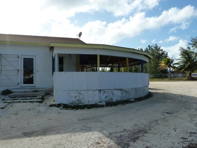
More on Morgan’s Bluff later but suffice it to say it is off the
cruiser’s track, the anchorage whilst shallow is not crowded, 3 yachts,
and the bar prices at $3 for a beer and $1 for a coke are very reasonable. The
locals seem pleased to see everyone and are noisily sociable; well it was well
into Saturday evening and dominoes, which appears to be more of a contact
sport, was in full swing. |