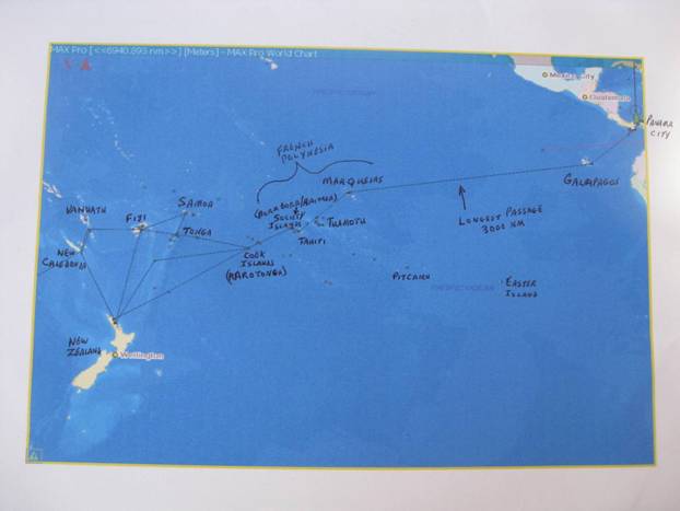
Pacific Tentative Plan and Route Map

|
08 54 .4 N 79 31.42 W Here is our tentative planning for
2010-2013 and also a chart image that shows our Pacific crossing route. (Hint: use your on-screen
magnifier to enlarge/read the map) Destination
Lat-Lon Coordinates Arrival
Departure
NM to Next Island Group Panama
City
86 07 N 78 45
W
Feb 23 Mar
10
863 Galapagos 00
70 S 90 40
W
Mar 15 Mar
20
2999 +++++++++++++++++++++++++++++++++++++++++++++++++++++++++++++++ French Polynesia: Marquesas
09 04 S 139 59
W
Apr 20
TBD
752 Tahiti 17
33 S 149 28
W
TBD TBD
136 Society
Islands
16 30 S 151 35
W
TBD July
15
487 ++++++++++++++++++++++++++++++++++++++++++++++++++++++++++++++++ Cook
Islands
21 02 S 158 42 W
July 18 Aug 1
826 Tonga 18
39 S 174 00
W
Aug 6 Aug 20
474 Fiji 17
41 S 178 52 E
Aug 23 Oct
25
1095 New Zealand 35
44 S 174 20 E
Nov 1 Apr 15/2011 1095 Fiji 17
41 S 178 52 E
Apr 21 May 15
604 Vanuatu 17
44 S 168 18 E
May
20 June 15 (Intermediate
Wpts: Torres Strait/Darwin/Roti/Bali/Singapore/Malaysia) Phuket, Thailand 07 49 N 098 21
E
Dec 1/11 Feb 1/2013
|
