Well supported causeway.
Scot Free III
Frank & Anne
Mon 15 Jul 2019 10:31
43:30.89N 65:36.65W
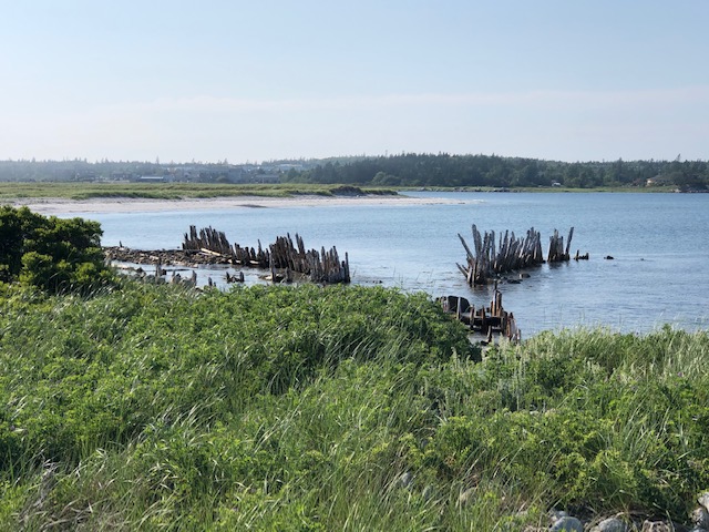
Woke to thick fog again yesterday and made our way, mostly under engine again, south and rounded Cape Sable, the most southern tip of Nova Scotia. The fog kindly lifted as we approached Barrington Bay, giving a good view not only of the pretty coastline but of the marker buoys taking us between sand banks and rocks. Went through a very narrow passage round a spit and into the cove at Barrington Passage, alongside the causeway. It’s like living on a main road - we are so close.
Had a walk ashore. Lovely scenery.
Met a couple who had been watching us creep in. We “did good!! “Ended up at Capt Kat’s Lobster Pound for a drink and nibbles (portion size=full meal) then meandered back with the fog closing in again.
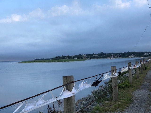
The causeway, linking Cape Sable Island to the mainland was built in 1949 to replace the ferry,about half a mile long, at present festooned with hundreds of bras after a Breast Cancer fund raising event.
Woke this morning to bright sunshine- here’s hoping.....