Aus Navigating the southern half of the GSS
|
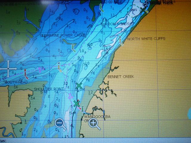
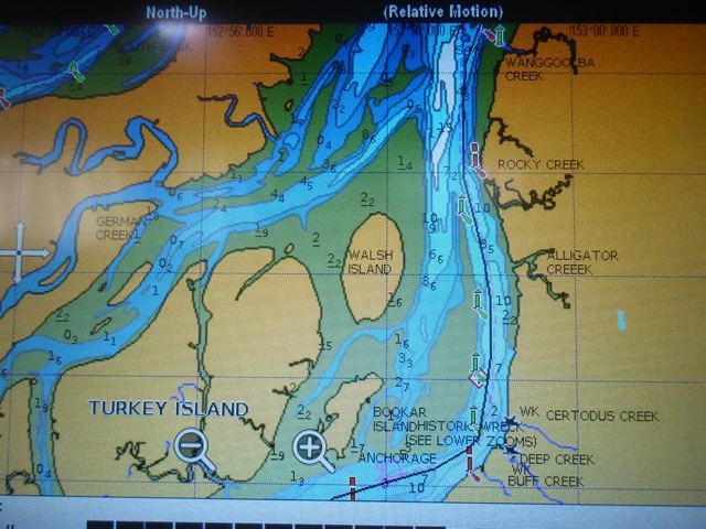
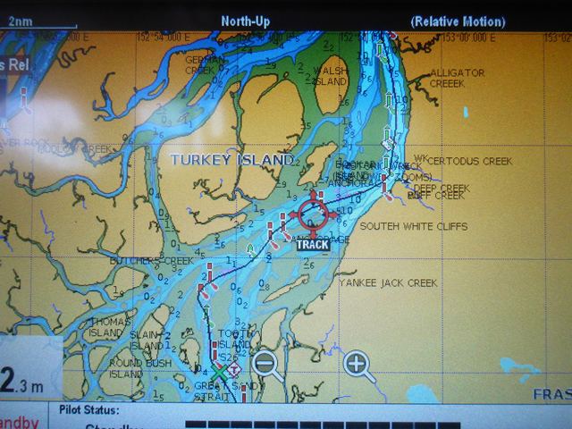
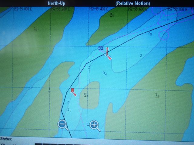
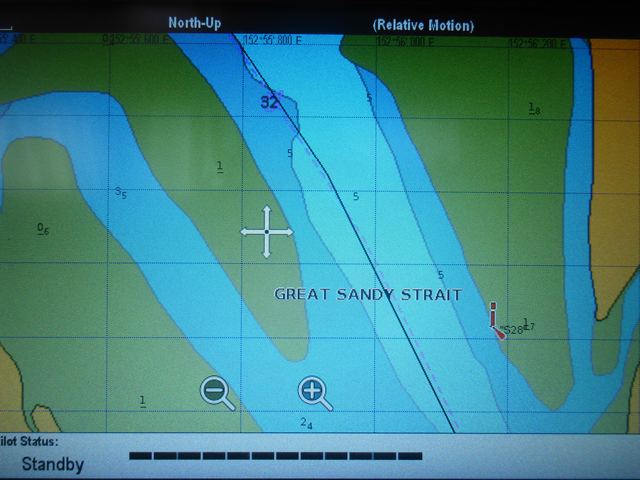
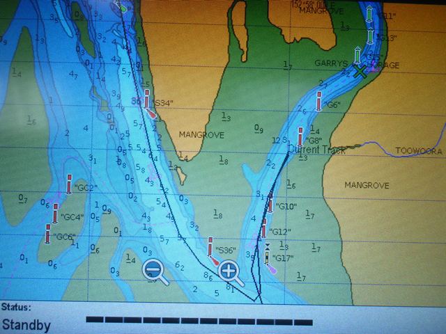
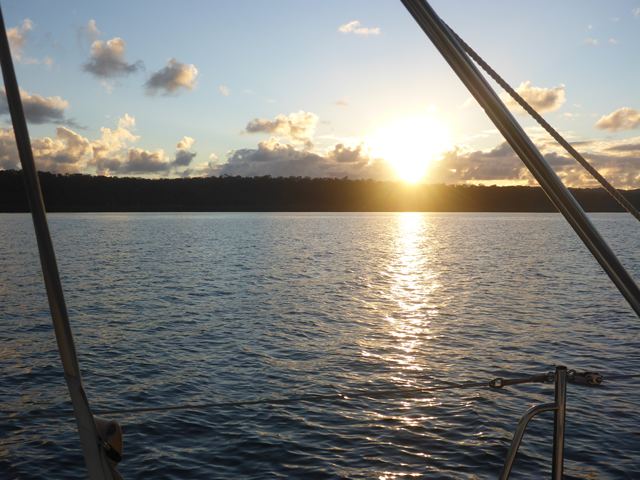
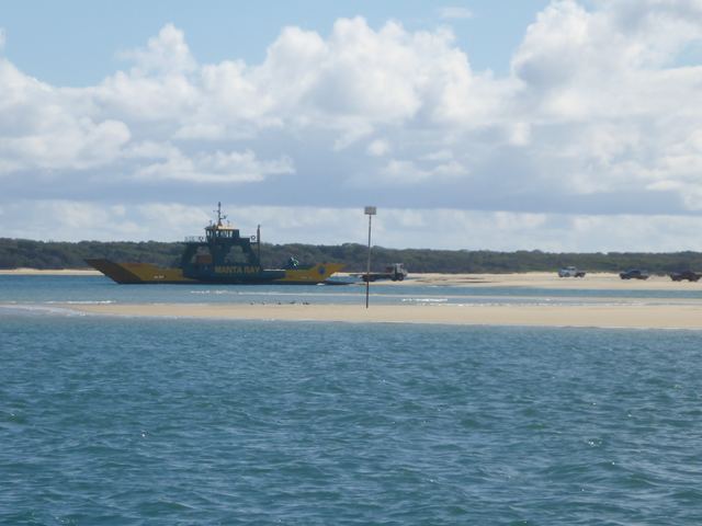
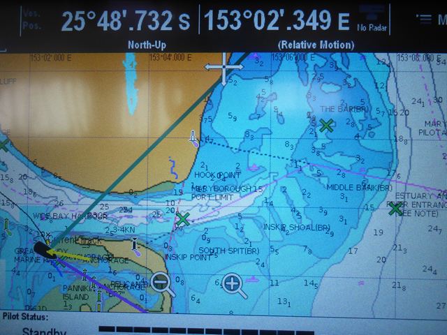
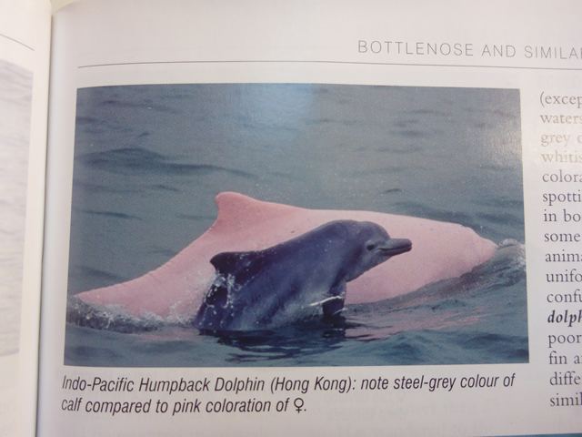
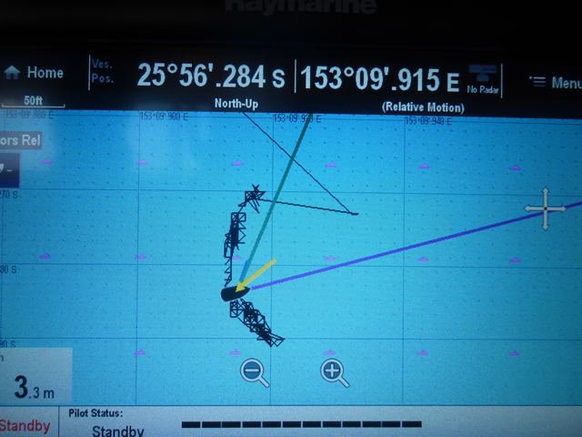
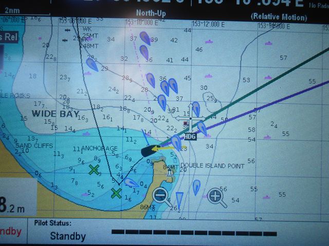
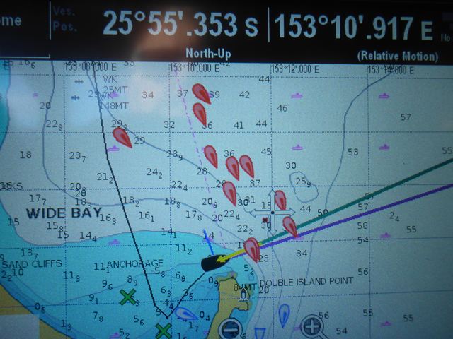
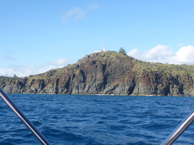
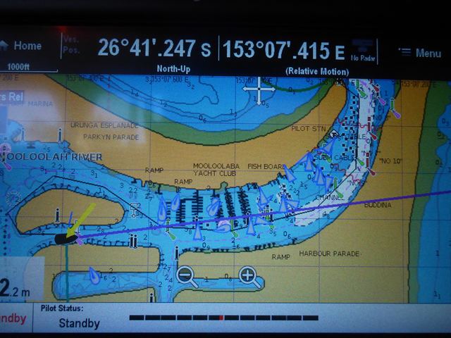
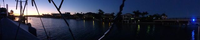
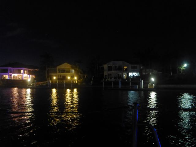
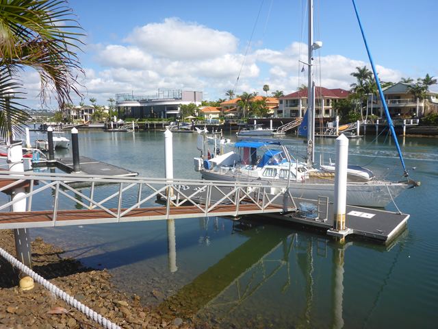
Navigating the Southern Half of Queensland’s own Solent The Great Sandy Strait 25:38.20S 158:58.002E It was only going to take four or so hours to get from our Kingfisher Bay anchorage southwards to Garry’s anchorage where we planned to spend the night where ever we could find enough water for Zoonie to go through Low Water safely. Since we were passing the mid-tide point at Boonlye we set off two hours before High Water with the novel theory we would benefit from the last two hours of flood and the first two hours of ebb for the last stage of the route. After that, all thoughts about tide times were put on the back shelf since my concentration rested on following the dashed pink line on the chartplotter from the top of the screen downwards and similarly on the photos, along the sometimes uncomfortably narrow channel. Vast areas of water were all around us, as in the Solent, but wearing my Polaroid sun glasses revealed the paler greenish water showing where the sank banks lay and were usually well marked with green and red channel markers. The GPS heading, the green line on the plotter, has a delayed reaction to course changes so as soon as I can follow a heading from the chartplotter by lining up Zoonie’s green line heading over the pink dashed line or the next waypoint Rob has previously set, then I take a compass reading, which has a more immediate response to a course change and is a backup in case the chartplotter freezes, as it did once on this journey, fortunately where there was plenty of water and a clear course for the next mile, so Rob had time to turn it off and on again. The intense fun came as we passed under Turkey Island where you can see first a red pillar buoy and within a few metres a red can buoy. You can see from the enlargement that the pink line goes to the right of the first red correctly leaving it to the left but then it deviates to the left of the red can. Problem is the sand banks are constantly changing so the pink line might well be the deepest route. Disobeying the rules was not an issue, just making sure Zoonie stays off the ground was the important issue. The water either side of the reds looked the same so in the end we thought it probably didn’t matter. As you can see we left it to port, obeyed the rules, watched the depths drop to an alarming 0.4 metres under the keel and held our breaths. The depth of 2.2 metres you see at the bottom left of the photo is the depth here in Mooloolaba when I took these photos 5 days after the event. When we set off there was no wind but as we turned after the two reds it was around 17 knots on the nose and the sun was well down in the sky. We turned to port in to the channel leading to Garry’s Anchorage and dropped the hook, as you can see, about half way up where the water was 3.4 metres and the time 17.35. We rewarded ourselves with a nice G&T and it was dark within 30 minutes. The next day was to be a long one. It was just a short distance to the main channel and we headed south to Inskip Point in Wide Bay Harbour to wait out the fall in the tide and then its late rise when we would set off to motor along towards the Wide Bay Bar. This sand bar outside the passage between Fraser Island and the mainland to the south shifts on a ten year cycle. To obtain the best waypoints to use for our crossing we phoned the nearby VMR. (Voluntary Marine Rescue has branches all around the coast and they organise marine safety. Some Australians register with them every time they go to sea.) VMR texted back the co-ordinates and they are the ones you see on the plotter photo, the highest on the right being the start point of the crossing across the bar. While we relaxed on board we chatted with Nick and Susie on Water Music and Susie commented that they and the other thirty odd boats would be dealing with the crossing in the morning, but we had four good reason to do it this evening. First we had already decided to and were comfortable with our decision. Second, the depth of water for us would be half a metre deeper on our evening as the tides were moving towards neeps, where the height of tide, the difference between High and Low water is at its least. Third the sun in the morning would be low in the sky ahead of us, whereas with our evening choice it would be tucked out of the way behind Zoonie. Finally, the thought of negotiating a confined passage in the company of many other yachts did not appeal! At half past three in the afternoon we recovered the anchor and set off, feeling that the trickiest part of our passage down the GSS was over. The car ferry was just leaving the island side so we had time to get past it and then we had around us some unusual dolphins. A youngster was charcoal coloured but the adults were pinkish. Our reference source, Hadoram Shirihai and Brett Jarrett’s book ‘Whales, Dolphins and Seals’ identified them as Indo Pacific Humpback Dolphins and our latitude was near their most southerly range, so we were indeed fortunate. Our heading was 080’ nearly due East compass. It felt good to be approaching open water again, but we still had this hurdle to cross. The depths were comfortable as we motored on down the Inskip Point Leads otherwise known as The Mad Mile, where we turned to a heading of 050’, but in a westerly wind and with an opposing rising tide there are sometimes standing waves here, hence the name. “Ready?” I asked Rob as I turned Zoonie right through almost 90 degrees onto the required course for the next mile or so. It was a good course we had been given and we had over 5 metres all the way across the mid blue on the plotter and were soon clearing onto the white part with Double Island Point anchorage 9 miles distant and reassuringly visible. Two hours later we were anchored in the bay named by Cook and described by Matthew Flinders in his Journal written in 1814. (Works of Matthew Flinders. The Perfect Library.) “Tuesday 27 July 1802. At half past nine (am) we hauled close around Double- island Point, within a rock lying between one and two miles to the NNE. (Wolf Rock you can see in the photo of the chartplotter). The point answered Captain Cook’s description: it is a steep head, at the extremity of a neck of land which runs out two miles from the main.” Flinders then goes on to describe Wide Bay, that we had just transited, and the entrance to the GSS, “and a small opening was seen in it, leading to a piece of water like a lagoon; but the shoals which lie off the entrance render it difficult for access, if indeed there be a passage for anything larger than boats.” Flinders goes on to explain why he declined the challenge of exploring the hidden waterway, “Had the Lady Nelson been with me, (the companion ship) I should have attempted to get her into the lagoon, having previously entered a conjecture that the head of Hervey’s Bay (at the north) might communicate with Wide Bay; but the apprehension that lieutenant Murray would arrive at the first rendezvous, and proceed to the next before we could join him, deterred me from attempting it with the Investigator or with boats.” How frustrated he must have been that he could have not explored the waterway and thus extended the discovery of his illustrious predecessor. The anchorage was beautiful and since the wind was still in the SE the roll was minimal, but we weren’t sure of the bottom. Rob didn’t feel that anchor bite the sea bed in the darkness, so we set the anchor alarm to tell us if Zoonie was moving beyond the length of chain plus her own 40 feet. As you can see from the picture she jiggled about on the circumference of her range and had not moved far by the morning. Not surprisingly, by the time I looked out of Zoonie’s big side window just after 6.00am there was an armada of white sails heading towards the Point, some passing inside of the rock described by Flinders and others taking a much further offshore route. We crossed his track and merged in with the fleet, a little like turning right at a busy junction and headed south on a smooth snakeskin sea with just enough wind to fill the sails. Sadly Zoonie could not keep up the average to get us to the Mooloolaba bar entrance just before High Water, so Rupert the engine was called in to assist. Twice on the way down the autopilot froze, so along with replacing the control unit (£600), which we have since discovered is still under warranty until January and replacement of the three short stays, we will also get the auto pilot looked at. Pan tropical dolphins came to see how we were getting on and just before entering the harbour an adult humpback whale rolled over revealing the white under its fins and belly. Again Rob and I were looking at the same spot of water at the same time to see this beauty. Their migration back to the Antarctic is nearly finished now, so we were lucky to see this one. As I write this Zoonie is happily sitting alongside her own pontoon at a luxury residential address opposite Minyama Island in Mooloolaba Harbour courtesy of Lynne and Geoff; I don’t think she has ever been so sophisticated.
|