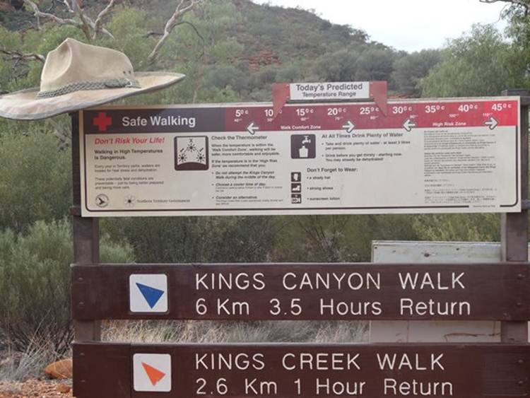
Kings Canyon Rim Walk 1
This was a really tough walk, up the side of a canyon, clamouring up and down domes at the top and stairs on the way back down. It was also a tad warm, 30C by the time we finished.
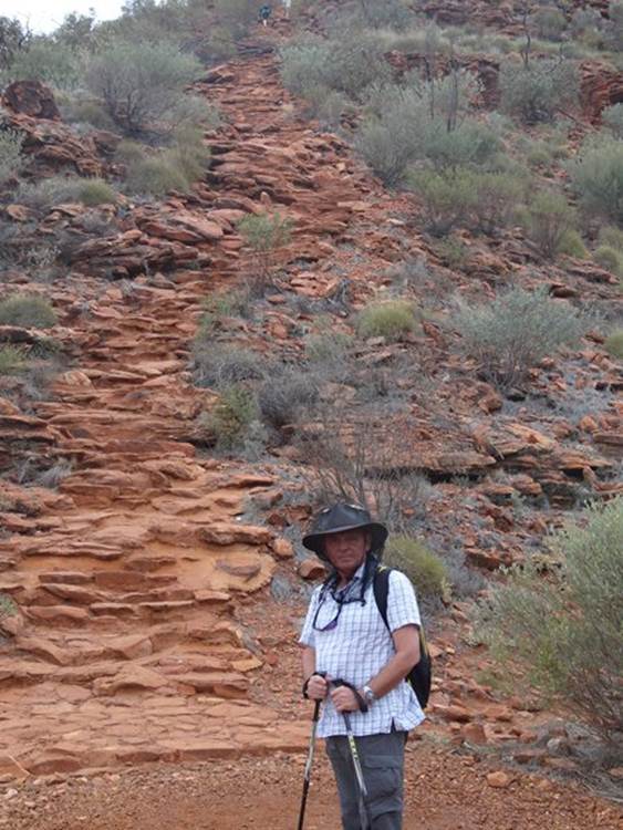
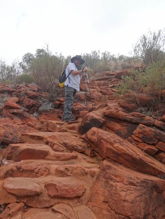
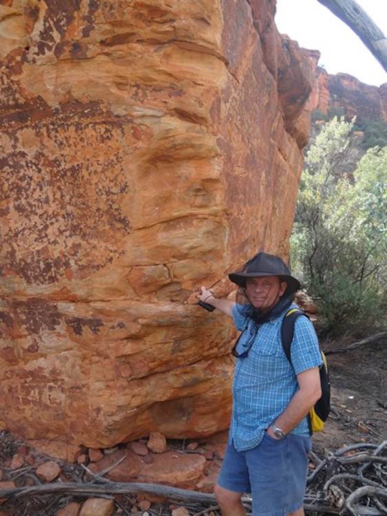
Paul at the start of the walk.
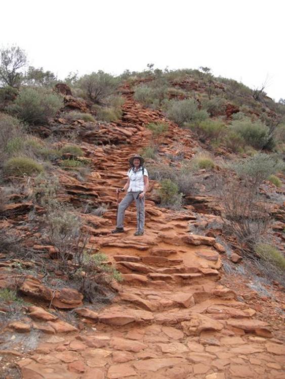
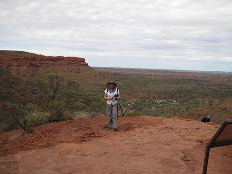
Halfway up
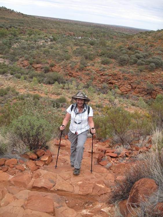
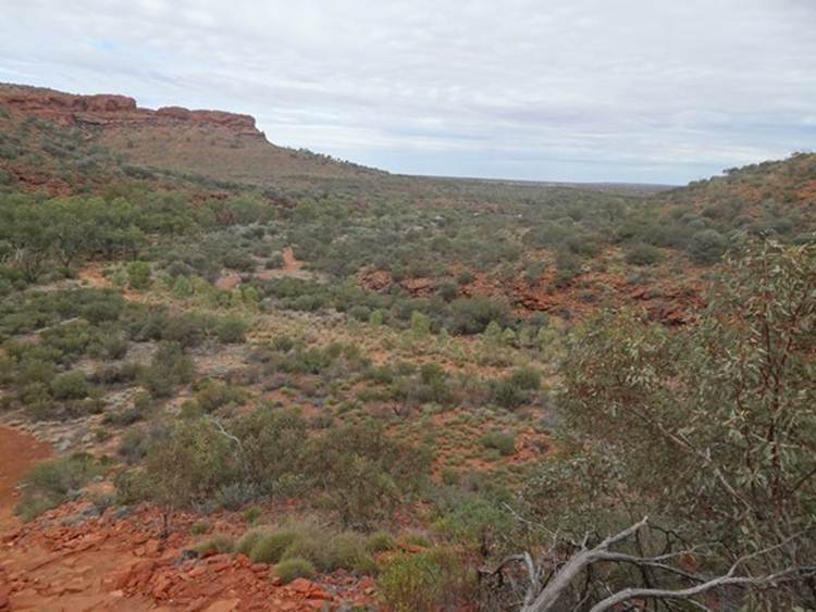
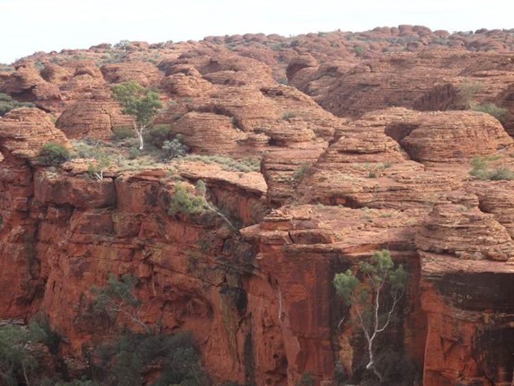
Spectacular views across the sand plains from the top of the canyon walls.
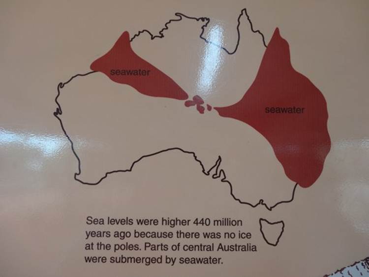
Kings Canyon is in the Watarrka National Park within the Gorge Gill Range. It lies within the intersection of three major landforms. Northeast from here are the MacDonnell Ranges. To the south and north are the sand plains of the Lake Amadeus region and western desert. To the southeast are the low hills and mesas of the Simpson desert. Bit of earth history. About 440 million years ago there was no ice at the poles and so sea levels were much higher all around the earth. The sea extended into central Australia from both the east and the west (much of Queensland coast was underwater).
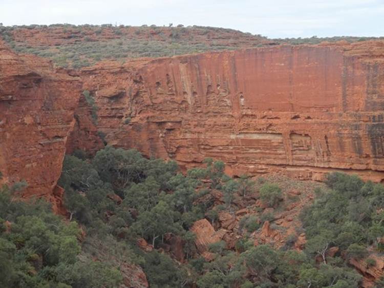
Australia was still part of supercontinent at this stage – despite the picture. There were no plants at the plant just a lot of bare soil. Rivers carried enormous amounts of sand and mud into the shallow sea and deposited it on shallow tidal flats and sand bars. Eventually this formed the Carmichael Sandstone. About 400 million years ago sea levels dropped and the waters receded from central Australia. The climate was drier but there were several rivers and freshwater lakes dotting the landscape. This part of Australia became a windswept plain covered in sand dunes. A huge amount of sand accumulated. The region gradually subsided under all the weight, compressing and compacting the bottom layers. Silica rich water trickled through the sand and cemented the sand grains together. That sand became the Mereenie Sandstone. Very hard and brittle and made of quartz cemented with silica. Beneath this layer is the Carmichael Sandstone which is more crumbly than the Mereenie Sandstone as it contains other minerals along with quart. About 350 million years ago central Australia was subjected to a big squeeze that formed the MacDonnell Ranges to the north. Here at Watarrka the sandstones were pushed up. Here you can see the hard Mereenie sandstone as the top part of the canyon walls above the weaker Carmichael sandstone that forms the slopes.
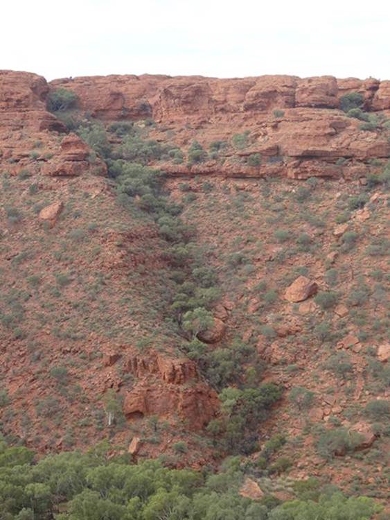
Wind, water and floodwaters cut down into the softer Carmichael sandstone. This undercut and weakened the Mereenie sandstone above it and blocks of rock have sheared away and tumbled down.
View of the southern canyon walls.
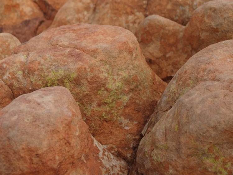
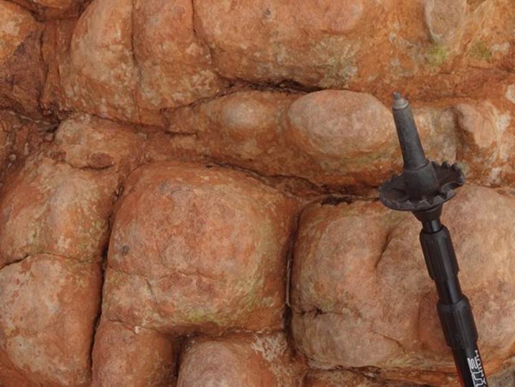
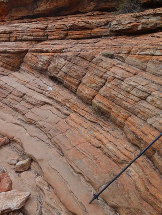
On the plateau at the top of the gorge are beehive-like sand domes. They are the result of erosional cracks in the limestone. Photographs of the plateau show a grid-like pattern of parallel ???? The domes start off as cube shaped blocks bounded by intersecting cracks.
Wind and rain have gradually worn away the sides and top corners over the last 20 million years.
The blocks have become domes separated by flat rock, all happening here in miniature..
On a grander scale.
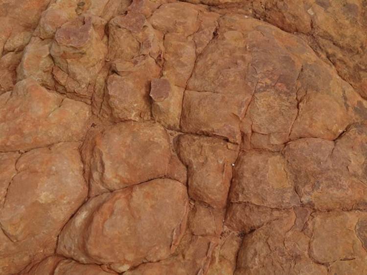
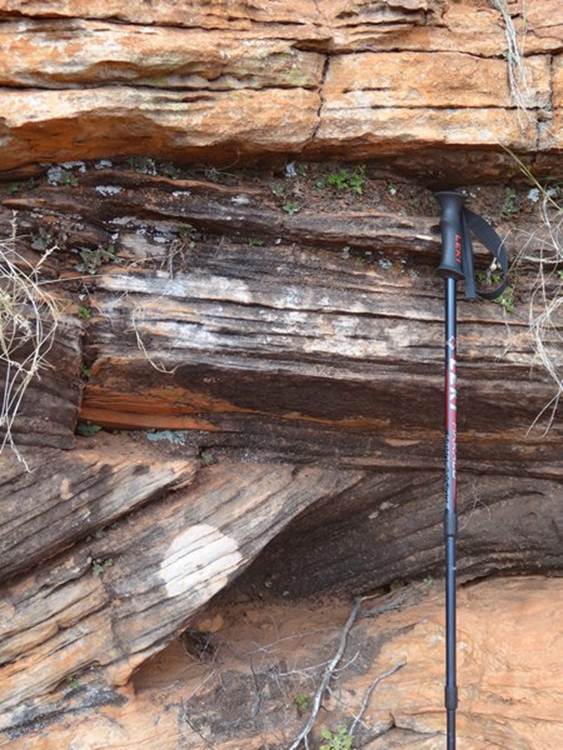
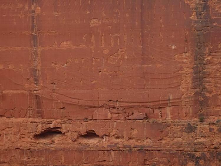
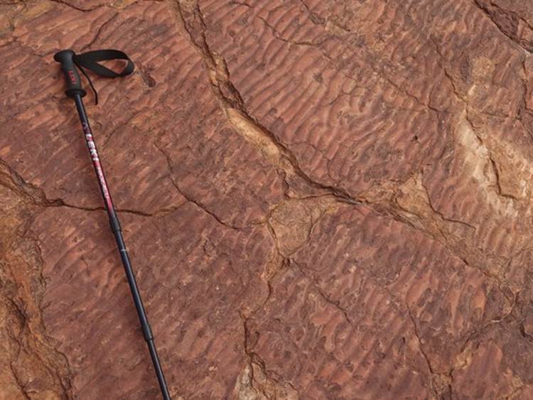
You can clearly see evidence that the Mereenie Sandstone was originally sand dunes by these great examples of cross-bedding., Cross bedding is really common in sand dunes that originate in deserts. The wind deposits sand in different direction over time. Sand falls down the lee side of a dune and forms a set of cross-beds. You can also see cross bedding in tidal environments but the layers are much thinner.
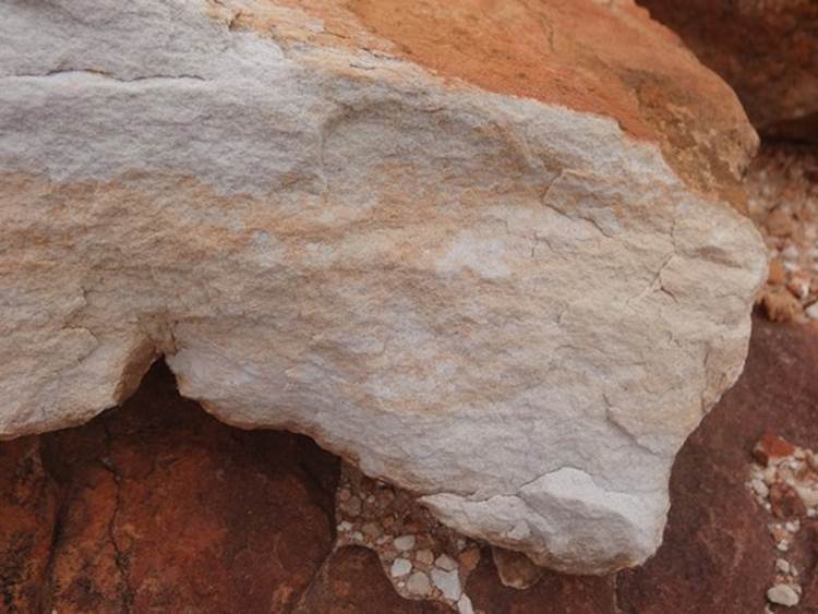
The Mereenie sandstone is actually a clean white fine sand when it piled up in large sand dunes. They appear red-brown now because iron-rich dust has been blown onto the surface and chemically fixed to the sand grains by fungi, which live off the iron and silica dissolved in rainwater. Alternatively water could seep in, soak up iron oxide within the rock and deposits it as an outside crust when the water evaporates. Tricky as one sign said that the Mereenie sandstone was iron free. Where’s that continuity person?
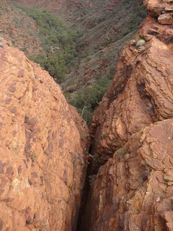
Kings Canyon was originally a crack in the Mereenie sandstone buts 20 million years of erosion have widened the crack a tad. The shear wall follows the main crack (or joint) from which the canyon formed. About 20 million years ago a crack in the Mereenie sandstone appeared. Wind and rain widened and deepened the crack until the Carmichael sandstone was reached beneath. The circular markings on the south wall are thought to have formed by the release of stress when the Mereenie sandstone cracked. The black and the green patches are from algae.
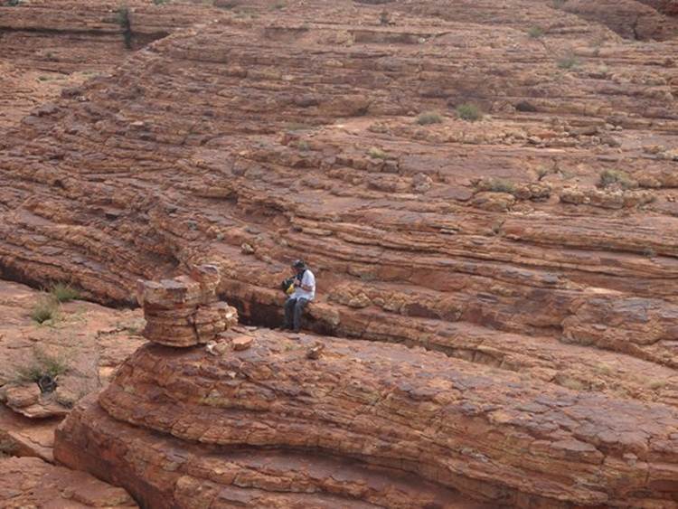
This is a narrow but really deep crack separating a huge section of rock from the canyon.
You had to go across a very narrow bridge to get to the other side. Here’s Paul waiting for me to return. Not surprised it was just like walking on th top of the world, apart from the rock under your feet you were suspended in mid-air.
Although central Australia was that windswept plain covered with sand dunes 400 million years ago, and the climate dry, rivers still flowed. There are several places on the top of the gorge where there are ripple marks suggesting that there was once a shallow lake at Watarrka. These ripples have been preserved in the Mereenie sandstone, material laid above them has since been worn away.
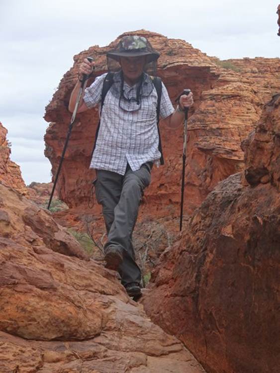
Paul doing a bit of a scramble.
|