Wai O Tapu thermal reserve 2
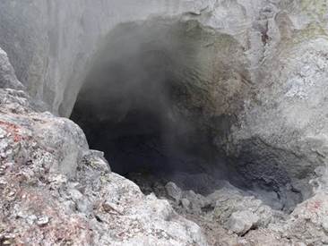
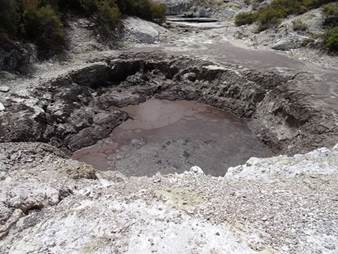
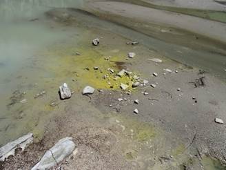
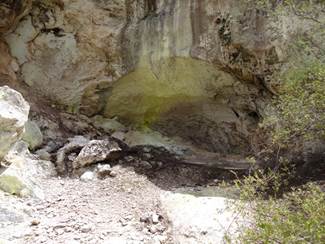
The scenic reserve is full of collapsed craters with lots of steam and different coloured ‘waters’ and deposits. The colours are due to different mineral elements contained within the thermal liquid. The craters are up to 50m across and up to 20m deep. Lots of them had hot water springs and most had sulphur deposts – that brilliant yellow colour – formed when the escaping vapours meet with the atmosphere. Most of the crater were formed over the last few hundred years. Basically the rising steam is acidic and it dissoslves the ground above as it rises, ultimatley causing it to collapse. You can see the acidic steam nibbling away the cave here. Bit of bubbling mud in the cave floor.
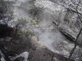
The most recent collapse was thunder crater in 1968, again full of loads of steam eroding away the rock.
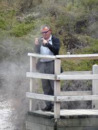
Devils Ink pots, a series of pools coloured by graphite. You can just make out dark black patches on the surface – this is crude oil brought to the surface as the water forced itself through the ground. Paul trying to get a picture of one of the steaming pools. .
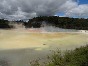
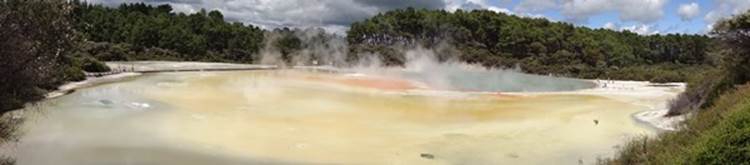
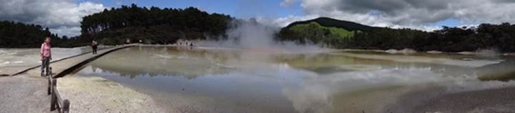
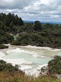
This is the artist pallet so called because water that flows here cools and the minerals contained within the water precipitate out in several colours. The large area of steam that you can see to the right is the Champagne pool – the largest of the hot springs in this thermal area. Earthquakes have dilted the area so the water runs over the flats in the front of the picture. The cloudy yellow water is acid sulpahte, the orange in the background antimony and or arsenic, the grey is carbon.
The champagne pool occupies a 700 year old explosive crater formed from a hydro-thermal eruption which formed the bank on the far side of the pool and the bank on which we took this 180 picture.
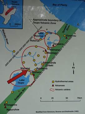
The Taupo volcanic zone is about 250 km in length and 30km to 80km wide, anchored to the south by the volcanoes of Tongariro, Ngauruhow and Ruapehu, the zone follows a north easterly direction. At the northern end is White Island, advertised as the only active volcano in NZ. Not quite true. Couple of nice diagrams here.
The water from the Champagne pool forms the primsrose terrace to the left of the boardwalk.
At the edge of the artists pallet yellow for sulphur and the cloudy green water is acid sulphate.
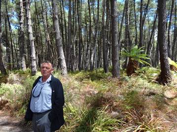
Paul walking through a stand of pines (actually he is telling me to get a move on with the picture) to the lookout across frying pan flat and Lake Ngakoro in the background.
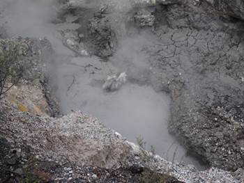
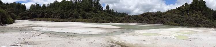
Frying pan flat, another eruption crater. The has lots of bubbling small springs and fumeroles.
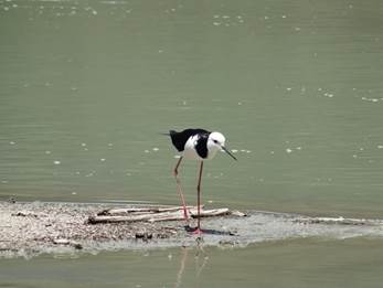
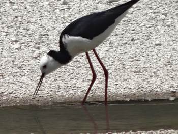
Home to a family of pied stilts who don’t seem to mind the heat.
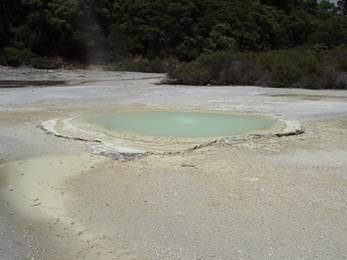
Oyster pool, guess why called that.
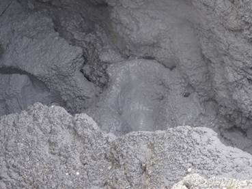
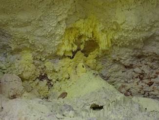
Great example of crystallised sulphur formed as hot sulpur gases have cooled in the sheltered atmosphere of the overhanging cave.
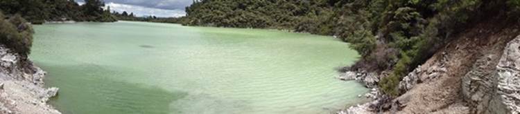
The green waters of Lake Ngakoro (the grandfather) which formed after an explosion 700 years ago. Lots of steam to the left hand shore showing its still geothermally active. The water in the foreground left is also different colour. The colour is due to fine particles in the water.
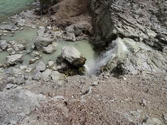
The milky coloured water entering via a small waterfall.
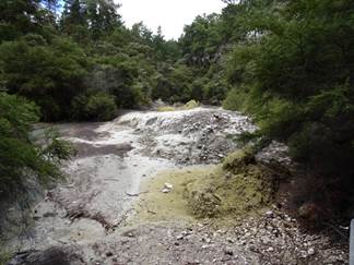
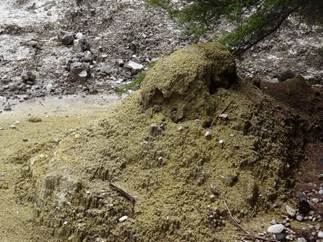
These are sulphur mounds which were formed underwater and exposed when the area was drained to build a road to the east in the 1950s.
|