Melrose - Alligator Gully
Went into the Flinders Ranges to Alligator Gorge, which is in the Mount Remarkable National Park. In South Australia some parks you pay entry for, others you don’t. This being a popular park, you had to pay – all of $10 (about $6.50). Here’s the permit boxes and the metal one is the honesty box:
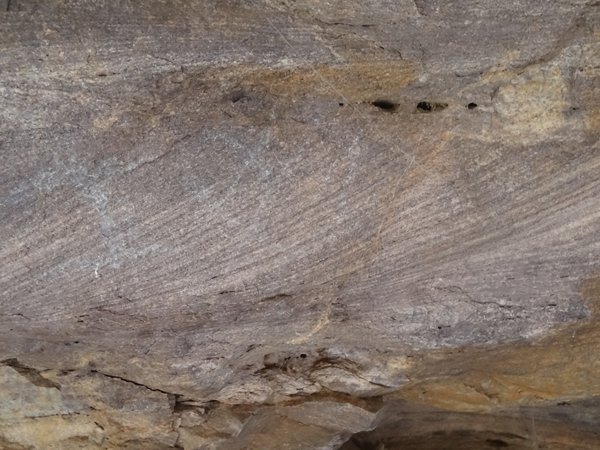
Alligator Gorge was originally called Ali’s Gorge after an aboriginal shepherd who used to bring 2000 odd sheep to the area to water and feed, in the 1880s. Nobody seems to know how it got converted to Alligator – I’d say people probably forgot who Ali was and assumed named after an alligator. Anyway, geologically Mount Remarkable and Alligator gorge are made of sandstone (quartzite) – a sedimentary rock – which is about 800 million years old. This sandstone was formed underwater. The gorge was at about 340m and we had to travel over some ridges that were over 650m high. Imagine how high they must have been and how much the area must have been uplifted. Bit like those marine sediments at the top of mount Everest, only not so high (obviously). About 50-60 million years ago faulting in the area occurred. Lots of stretching and cracking occurred leaving behind a basin shape (syncline). Over time, erosion has turned the basin into present shape. Soft rocks have worn away leaving the deep gorges and ridges of the area. We did a short (2 km) walk down into Alligator Gorge and back up the other side. It took just over an hour and a half. Lot of steep steps down and up. You can see the sedimentary layers in the sandstone outcrops in the gorge walls.
These steps were called ‘The Terraces’ and are eroded layers of deposited sandstone. Here’s Paul
And here’s me – with my new hat on.
The great thing was that you could see ripple marks in some of the eroded layers. These would have formed in an ancient sea by tidal currents just as we see them on the beach today. More sediment would have fallen over the ripples preserving their outline.
Here you can see the ripples in cross-section.
As we walked through bottom of the gorge it got narrower and narrower. These spider webs lined the walls. They looked like funnel web but the spiders looked more like house spiders – those with the long legs.
You could almost stretch arms and touch each side of the gorge.
After lunch we walked to two, so called lookouts across the gorge. They were on the edge but the gum trees have grown since the area was declared a national park and so you couldn’t really see a lot. Paul walking up the path after being discussed at second lookout.
And me stomping my way back up the hill.
We stopped at two historic monuments on the way back to the caravan site. Wait for it, wait for it…. This is the Cheese Tree. Seriously, the plague says ‘This tree was used as an aid in the processing of cheese by Eddy Bishop during the years 1868-1878’. The mortise hole you can see at the bottom of the tree I assume was used for climbing the tree. Further information from the museum in Melrose – it was shut when we were in town.
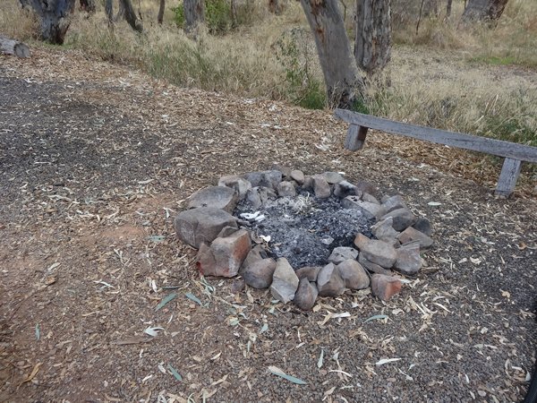
And then we had a rock that marked the Goyder’s Line. The line passes somewhere through the area and was drawn (on maps!) by the surveyor general George Goyder in 1865. It approximates the 250mm rainfall per annum contour. Agricultural districts lie to the south of the line, pastoral regions lie to the north of the line. Paul and I were both so excited we forgot to take a photograph. I mentioned earlier that campsite had DIY fires. Here’s one:
I know I am getting seriously sad. |