Road to Tuatapere
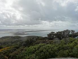
Position 46 07.623 167 40.522E Just outside Invergill is Bluff, furthermost port in NZ, or was it the longest settled port in NZ, or even the southernmost town in NZ (town note, not city). This is town from which Fred and Myrtle Flutey front parlour full of paua shells came, that we visited in Christchurch. The tourist radio said a ‘fairly scenic’ drive. Fairly to be interpreted very loosely. The main reason people come here is to catch a ferry to Stewart island, and who can blame them. Drove to the top of the Bluff Hill, unfortunately rained a lot (and bitterly cold). Bluff Hill is the worn down stump of an igneous intrusion that forced its way towards the surface more than 235 million years ago, when most of New Zealand lay under the sea on the edge of the ancient supercontinent of Gondwanaland. Here’s some of the not so stunning views. Looking back towards the causeway you cross to get to Bluff, the town and docks, shame about that pole.
Out of the estuary into Toetoes Bay.
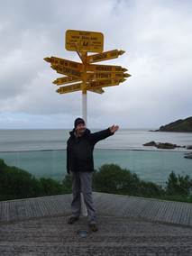
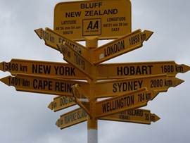
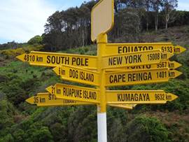
Drove to Stirling Point for the compulsory photo stop.
London 18958km, equator 5133km and the south pole 4810km – no wonder it’s cold
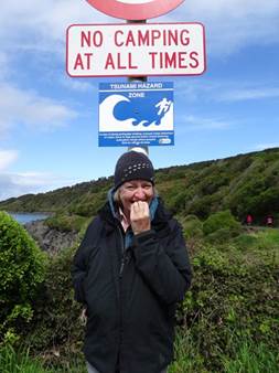
The first tsunami warning sign we have seen – if you see that tide go way, way out - run for the hills.
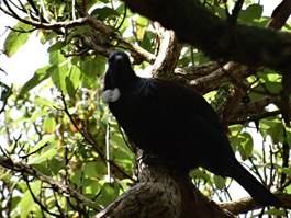
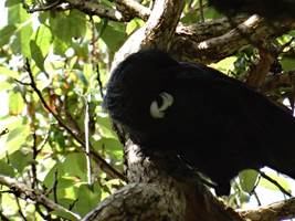
We did walk along the shore for an hour or so. There are loads of birds here with beautiful calls. This is the Tui, the white blobs are actually two feathers – OK Paul got that one right.
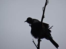
This one was really giving it some wellie.
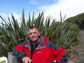
Masses of flax along the pathway – and roadways when you start to look. More than 50 varieties exist in NZ and it was Bluff’s first export crop. Vital to Maori for clothing, hunting, fishing, baskets, shelter, sails etc. The zig zag edging along the flax leaves are the work of a small flax notcher caterpillar with damn strong jaws.
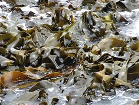
I’m becoming obsessed with seaweed. Bit of fungal art.
Paul is becoming obsessed with traps. We are arguing about what they are trying to trap.
We walked as far as one of the leading marks and then returned – about an hour. You can walk all the way around the headland.
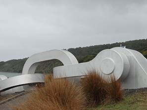
This stylised anchor I thought was representing Maori enslavement. In fact it symbolises the Maori legend where south island is the canoe of Maui and Stewart Island the anchor. Here the anchor disappears into the water (figuratively speaking) and it comes out of the water in a similar sculpture on Stewart Island. The chain also symbolises the strong links that Maori have to the land and their peoples.
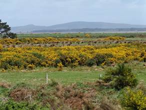
Gorse is in flower at the moment. It was first introduced as hedging and you can just make out its use as that here. Unfortunately gone rampant and nothing here to really eat it.
Passed through a town called Riverton whose claim to fame, as far as I’m concerned is this giant paua. There is a paua souvenir factory here – traders welcome.
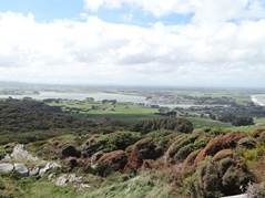
There is a viewing point here as well. Jacobs river estuary to the left and Riverton at the river mouth.
Not a lot to say about Tuatapere except farewell. We stayed at a backpacker’s site, basic. |