Portland
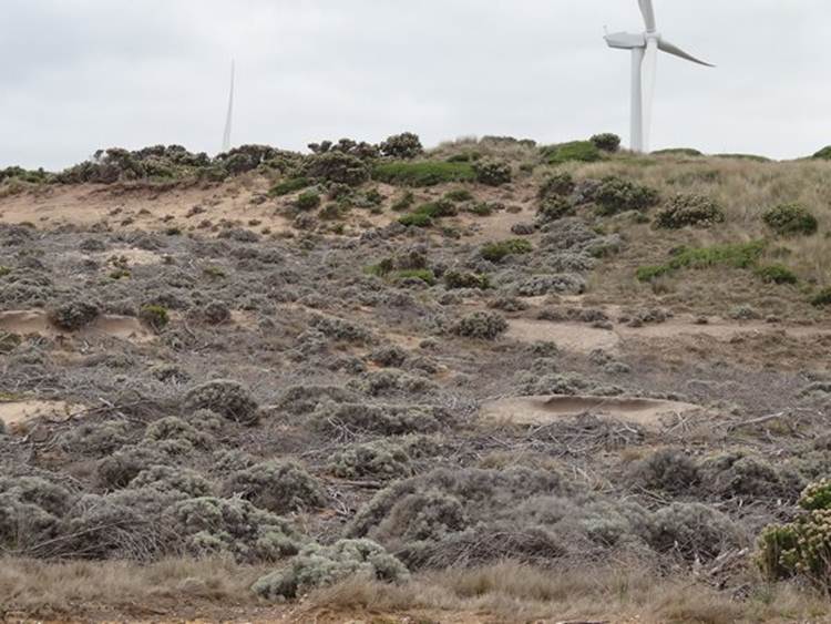
Staying in a total dump in a town called Portland, unfortunately booked it before we arrived. No lights in the toilet blocks, which were built in the 1960s. If you come Portland don’t stay in the Portland Bay Holiday Park – in fact don’t bother to come to Portland at all. Having said that, the bay is the only deep sea anchorage between Melbourne and Adelaide, and is not far from the southern shipping lanes. There’s a big aluminium plant here and several large ships in the bay waiting to be loaded. Export trade includes aluminium ingots, logs, woodchip, wood products, livestock and mineral sands. There’s a large harbour and a small marina which was opened last week. We visited Capes Grant, Nelson and Bridgewater. Cape Bridgewater had a (not very active on our visit) blow hole and a ‘petrified forest’. Once this area was covered in sand dunes and rainfall and groundwater have hardened these dunes into sandy limestone. The landscape adjacent the sea was mostly barren – severe conditions coupled with rabbits, which has exposed the ground, and led to major erosion. Most of the greyish stuff in the picture is actually chopped trees and twigs, bought in to try to stop the wind erosion.
You can see the rugged nature of the ground in this picture, the pot holes are a result of wind and rainwater / sea spray dissolution and erosion.
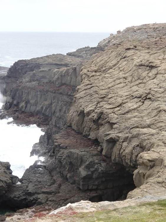
At the blowhole took this photograph of basalt which underlies the limestone. This is basalt columns.
The basalt cliff that you see here are the tallest in Victoria and the result of an enormous lava flow. The layer of pink you can just make out in this picture is scoria – a basalt pumice. It’s made by bubbles of gas escaping from lava – bit like soda bubbles. When fresh the rock is black and glassy, but here the reddish colour comes from the volcanic steam and/or hot water.
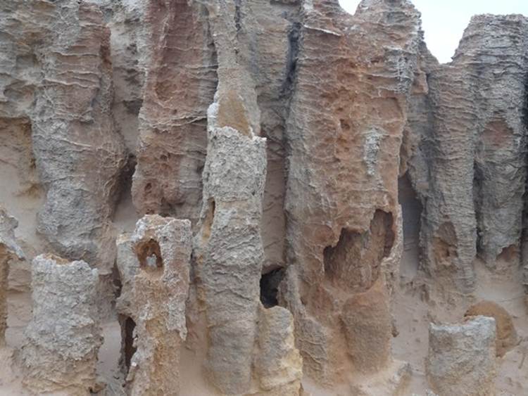
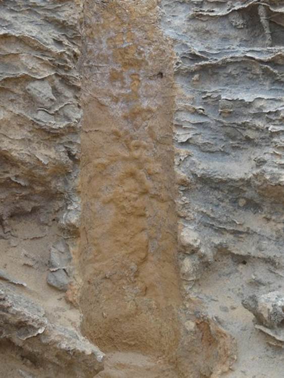
The star of the show at this site was the petrified forest. Early theory suggested it developed when a Moonah forest was smothered by a large sand dune, creating unusual sandstone formations around decaying tree trunks. Now thought to be solution pipes. An acidic solution of water gathers in a shallow pan, often at the base of a plant, and seeps down dissolving the limestone sand gathering a build-up of minerals. The mineral saturated water moves sideways, cements the sand and forms a hard trunk shaped pipe. These pipes have become exposed by weathering and grazing.
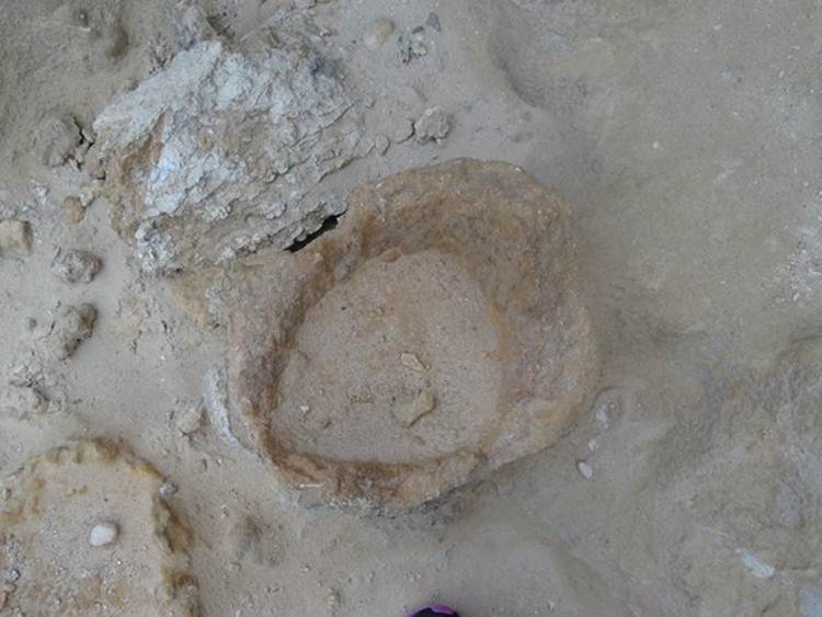
Base of an eroded pipe.
The pipes here are about 1-3m tall but in some areas that can be as tall as 20m. You also get them in other parts of Australia, the Caribbean and Bermuda.
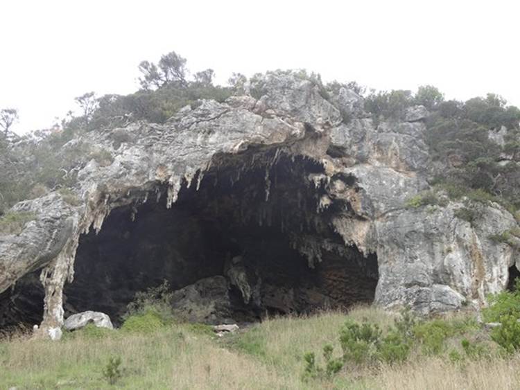
This is Tarragal, an exposed limestone cave. We climbed about 10m from the road to reach it. You can make out a column on the LHS.
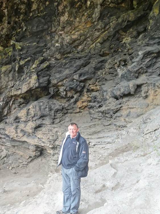
Paul standing in the entrance.
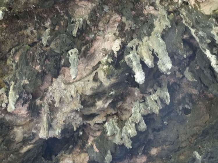
This was obviously a subterranean cave at one time, these are stalactites hanging from the roof.
Paul with a flowstone behind him.
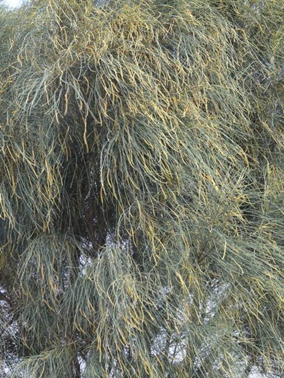
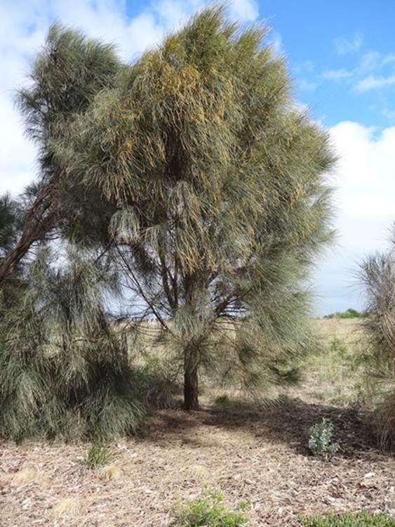
These are she-oaks and there are lots of different varieties. This one is the drooping she-oak, Allocasuarina verticillata. Just love those poster boards. It is called Gneering by aboriginals who used it for making bomeranags and other wooded implements.
They have very long pine-like needles and look all fluffy!
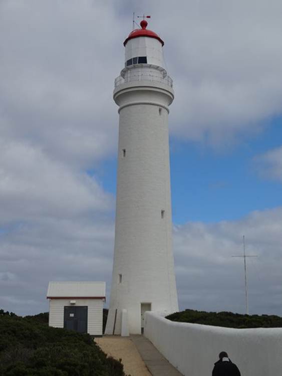
At Cape Nelson we had lunch in a teeny weeny café at the lighthouse and had some of the hottest food we have had in Australia. Normally its lukewarm and always served on cold plates. Weather is very chilly at the moment, we are in jumpers and coats, so having hot food was great. This is Cape Nelson lighthouse built between 1882 and 1884. Its 32 m high and can be seen 21 nautical miles away.
Before that there was a lookout but the lighthouse was built after several ships had gone aground on the rocks.
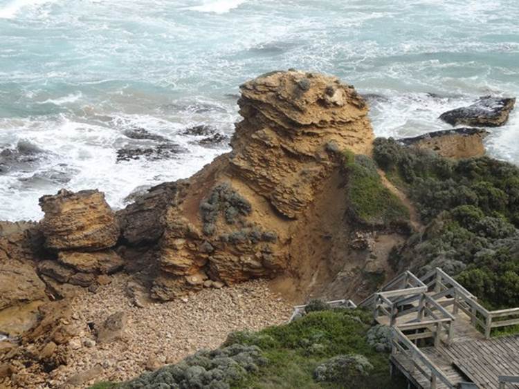
This is yellow rock which is a popular spot for local artists, allegedly, and a surfing beach. There weren’t any about when we were there. The thing about the trails in Australia is that they are all beautiful presented (well mostly all). You have boardwalks and well defined routes so as to make as little impact on landscape as possible. This is typical example of that because the boardwalk and platforms make the beach accessible to prams and wheelchairs via a staircase.
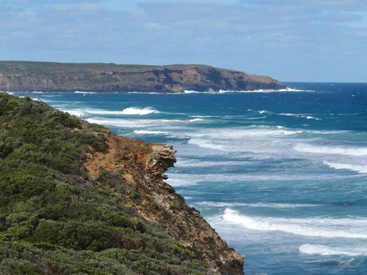
View down the coastline.
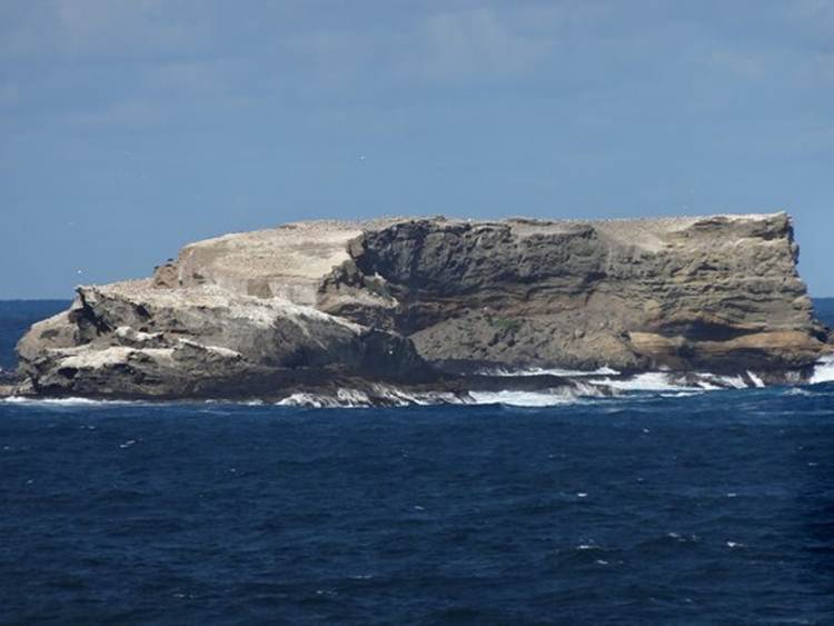
At Point Danger on Cape Grant is the only gannet colony on mainland Australia. Guess what it seems to have disappeared. The whole area was fenced off. This is Lawrence rocks just offshore and the white here is gannets. Maybe they moved!
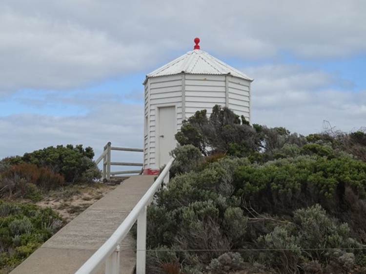
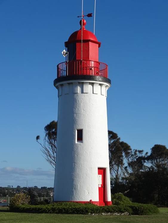
Next door to campsite is Whalers Bluff lighthouse. Built on the top of a cliff you can see this 24 nautical miles offshore.
|