Victor Harbour
Position 35 33.52S 138 36.52E This is the Big Lobster – on our way to Victor Harbour. Absolutely no idea why it was there, but it was big!
The Princes Highway, to Victor Harbour, runs alongside the Coorong National Park which stretches more than 130km. The area consists of several large saltwater lagoons are on the landward side. Seaward the huge sand dunes of the Younghusband peninsular protect the lagoons from Encounter Bay and the Southern Ocean. You can just make out the sand dunes in the background from the Tanganekala lookout.
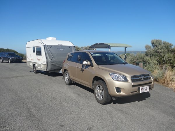
Carl the Van at picnic spot.
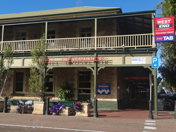
One of the pubs in Victor Harbour, a seaside town about 1.5 hours from Adelaide. Very packed because of the extended weekend due to ANZAC day.
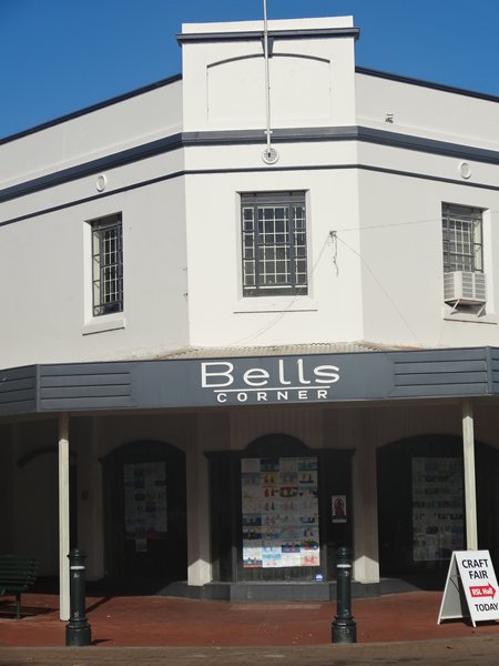
Opposite the pub was Bell’s corner. Originally it had the nice balcony like the pub, but these have been removed and replaced by these canopies. You see these a lot in Australia.
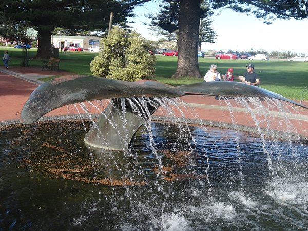
Victor Harbour has several claims to fame. You can spot Right Whales between June and October as they come up from the Antarctic for the winter to feed and breed. Everywhere you go in Australia there are statues and fountains along walking paths - this is a nice whale tail fin to commemorate whales as a onetime industry and now tourist attraction.
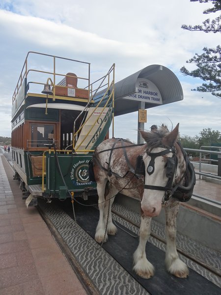
Victor Harbour also has a small island offshore, called Granite Island, which is connected to mainland by a bridge on which a horse drawn tram still operates. The granite originated when magma squeezed up from deep within the continental crust during a mountain building episode about 500 million years ago. Paul on the causeway to the island. The tramlines are between the two yellow lines.
The small shire horses are ridden in everyday from 4 km away. There are several of them but only four work a day. They work in rotation on site, doing 4 trips between rotations.
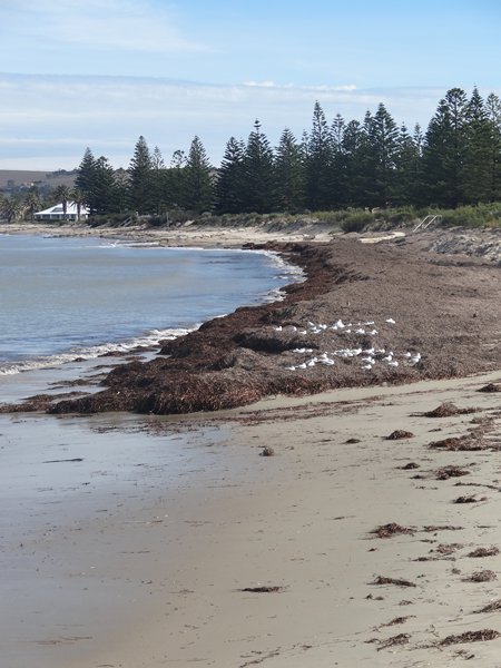
All around the island and in the bay are sea grass beds. One of the animals living there are sea dragons – which Paul had never heard of until a couple of weeks ago. He’d also never heard of squab either. Anyway here’s a lot of sea grass washed up on the beach. Presumably this is either not a beach that you go swimming off or end of the season and so not cleared.
The town also has a steam engine that runs to Port Elliot about 20km down the road. Paul took 20 photos of this train, yawn, yawn. If you are sad enough to want to see them all let me know. Train was called the Duke of Edinburgh!
Speaks for itself.
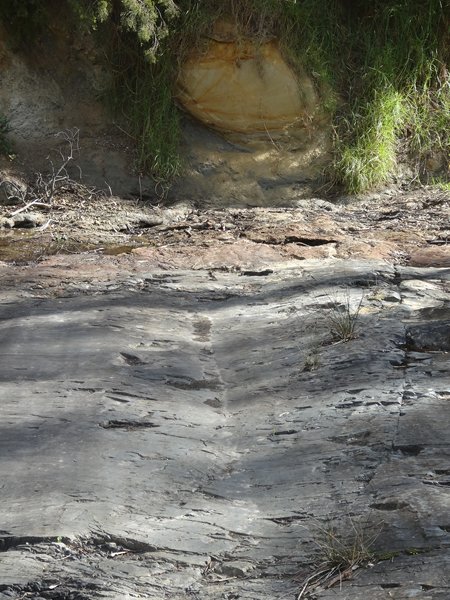
This is Selwyn’s rock, named after the geologist who realised what he was looking at. According to the sign it is one of the best examples of evidence of glaciation, not only in Australia but in the world. Don’t think I believe that one. However, you can see the marks that rocks borne in glaciers have scratched into the surface of the local Kanmantoo bedrock which is about 450 to 500 million years old. They were made about 250 to 280 million years ago when the whole south coast was covered by a glacial ice sheet, which moved inland to the northwest.
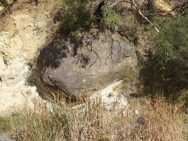
This large granite boulder (erratic) is similar to those found on Granite island some 14km to the south. The erratic’s are about 450 million years old and were collected from Victor Harbour and dropped nearby as the ice melted. The erratic was ripped away from the bedrock by the moving glacier, and moved to here, getting rounded in the process. Boulders similar to this one – and who knows maybe even this one, would have made the groves in the bedrock as they were carried along in the ice.
You can just make out the deformed sandy horizons beneath this erratic. The glacier started to melt and the boulder will have sunk out to the lowest part of the ice and settled into the underlying glacial sediment (till), deforming it and warping it under its weight.
This is the ferry that takes vehicles and people to Kangaroo island. We enquired about price – a mere $580 return. We ain’t going!
|