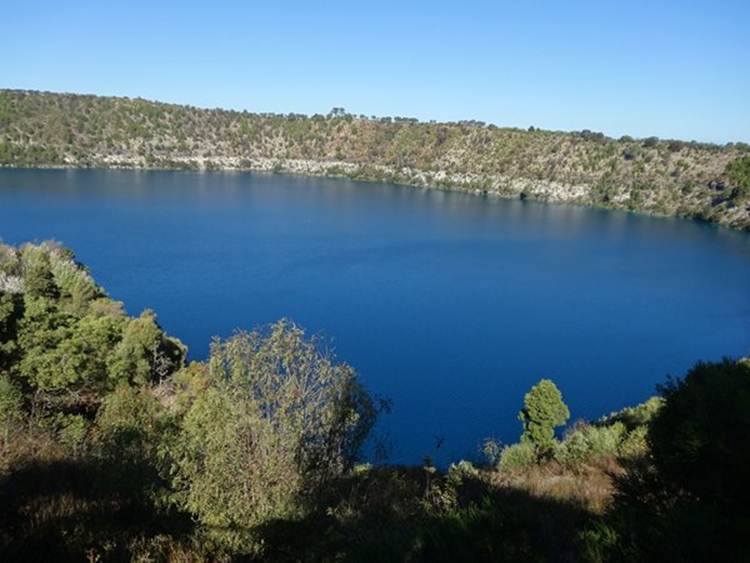
Mount Gambier - Blue Lake
Position 37 50.74S 140 46.19E After Portland this is a delight. We are in a camp site on the slopes of Mount Gambier – a volcanic crater. In southern South Australia, and Victoria, there are a number of volcanic sites thought to have arisen when some crustal fissuring along a fault occurred along this part of the coast. Prior to this, between 15-40 million years ago, the area was covered by that shallow sea, rich in calcium bearing organisms which formed, in this area, the Gambier limestone. It is very porous. Small outflows of basalt lava occurred about 1.5 million years ago to the north of Mount Gambier. At Mount Gambier there were two volcanic periods very close together. About 4000 to 5000 years ago, the first activity was some small scale lava flows which flowed out through to the surface through gaps in the limestone. These solidified forming a cap, if you like, in the area and then everything quietened down. However, the groundwater within the limestone, beneath the surface basalt layer, percolated down through the limestone via volcanic conduits to the hot lava sources deep below the surface. The water became superheated steam. Hot steam, solid rock, not a good combination. Pressure built up and new vents blasted their way through the basalt cap depositing a thick layer of ash and creating the craters at Mount Gambier. These types of explosive structures are called maars, layers of ash and rock form the crater walls. Carbon dating puts the main period of activity at about 4600 years ago. Not only are they interesting volcanic features but a good example of what oral history can tell (Ring a ring of roses!). Local aboriginals – the Booandik Tribe – in their oral history (dreamtime) tell of their ancestral giant Craitbul, and his family (wife and two sons), who wandered around the south eastern region looking for a place to live. They camped and dug into the ground to make an oven at Mount Muirhead and were happy there for a while, but then they were frightened away by the groaning voice of the bird spirit Bullin warning them about of an evil spirit Tennateona. They then camped and made an oven at Mount Schank but were again visited by Bullin and threatened by the evil spirit. Moving to Mount Gambier they managed to escape from the spirit and lived there for some time. Again they dug into the earth and made an oven but one day water came up from below and put out the fire. This occurred four times (the Valley Lake, Blue Lake, Browns Lake and Leg of Mutton Lake). Finally Craitbul and his family settled in a cave on the side of Mount Gambier. This is the Blue Lake, the oven that filled with water. After the explosive eruptions finished the ground water level was restored and the Blue Lake formed in the crater. The limestone is the white area just above the water level. It goes well down below the surface. The lake itself is really deep in places, the average is 80m but at the deepest point it is 204m.
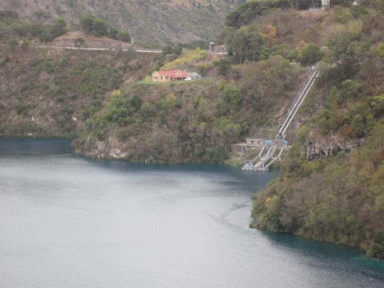
Apparently the lake is a brilliant blue between November and March and grey the rest of the time so the leaflets say. It looks pretty blue to me. A thermocline forms in the summer so any phytoplankton in the upper layers soon run out of nutrients die and sink down through the water column. The algae, and decayed land vegetation, leave behind humic substances. In the summer, degasing of carbon dioxide changes the pH of the surface water and promotes calcite precipitation. As it does so the humic substances, which are chemically attracted to calcite crystals, co –precipitate out with the calcite. The water then gets very blue. During the autumn the water cools down, overturns and brings those algae and humic substances back to the surface. The lake provides Mount Gambier with its water. Water in the surrounding area is at the same level so the lake represents the ground water level. The pumping station in the lake.
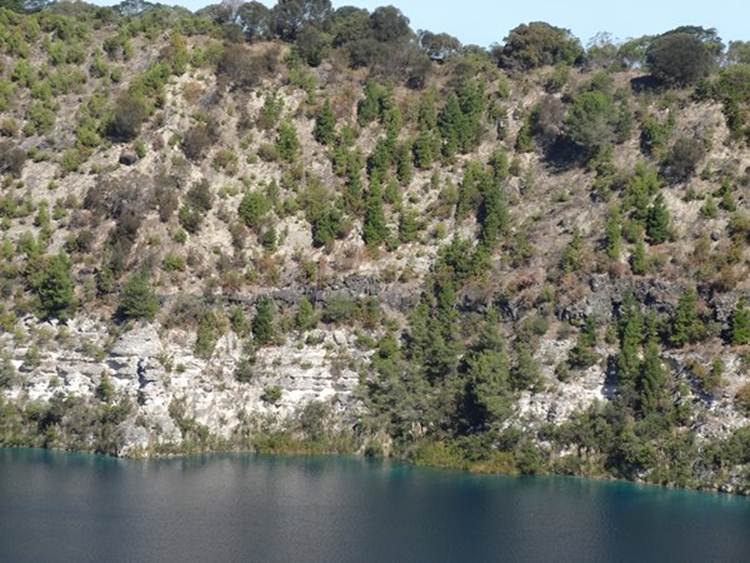
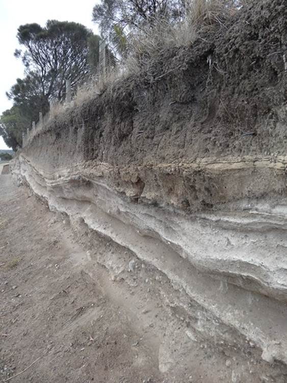
The dark line above the whiter limestone is the upper layer of basalt that formed on the surface. It is up to 20m thick in some places but only extends about 8 km from the Blue Lake.
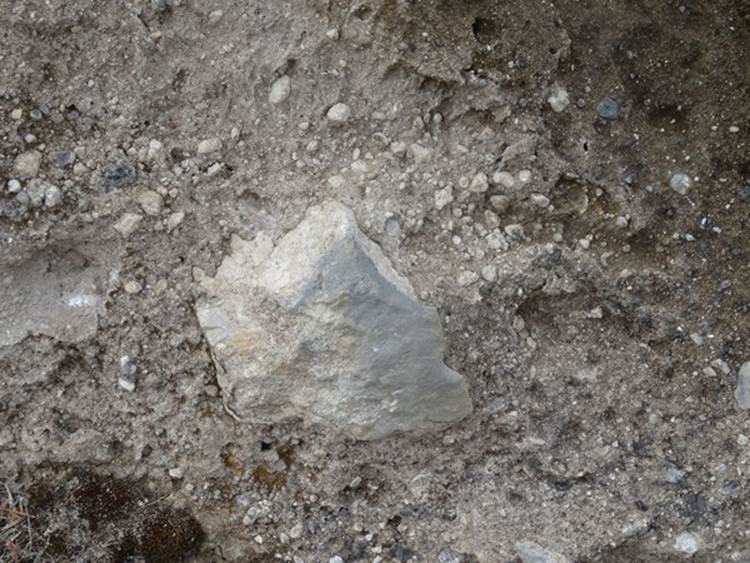
When the maars erupted, as well as lot of ash, large blocks (bombs) of basalt and limestone weighing up to 20 tonnes were ejected. These volcanic bombs lie within the ash deposits. Here you can see some small ones within this small landslide.
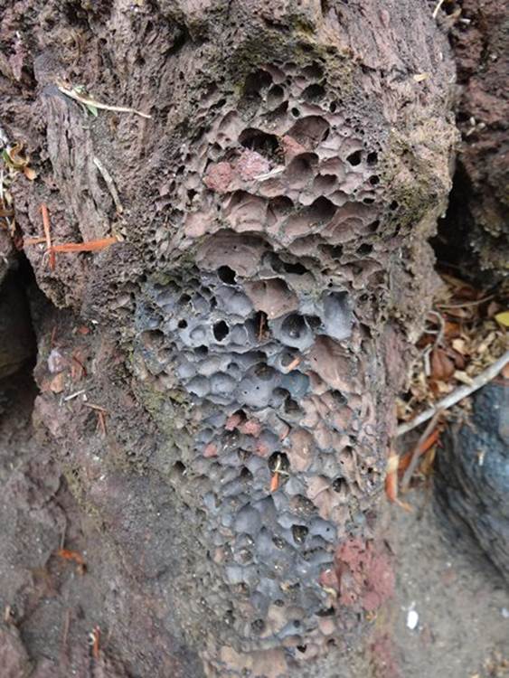
Here are gas / air bubbles preserved within the rock.
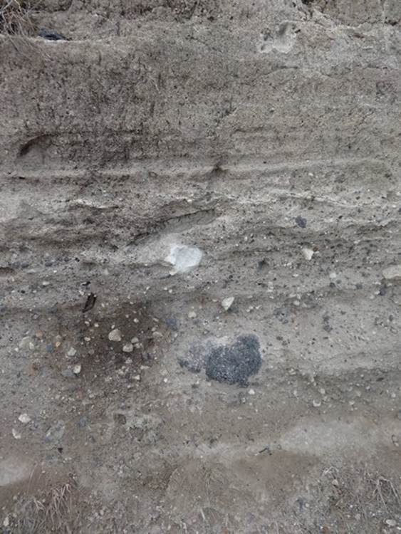
Volcanic ash surrounds the area. You can see small pieces of basalt and limestone caught in the ash.
Good picture of weathering that reveals layers of ash.
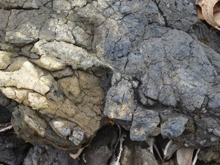
Some nice charred rock.
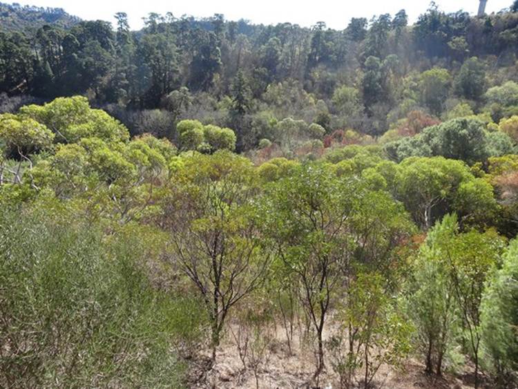
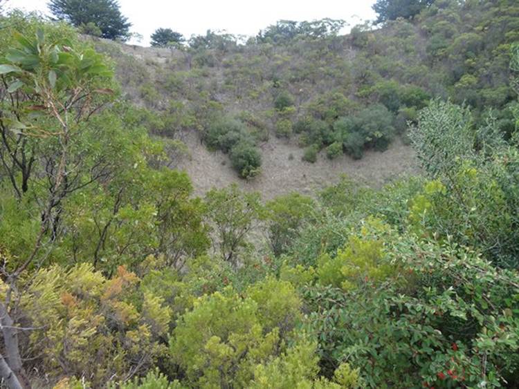
This is mutton crater, literally just across the road from the Blue Lake. It had a lake in its base which looked like a leg of lamb – honest. There used to be water in the base but water table levels have dropped and now no lake remains.
Another interesting feature you can see here is blowholes! These are vents through which steam was discharged. This is the Devils Punch Bowl – would have looked better from above.
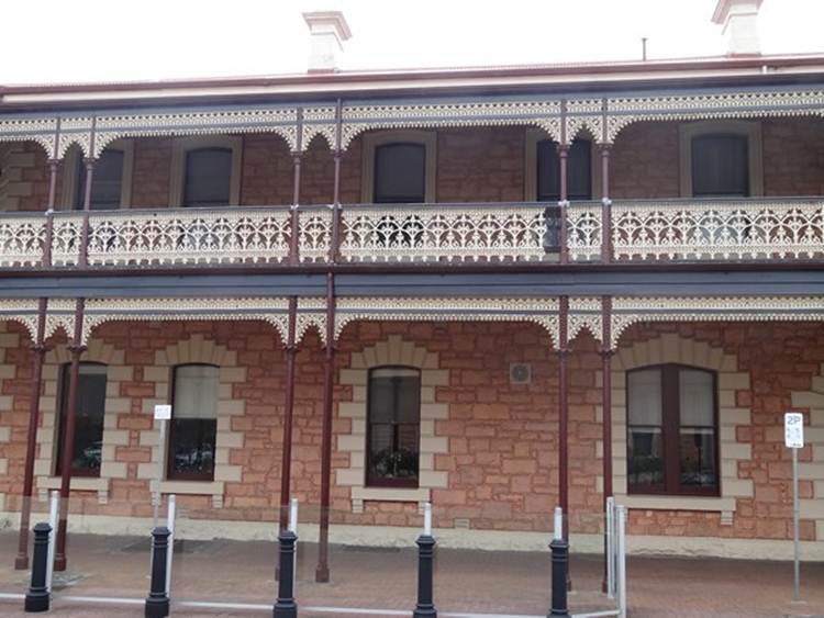
One of the nicely preserved balconies attached to one of the pubs in the town.
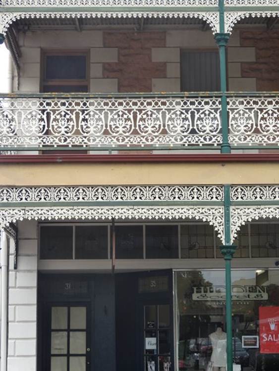
This one was above shops. Older towns in the hinterand have their entire highstreets lined with archways like this to protect you from the intense glare of the sun.
|