Great Ocean Road
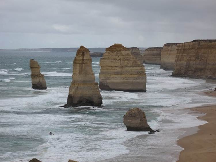
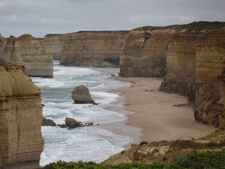
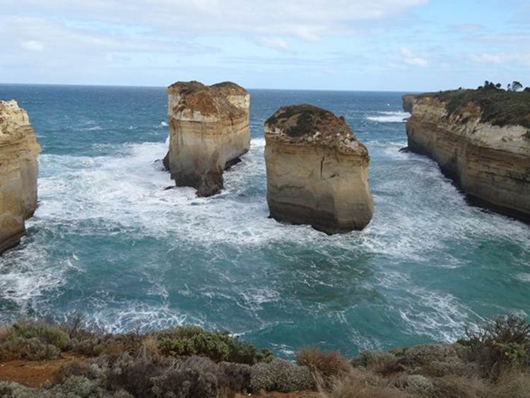
The section of the Great Ocean Road between Princetown and Peterborough, contained within the Victoria’s Port Campbell National Park, is the most spectacular. The landscape is limestone (karst) so the area was underwater at one time. It was formed 10 to 20 million years ago, in the Miocene period, and to create limestone this thick it was underwater for a long time. Sea levels were much higher then. The formation of the limestone began with deposition of lots of plankton skeletons, mainly shellfish and calcium carbonate rich plankton. Sea levels dropped again during the last ice age (about 5 million years ago), exposing a huge limestone sandy plain that stretched from Tasmania to the states of Victoria and South Australia. As the sea retreated, the rock cracked in a chequerboard pattern, leaving deep vertical joints. At the end of the last ice age (about 15,000 years ago), sea levels rose again, partly covering the plains, reaching present levels about 6000 years ago. The cliffs were formed when the sea undercut the land causing it to collapse. Harder blocks remain as stacks while the rest of the coast continues to erode away. They are ephemeral features of this limestone coastline retreating at a rate of about 2 cm / year. These are the Twelve Apostles, although not all twelve are visible in one picture, being hidden by other stacks and headlands. Apparently in the 19th century these formations were called the ‘Sow and Piglets’ – much better name if you ask me.
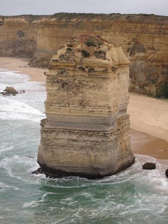
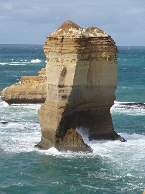
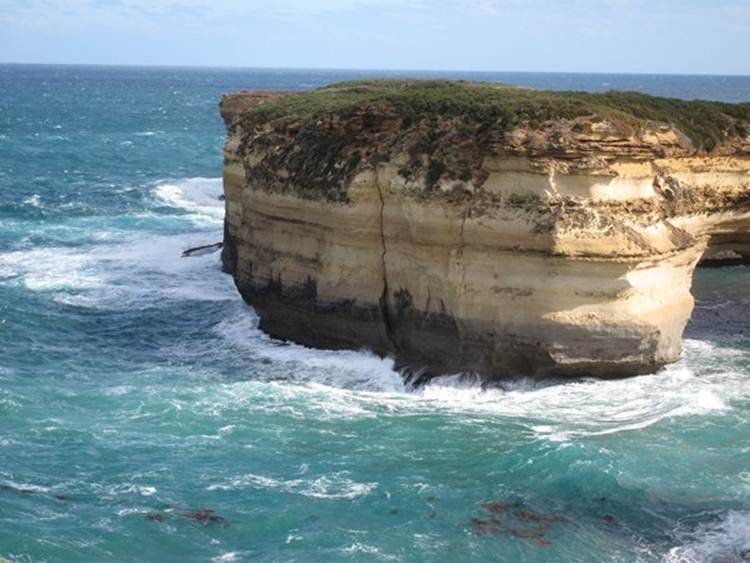
You can see the undercutting of one of the stacks here. Waves attack softer layers at the base undercutting the rock until it eventually collapses.
Here you can see slumping of the limestone that will eventually result in another stack.
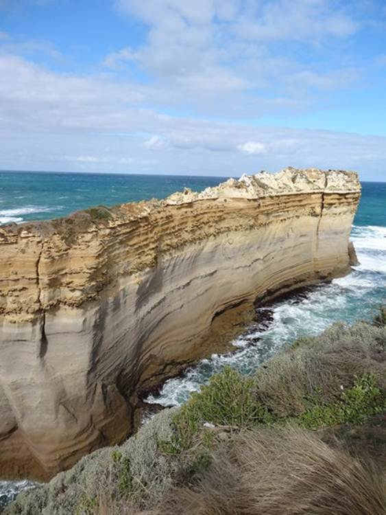
All the banding is a result of weathering, by wind and rain and spray, of rock layers of differing hardness which erode at different rates.
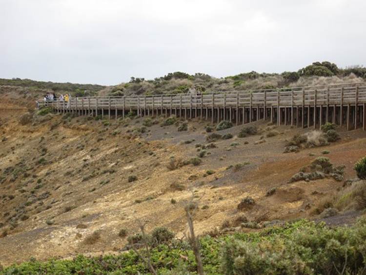
One of the viewing platforms.
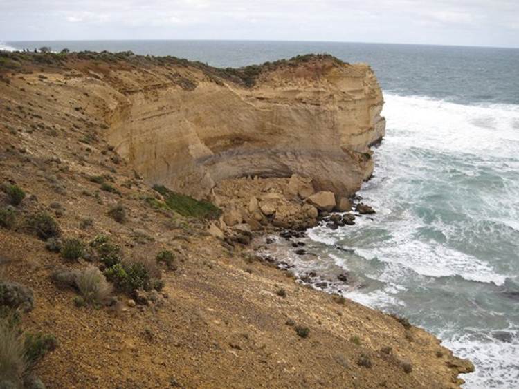
An indented coastline.
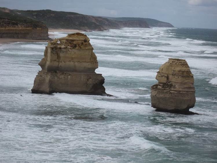
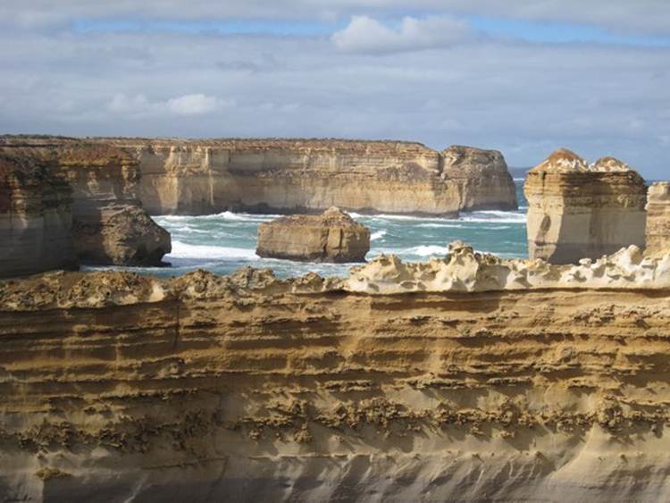
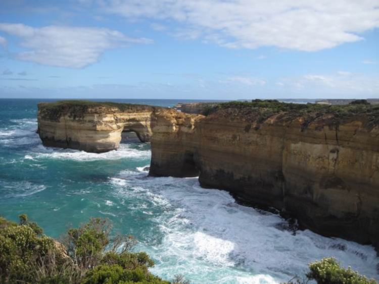
In some places the limestone has been eroded to form small (and large) embayments. This one with these two stacks was just along the footpath from the main viewing platform.
This rock is called the razorback. The sharp edges and bumps along its back are caused by windblown spry, which hardens small areas of rock. The softer rock around these erodes away, leaving an uneven surface. Wave energy along the sides of the stacks carves the deep smooth grooves just above sea level. On average there is one wave every 14 seconds. You do the math. All of these stacks were once connected to the land. Vertical cracks in the rocks have been further eroded by rainwater.
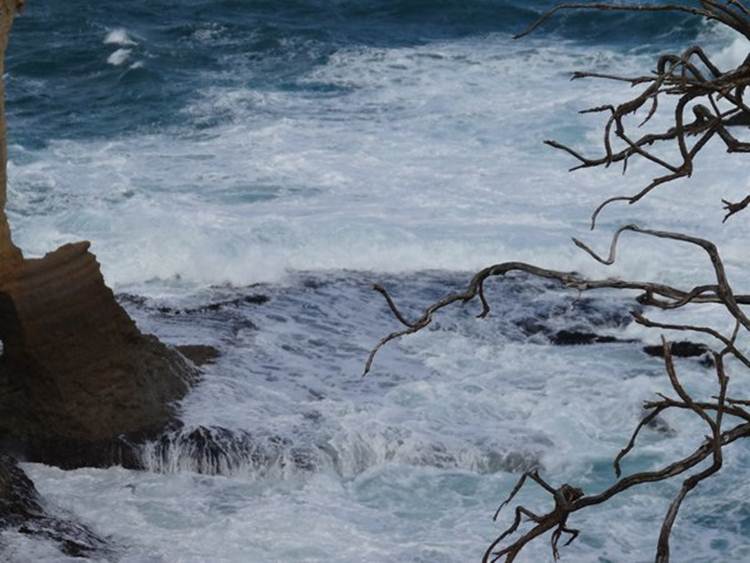
The force of the waves has undercut the base of the rocks. Huge blocks of rock have fallen away and into the sea leaving the rock shelves that you can see at the base.
You can see the waves undercutting one of the stacks north of the razorback.
More stacks in the background behind the Razor back.
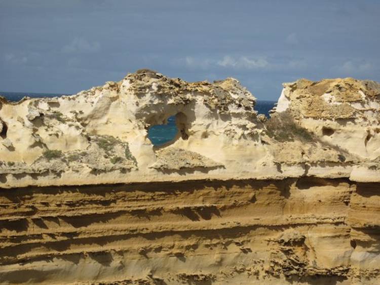
Close up of the effects windblown spray erosion. Rainwater and spray dissolve the rock and enter smaller cracks to give this very sharp outline.
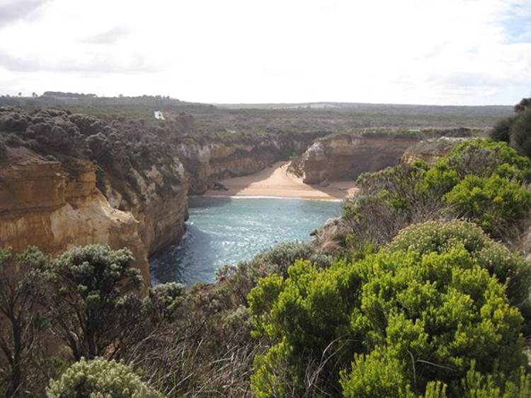
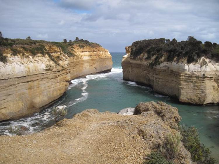
As you can imagine (or not, as the case may be) this part of the coastline was, and still is, treacherous to sailing vessels. Back in the 19th century the growing colonies of Victoria and New South Wales were dependent on ships from Europe for supplies and transport. Between here and Tasmania is a bit of seaway called the Bass Strait, and it became a major shipping route. Several ships inevitably went aground and sank, so this part of the coastline is also known as the Shipwreck coast. Loch Ard Gorge is classic example of erosion of vertical crack that has, in this case, created a gorge which then opens out into a small beach at the base. It gets its name from the clipper Loch Ard that went down in 1878. The tiny bit of ledge that you can just on the LHS (it looks like a small black smudge sticking out of the cliff about half way up the cliff face) is the place of the shipwreck. Two people survived.
Seawards of the gorge itself.
Tiny beach at the end.
View looking out to sea from the head of the gorge.
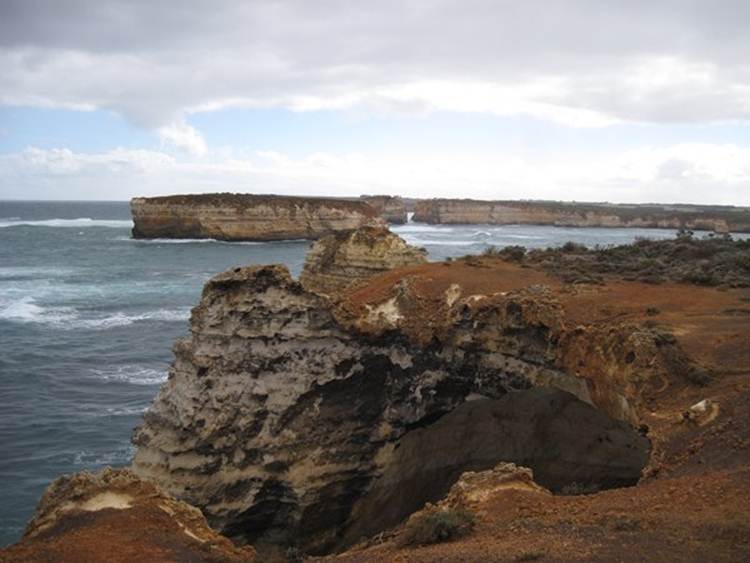
This is the Bay of islands, not as spectacular as some of the other stops.
|