Leaving our Mark and Scaling the Heights

Aurora_b
Mike and Liz Downing
Fri 11 Jul 2014 00:54
|
More work to keep us busy. Have been up the mast to
check everything looks okay and under the boat to check the rudder bearing and
give the waterline a wipe. She's remarkably clean underneath and a wipe around
the waterline was all that was needed. The water here is clear, but
definitely cold, but not so bad with a 7mm semi-dry wetsuit on! The only problem
with that is that without weights its incredible difficult to get down
under the boat and you literally have to grab hold of what you can,
like the rudder, and pull yourself down. Anyway, the rudder bearing looks
okay, just some antifouling missing where the rope had got caught. Had to go
down to check it as a boat we know was lost about 2 weeks ago off
Madagascar when their bottom rudder bearing failed. The people on board
were okay and save by a freighter that was diverted by the rescue
authorities to go to their assistance. So we've checked and it looks okay, so
finger crossed. Then there's finishing our picture on the wall - although
purely functional rather than artistic (Clive, where were you when we
needed you!) it still took quite a lot of time and patience to get it to
look okay.
Despite all the work we did manage a trip to the
island of Pico. When here 18 years ago we would stare across to the mountain,
which we still do constantly as the clouds around it are forever
making different patterns. (We must have as many photos of Pico as we do of
the Sydney Opera House!) Anyway, staring across we said it would be good to
climb to the top one day. Last Wednesday was a glorious day with not a single
cloud on Pico, so after an 18 years wait it was the day to give it a go. The
local Tourist Information write-up suggested it wasn't to bad - 5km along a
well marked route. What an understatement! What it didn't say was that the 5km
involved a climb of 1,150 metres, or 3,737ft! The mountain is
2,350m (7,637ft, approximately twice the height of Snowdon), but the
climb starts at 1,200 metres where the road ends. The route is very uneven
climbing up lava with quite a bit of rock scrambling, and quite exhausting, but
easier going up than down. Going back down we wondered how on earth we had
managed to get up! So coming down took a lot longer, but it did mean we got to
see a beautiful sunset looking down over the clouds below us. 18 years ago you
could go up in the afternoon, see the sunset from the top, camp on the mountain
and see the sunrise from the top the next morning. You're not allowed to camp
anymore so that wasn't possible, but at least we did see that
sunset. We ached just a little the next day (another
understatement!) and had a well earned day's rest.
 Another trip up the mast to check the
rigging looked okay. There are pictures everywhere.
 Our picture taking shape,with masking tape
still in place.
 It took two - painting letters drives you
round the bend!
 The finished article - purely functional
recording our visit. Wonder if that will still be here
in 18 years time.
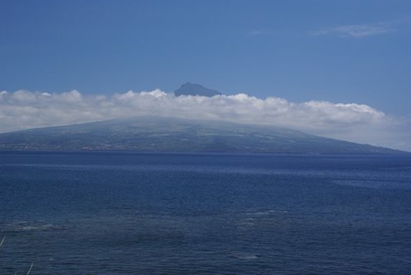
 Looking across the water to Pico, which you
can't help doing all the time.
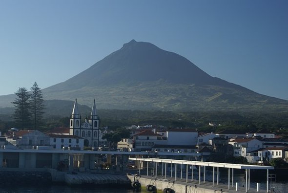
 Arriving on the ferry at Madalena, the port
of Pico. The crossing takes about 30 minutes.
Not a cloud to be seen on the mountain, which is very rare.
Note the small pimple on the
top of the mountain.They call it Little Pico - it's actually about
80 metres (260ft) higher
than the surrounding
summit.
 On the summit, sitting on the top of the
pimple! The views were fantastic and as the cloud
started to roll in, it was all below the
point where the climb starts so we were looking down
on top of the cloud the whole time, just like being in an
aeroplane. Talking of which, the
local planes were actually flying below
us.
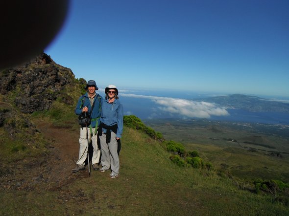
 To climb it they highly recommend you
hire a guide as people do get into trouble. So we
did and that's his finger in the corner of the lens! His name
was Noel and he was great,
knowing everything
you could ever want to know
about the mountain, the rocks, how it
was formed, plant life and where
all the fumaroles were - the
mountain still breathes
steam and gases if not fire! One day it's
expected to erupt
again.
 Above and below, the terrain to be
climbed.
  Heading up again after a break,climbing on
lava flows and tubes.
 Not too difficult going up, apart from
puffing and panting - coming down on this was quite
a different story and very slow
going.
 On the edge of the top crater with just
Little Pico to scramble up. That was a proper climb
using both hands and feet.
 Noel, our guide. He was French, but has
lived on Pico for many years. He didn't stop talking
from start to finish and looked after us
very well.
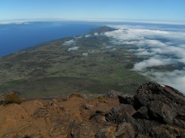
 Views from the top, looking along the length
of the island of Pico.
 And that's the island of Faial, where Horta
is, and the boat.
 Looking down on the cloud that surrounded
the southern side of the mountain.
 Later in the evening now and the cloud has
started to engulf the whole island, but below
us. The rock is all that can now be seen of
Faial.
 The sun went down just as we arrived back at
the starting point,so perfect timing and the
end of a perfect day.
|