Tonga - photos of Port Maurelle
Aurora_b
Mike and Liz Downing
Tue 14 Dec 2010 06:49
|
Port Maurelle, or anchorage No. 7 according to the Moorings
charter chart that most people had, was a favourite - a wide, sheltered bay with
good holding, clear water and a lovely sandy beach to look for
shells. It even had fruit bats flying around the trees in the
evening. Although called Port Maurelle, there is no port or anything
else there except the half-moon beach surrounded by palm trees. It was named
after the Spanish navigator who was the first European to make landfall in the
Vava'u islands.
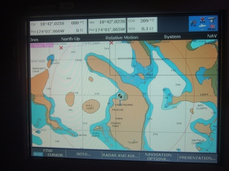 Aurora B anchored in the bay, shown in the middle
of the chart.
The seas within the island group are sheltered and give
good sailing in flat water. It's an ideal place to come and charter, but we
didn't see many charter boats. Possibly the expensive air fares to get here
might be the answer!
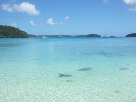 Looking out from the beach. The boats are a fair
way off as there's a band
of coral in front of the
beach.
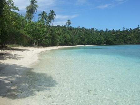 Just how we imagined the South Pacific would
be!
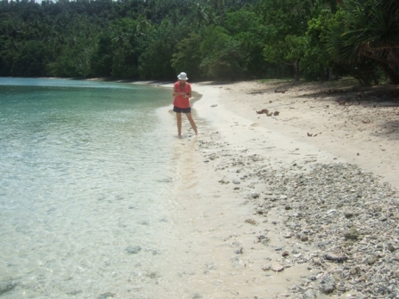 Liz looking for shells along the
shoreline.
|