Monday 21st February - Arthur's Pass and the Earthquake
Aurora_b
Mike and Liz Downing
Fri 25 Mar 2011 10:17
|
Another beautiful day as we headed towards and through the
mountains. The weather so far has been excellent. It's getting a bit colder as
we head south - we're in the roaring forties latitudes here - but the sun has
shone most of the time and we've had no rain, often the case on the east
side as the weather comes from the west and all the rain drops on the mountains
on the west coast. The mountains here are real mountains - hundreds if
not thousands being in the 4,000 - 6,000ft range and many rising
to 10,000ft with snow on top and they really are a magnificent sight. To
compare, back home Mt Snowdon is around 3,500 feet and Ben Nevis just over 4,000
feet. Mt Cook, the highest mountain in New Zealand, further down the west
coast is 13,036ft. It was a relatively short trip to the pass from Springfield,
but it was the most spectacular drive we have ever had - the road winding
between the high, dramatic peaks in bright sunshine and blue
skies. High on the plateau leading to the pass are the Castle Hill Rocks -
an outcrop of huge exposed grey rocks and boulders littering the mountainside.
It was easy to imagine Frodo and his comrades running through here with orcs hot
on their heels. It wasn't filmed here, but it was very similar.
We arrived at lunchtime at our next stop for a 2 night stay a
small motel in Arthur's Pass village, even smaller than Springfield -
a lot of the villages are so small that if driving and you blink you
miss them! Arthur's Pass village is up at around 2,500 feet with
steep mountains on both sides of the road and geared towards walking
and climbing in the mountains. The transalpine railway stops here so
it is possible to arrive via the transalpine express that runs once a day in
each direction. We saw our first 3 Keas in the village - the world's only
mountain parrot. They're about the 18 inches high so quite big, very inquisitive
and have a reputation for pinching food and pecking the rubber out of
windscreens! As well as being endemic (only found in NZ) they are considered
endangered with only around 5000 left.
A walk in the afternoon took us to the Devil's
Punchbowl - they have one here too, but unlike the one in the UK, this one
is a spectacular waterfall. The following day was one we will not forget as
we experienced out first (and we hope last) earthquake.
Relaxing at lunchtime after a morning walk in the hills our motel room
(a single storey wooden cabin) started to wobble gently, like a jelly
- a very strange feeling. The motel staff confirmed it was an earthquake
and as it had started to rain (the weather changes very quickly) we
switched on the TV to see if there were any other reports. 15 minutes or so
later, news started to come through that poor Christchurch, 100 miles to the
east, had been hit again. This is a country on the move and a lot of places
regularly experience earthquakes, but only very rarely in recent times have they
been big. The Australasian plate and Indo-Pacific plates meet here creating the
Alps which, along with the plate boundary, run the full length of the South
Island.
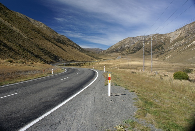 On the eastern side the road winds its
way towards Arthur's Pass.
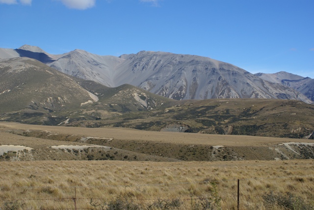
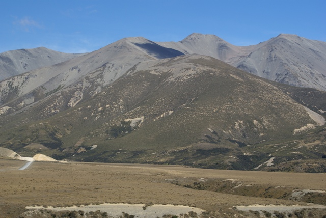
 This and the 2 below show the spectacular
mountains scenery along the road.
  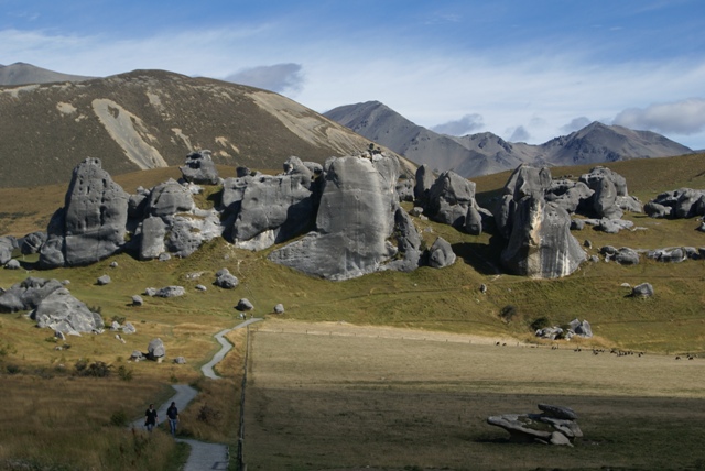 Castle Hill Rocks on the way to the Pass. The
figures in the foreground give some idea of their
size.
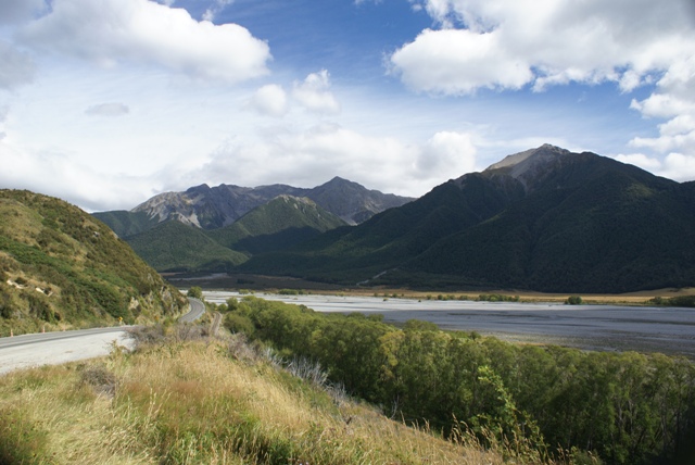 The road to Arthur's Pass goes over the
Waimakariri river to the right and through the shaded valley
between the mountains.
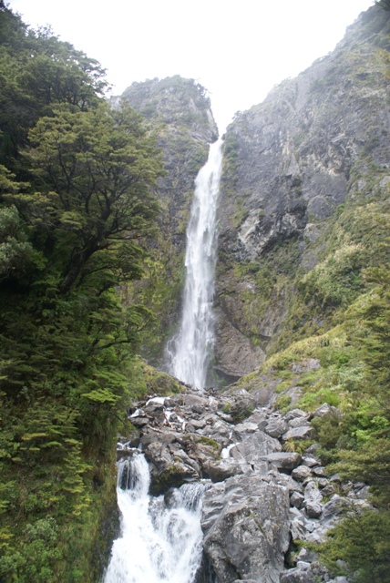 The Devil's Punchbowl waterfall at Arthur's Pass,
coming down in
torrents, after a relatively dry
spell!
 The transalpine railway station and
.....
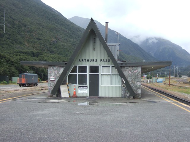 .... station building.
|