Heading East - Nasasobu Bay 16 45.176S 179 51.089E
Aurora_b
Mike and Liz Downing
Tue 29 May 2012 09:29
|
The anchor reluctantly came up this morning - the
chain caught twice on the coral and gave us a bit of a scare, but it did
come up. So it was off to Fawn Harbour about 37 miles to the east. The plan had
been to head south about 5 miles to get away from the land and then head east,
or slightly north of east to get to Fawn Harbour. This is the recommended
ploy when the winds in the south east, which the forecast said it would be. The
wind hadn't read the forecast - it was light and coming from the north! This
continued for the first 2 hours, so the plan went out the window and we
headed east much earlier. It then swung to the east where it stayed
light for the rest of the passage. So it was a close-hauled motor-sail
all the passage. It was also a different destination. Within about 10 miles
or so off Fawn Harbour we heard 4 of the rally boats on the VHF
radio and made contact, finding they were in another anchorage a few
miles further to the east, so that's where we headed. They were in a
large bay between an outer reef and the fringing reef round the land. To get to
it meant negotiating the Dakuniba Boat Pass, a gap in the reef about 90
metres wide. Okay if you have a chart plotter that gives that level of
detail, but under 12 miles on this part of the coast our Navionics
Gold electronic chart (from 2009), shows no detail at all and changes the whole
coast to a block diagram with straight-line edges - no good for navigation! So
it's Mark 1 eyeball navigation, but we have found
something that looks like it's going to be very useful - navigation
with the aid of Google Earth. Sailors back in the UK may already be using it,
but if not, it's definitely worth looking at.
We hadn't looked at Google Earth (other than the position
map on this blog) for years, so once told that it was good we
downloaded it in Savusavu (good Internet access) and zoomed into the
coast passages that we were considering. Google Earth keeps all this
information in store, so when not attached to the Internet you can still access
it. Zooming in low shows the anchorages and the reefs and it is possible to put
placemarks in on Google Earth and then transfer them as waypoints to the
chartplotter. So when changing destinations today, it was a quick load of Google
Earth, put in the placemarks for the new destination, transfer them to the
chartplotter and we had a route to follow through the reef, BUT I was
also on the bow! The waypoints were dead on and we went right down the
middle of the pass. One other benefit of Google Earth - we have a
connection from our Raymarine navigation systems that plugs into
the laptop and allows the navigation data to be transferred to the
laptop. Using this with Google Earth and putting on real-time, our
moving position is shown on Google earth with a small length of trail, so we can
see on the satellite picture where we are in relation to the coast and
reefs. It's also great for checking out other people's way points (and waypoints
are being swapped all the time here). In the absence of decent charts, it
looks like it's going to be really helpful and as you've probably already
guessed, although only having only used it on one passage we're
impressed. We have some younger American friends here and using
their vocab, on what we've seen so far we think using Google Earth is both
Cool and Awesome!!
Having gone through the pass we joined the others who were
anchored just behind the reef to snorkel on the reef. So Liz had her first
snorkel in the tropics since leaving Tonga in October 2010. A long wait and
we're glad to be back, but for me the wait goes on until my leg heals and that's
really frustrating. Before the sun got too low in the sky, it was time to
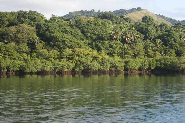
retreat from the reef to a small mangrove-lined bay hidden inland with hills
clad in rain forest and coconut palms all around - Nasasobu Bay. Or at
least it would have been if our chain hadn't got really stuck this time. We
freed it, but it took a lot of maneuvering in different directions and quite a
bit of persuading with engine power to get it up. On reaching Nasasobu Bay it
was like a mill pond - not a ripple. As it's lined with mangroves it would
be a superb cyclone hole, offering great protection in high winds. As dusk
approached, lots of big fruit bats took to the sky above the trees.
It is very tropical and very remote here, and feels it.
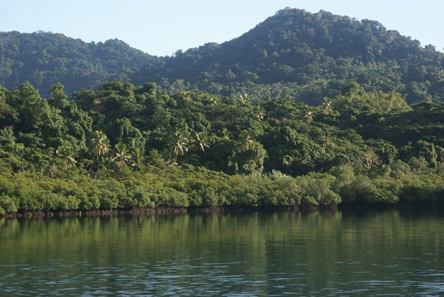 Above and below - pictures around Nasasobu Bay.
The tide is exposing the roots of the mangroves.
  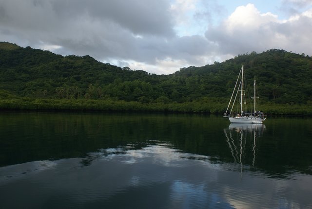 Sea Bride - one of the 4 rally boats we met
here.
 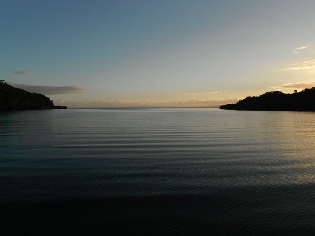 Looking out the entrance to the bay towards the
barrier reef. The reef can't be seen here, but goes
right
across the picture. The pass out of the reef is
round the headland to the left.
|