St Helena - Inland
Aurora_b
Mike and Liz Downing
Sat 12 Apr 2014 18:09
|
A tour of St Helena was arranged, but unfortunately it
wasn't one of the best days. It's interesting that until coming here, when
thinking of St Helena and Ascension Island, I thought of cold rocky outcrops in
the Atlantic. I didn't think of them as tropical Islands. But, obviously they
are islands, and they are both in the tropics, so tropical islands they most
definitely are. Ascension is only 8 degrees from the Equator, so closer to the
Equator than all the Caribbean Islands, but there's not a coconut palm to be
seen! The south east trades keep the island quite a bit cooler than you would
think. Ascension, being 700 miles further north, is definitely warmer. Today it
was over 30 degrees and at 22.30 it's still 28, But still no coconut
palms.
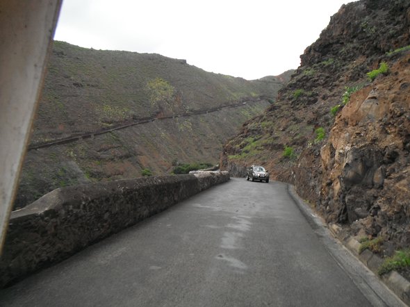 The long and winding road - out of the
Jamestown valley.
 The view from the top of the valley looking
down on the visitors' moorings -
not a lot of protection from the ocean
(actually none at all!).
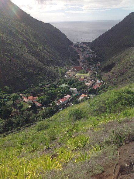 Jamestown squeezed in the steep-sided
valley.
 All the roads were narrow and windy - like
the West Country. 4th gear rarely gets used!
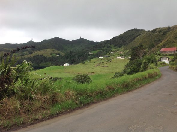
And
.................
 ...............the views round each bend
were quite spectacular!
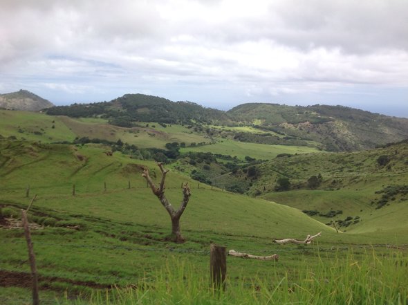
 The not so green hills in the distance are
evidence of more recent volcanic action.
 Above and below - beautiful Hobbiton-like
scenery.
   Dave feeding the donkeys with carrot tops. A
local along the way had given him a bunch of
freshly dug carrots for his next passage.
The donkeys much preferred them to the grass!
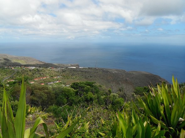 More stunning views. That's New Zealand flax
the foreground. Apparently the Island
used to be covered in it as it was the main crop and producing
products from it (like hemp
for the production of sacks)
was the main money earner
for the Island.
 The Governor's Residence - the Queen's
representative on the
Island. Not a
bad little
place!
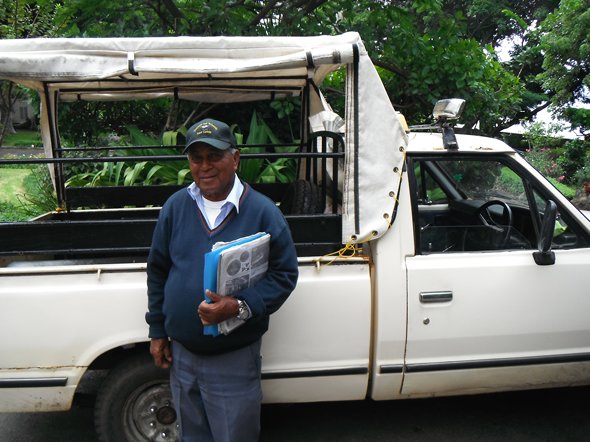 Our Guide and driver - Robert - doesn't
look 78 does he. It must be a healthy climate!
 High Knoll Fort - the main fort perched high
up one a hill overlooking Jamestown. It was
big enough for the entire population of the Island (around 5,000)
to take refuge in if the
Island came under attack.
The walls are supposed to be
6ft thick to withstand cannon
ball attack from ships in the
bay.
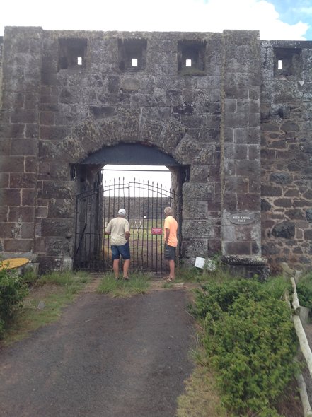 Unfortunately they had a land
slide under one of the walls and it's
considered too dangerous to allow people in. So all we could do
was
peer though the locked gate.
 When we returned to Jamestown we found the
locals had been having a fishing competition as part
of their 'Marine Awareness Week'
festivities.
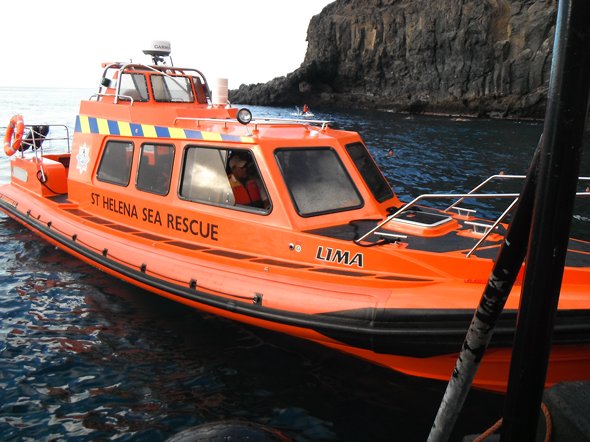 As part of the festivities the rescue
boat put in an appearance, as .........
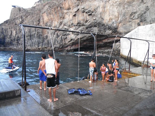 ........the local children used the
ropes normally used for getting ashore from boats, as swings
to swing and jump into
the sea. The water is
beautifully clear and it's one of the few safe
places to swim (when there's little
swell).
The island is very rocky all around the coast
and the
currents are generally too strong to
swim.
|