11th April - Tongariro National Park
Aurora_b
Mike and Liz Downing
Fri 22 Apr 2011 07:11
|
The Tongariro National Park covers an area
of about 3,000 sq miles and is one of only a handful of sites
worldwide with dual World Heritage status - for its natural and cultural
value (the area is very significant to Maori culture). It includes 3 major
active volcanoes - Mt Tongariro at 6,400 ft high, Mt Ngauruhoe (used for Mt
Doom in Lord of the Rings) at 7,445 ft and Mt Ruapehu at 9,090 ft - the highest
mountain in the North Island, with 8 glaciers on its slopes. Although they are
active and smoldering away nicely (the last major eruptions were only 12 years
or so ago), they have tramping tracks around them and Mt Ruapehu is the skiing
centre of New Zealand, with many ski slopes and ski
lifts. There's supposed to be a good early warning system for
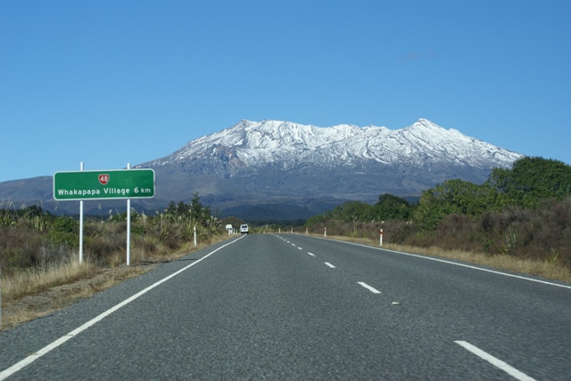
eruptions. We hoped that worked as we headed for the very small village of
Whakapapa where it all happens.
It was another fine day with bright blue sky
and sunshine. It had snowed a few days earlier and the top of the mountain was
covered in snow, adding to its beauty. So a quick decision was made to
drive on further up the mountain to have a look at the ski
lifts which run in the summer to take trampers and climbers up the mountain.
They turned out to be chair lifts - what to me, who's not that keen on
heights, looked like a little 2 seater basket hanging on a pole.
But having such good weather, another quick decision was made to buy
tickets to go up as far as we could go. Not so good was that we were
then told that we would have to wait 30 minutes as the top lift had broken
down! One of my worst nightmares is to get stuck hanging high above the ground
in one of these things. So not an enjoyable wait. But having
been assured they'd fixed it, off we went on our first ever chair
lift, having first put coats and over-trousers on - they said that with the wind
it was going to be a very cold ride. Once used to the motion, it
was fantastic. The views were spectacular, both looking up to the
snow-capped peak and down into the valley. We even got off the
first lift and onto the 2nd without any hesitation!
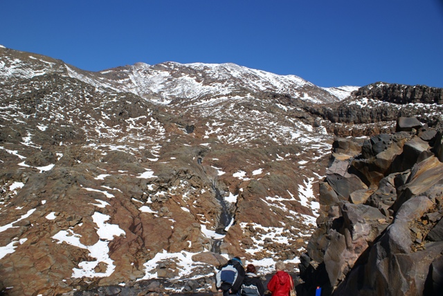
The second chair lift takes you up to 6,565 ft where we
were able to climb on the partly snow covered mountain and take in the
magnificent views down around us and up at the white snow-covered mountain
against the bright blue sky. Quite an experience for us from the flat
lands of southern England. Later, when coming down in the chair
lift and facing down the mountain, we had the video camera running the
whole time to catch the views.
Once down there was just time to try and drive
right round the roads that circle the national Park, so we could see the
mountains from all sides. At least we thought there would be time - the
last half an hour was in the dark, so not quite a perfect day, but not
bad! As an aside, village names in NZ can sometimes be a little lacking in
inspiration. One of the villages on the road surrounding the
National Park is called 'National Park', a bit like the village at the
Fox glacier being called 'Fox Glacier'. Still, they're a lot
easier to pronounce than most of the names here! 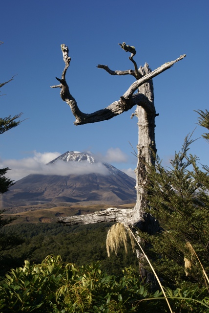 Mt Doom,
almost framed!
 The perfect volcanic cone of Mt Doom
(Mt Ngauruhoe), 7445ft high and not a hobbit in
sight!
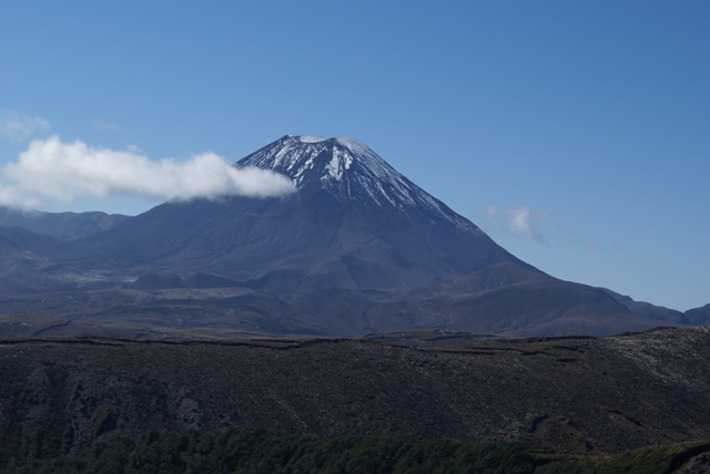
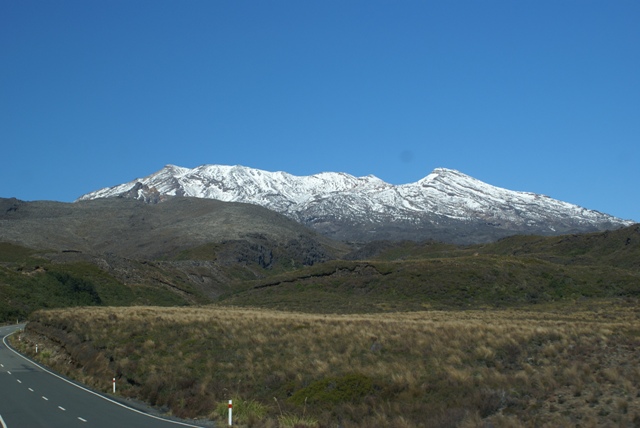
 Mt Ruapehu at 9,090 ft - the highest
mountain in the North Island. One of many photos - with no
clouds
on the mountain we
kept stopping to take photos in case it clouded
over by the time we actually got to it.
We didn't have to worry - no clouds all
day.
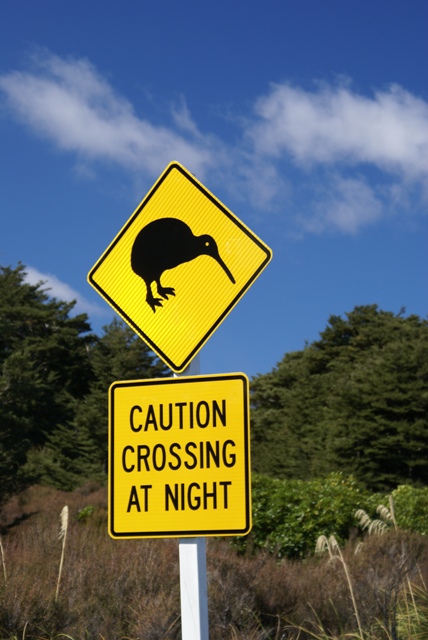 Kiwis (the bird that is!) are very rare and
nocturnal. So we didn't
see any in the wild. This sign on the road
to Whakapapa suggests
they're about in this
area.
 Getting a bit
closer.
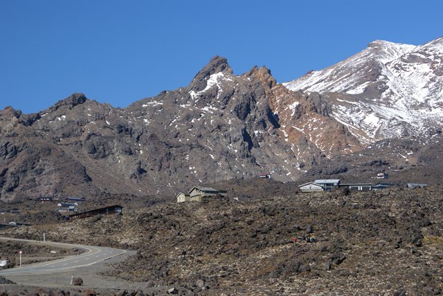 Base camp - the ski centre where the road
ends. To go any higher you have to walk, or get a
lift!
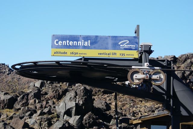 The first chair lift, starting at 5,298ft
and rising 439ft.
 Baskets on poles!
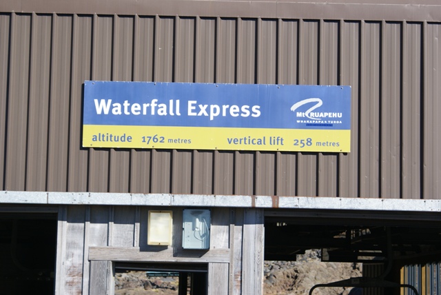 The second chair lift, at 5,727ft, rising
another 839ft, to 6,565ft (2020 metres).
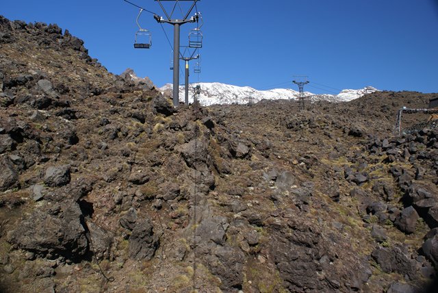
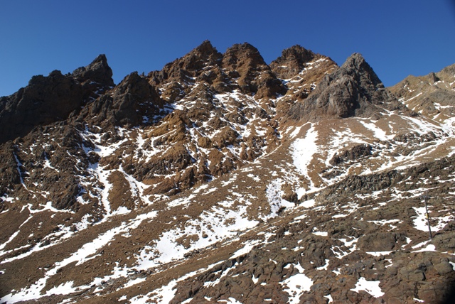 Above and below, the
barren, rugged scenery looking up Mt Ruapehu to the blue sky
above.
 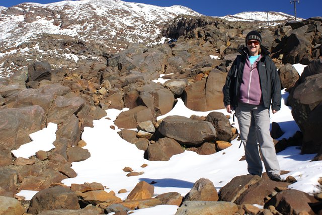 Another intrepid
explorer!
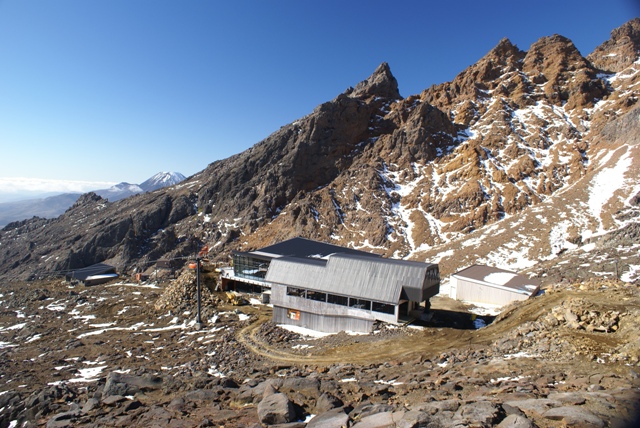 Looking down on the top chair lift station,
and behind it a new cafe/restaurant is being built.
Mt Doom is off to the
left.
 Mt Doom and, with a bit of cloud in the
way, Mt Tongariro.
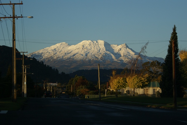 Looking along the road in Ohakune towards Mt
Ruapehu as the sun starts to set. We drove along
the road that goes right round the Tongariro
National Park, so we have photos of the mountains from
every direction, except the last bit, when
it was dark!
|