Pictures of the San Blas
Aurora_b
Mike and Liz Downing
Mon 25 Jan 2010 01:40
|
Now we have wifi we can send pictures. These are a few of the
San Blas Islands. There are over 300 islands scattered along the coast in groups
around cays or reefs. The Kuna Indians live on quite a number of the islands,
but mostly those close to the mainland where they get a lot of their food and
building material from. Some islands have huts shore to shore, others
may just have a few.
 The Western Holandes. Our first landfall in the
San Blas Islands - anchored in 50+ feet of water, it gets deep very
quickly!
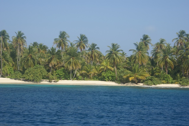
It's thick with palms and
uninhabited.
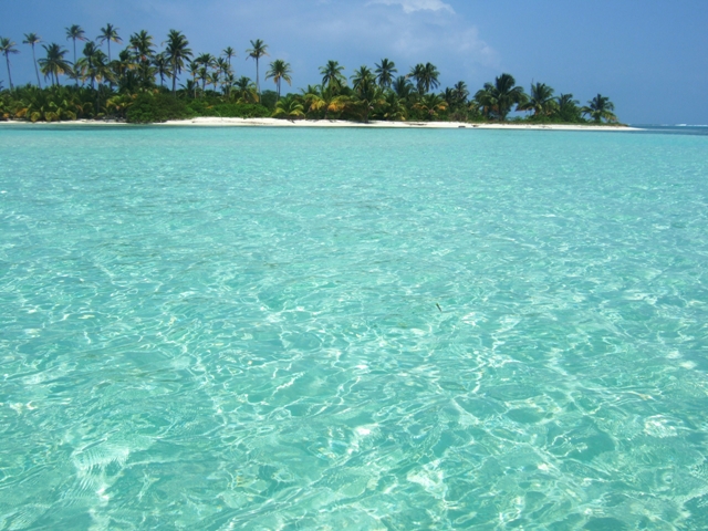 Eastern Holandes. A lovely colour, but very few
fish. We think the Kuna Indians must have over fished the
area.
In the Holandes group there are about 20
separate islands, all connected by a 7 mile long outer reef.
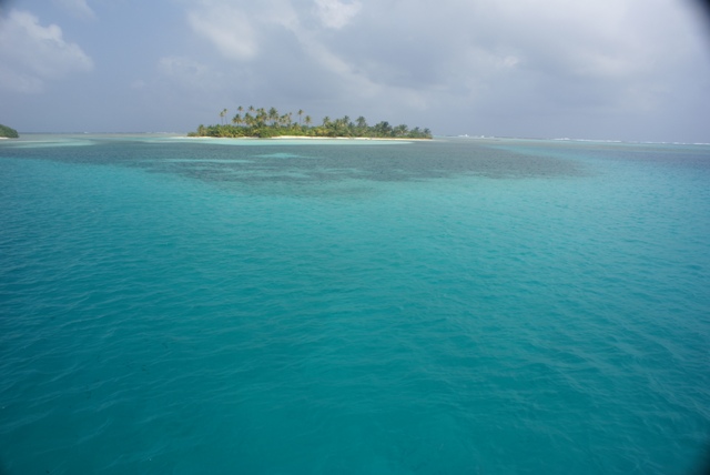 The colour of the sea was a bit special. You can
just see the breakers on the outer reef.
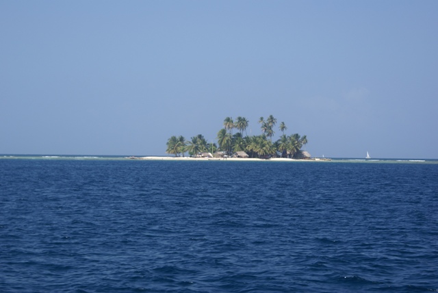 One of the islands close to Porvenir (where we had
to check in), with a few inhabitants.
Once behind the islands there is little swell and
the sea just has a wind blown chop on it.
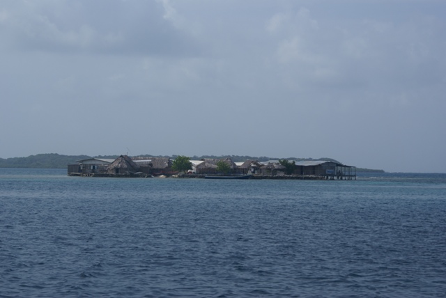 Nalunega - one of the fully inhabited islands we
anchored close to. If the sea level continues to rise, these
will disappear. One of the punishments
issued by Kuna chiefs to
wrong doers is to collect dead coral rubble
to increase the height of the
islands.
 And another inhabited
island.
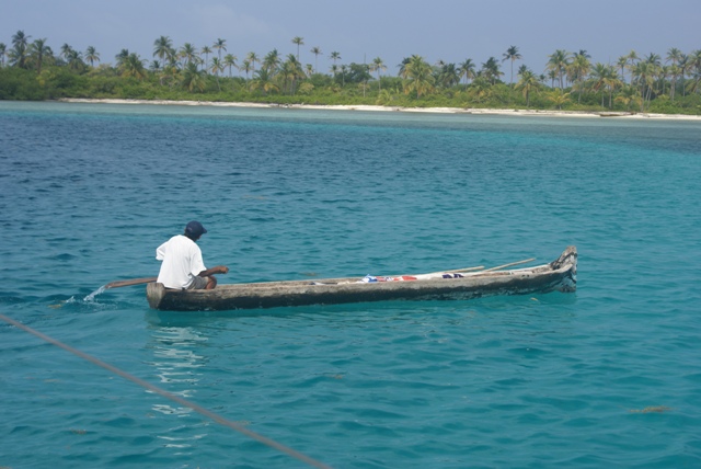 One of the Kunas paddling out to the reef to go
fishing.
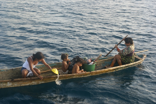 3 generations of the family (we think). They came
alongside to sell molas (fine stitch embroidery, which they
are famous for). The
canoes have to be bailed out
at regular intervals.
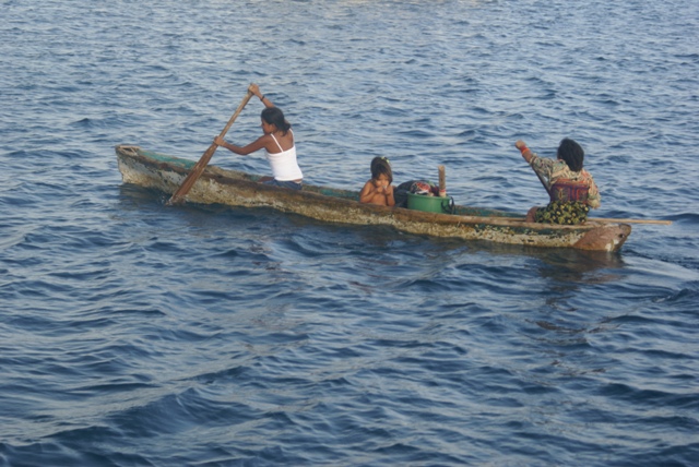 Paddling away after a successful sale - we bought
2 molas!
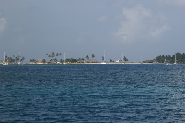 The island of Porvenir and the anchorage in front
of it. The white building is the airport! There is a
grass
runway behind the trees for prop planes. You
cannot anchor in line with the runway as the planes
(one
every day or so) come in just above the water
before touching down.
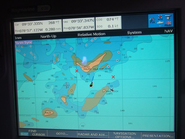 The chartplotter showing Porvenir and us (the
black boat in the middle) in the anchorage. The charts are out by
about
0.1 miles on latitude and 0.25 miles on longitude,
so you can use the chartplotter to get you close, but then it's
eyeball navigation. Never like having a reef just
behind us!
|