Martinique
Aurora_b
Mike and Liz Downing
Fri 24 Apr 2009 13:06
|
Having stayed one night anchored in Prince Rupert Bay in
Dominica the anchor was raised to head south once again, this time for
Martinique. At least we tried to raise the anchor - the windlass struggled and
it came up very very slowly. The problem was that the anchor had
hooked into a bed of dead coral and a huge lump had come up
with it. The lump looked like it ought to just slide off the anchor,
but it wouldn't budge and we were just deciding how we might get rid of it when
a local fisherman in a small boat came past and came to our assistance. A
few blows from a hefty stone that he happened to be carrying broke the coral in
several bits and it did then slide off the anchor. So we were free to head
for Fort de France, the capital of Martinique.
The passage down the leeward coast of Dominica was mixed,
with strong winds funneled down from the hills one minute and no wind at
all the next, In contrast, the open sea passage from Dominica to
Martinique was much more consistent at around 20kts on or around the
beam and we made 7 to 8 kts most of the way, with 2 reefs in the main and the
genoa rolled a according to the wind strength. A squall raised the wind to
28kts and the genoa was rolled away and we maintained 6 to 7 knot under the
double reefed main until in the lee of Martinique.
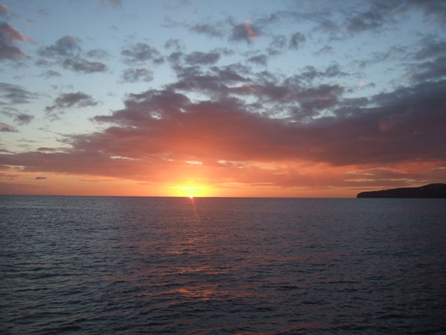 Above and below, sunset at Schoelcher, near Fort
de France, where we anchored overnight.
On the approach to Fort de France we went passed a small
town called Schoelcher as the sun went down. Although there was very little in
the pilot book about it, it looked well sheltered so a quick decision was
made to try anchoring off it rather than enter Fort de France in the dark,
especially as we would be heading south again in the morning to get to Le Marin
on the south coast. Apart from a couple of moored boats we were the only ones
there in what turned out to be a very peaceful bay with a flat sea and just
a gentle swell. 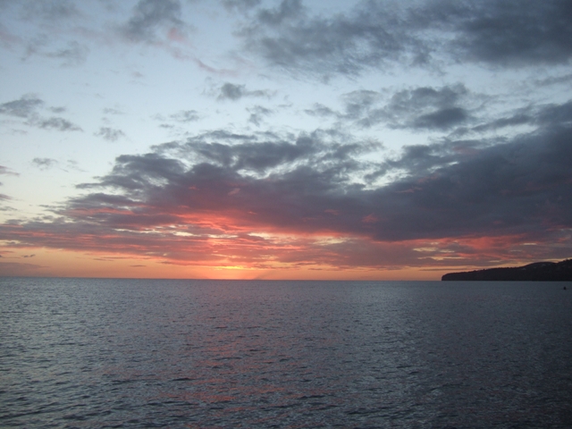 Heading south again the next day, the sail down the remaining
part of the west coast was superb - a strong winds over a flat sea
protected by the land. It wasn't so good though when we had to turn east along
the south coast. The strong wind was now on the nose and we encountered big seas
as we passed Diamond Rock, tacking the last 10 miles or so to get to Le
Marin. When there we found that the charts and GPS were out by about 100
yards. It's not the first time - when anchored in Antigua the GPS put us on
land!
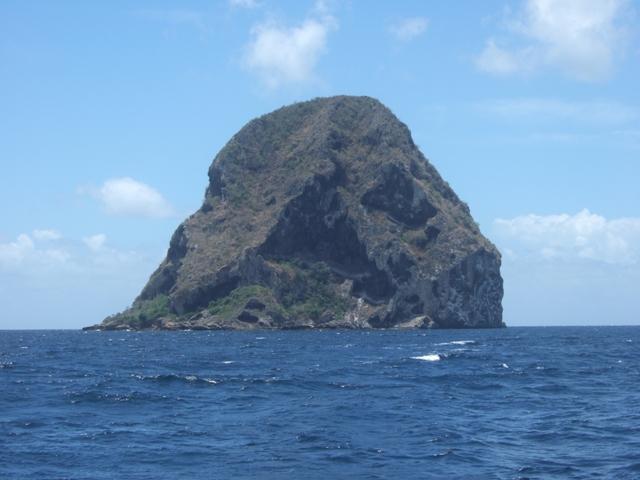 Diamond Rock, on the south west corner of
Martinique.
Diamond Rock is about a mile off the coast. When England was
fighting the French back in Nelson's day, the English fleet in this part of the
Caribbean was based in Rodney Bay St Lucia, about 25 miles to the south of
Martinique and the French were based in Fort de France. The
enterprising English declared Diamond Rock to be a ship and managed to put guns
on it to take pot shots at the French every time they headed south from Fort de
France.
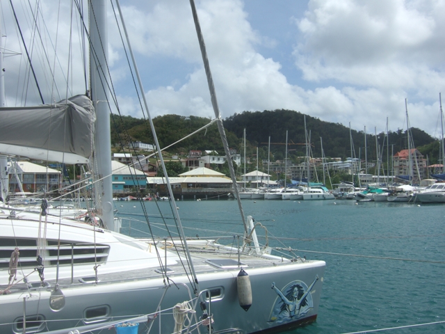
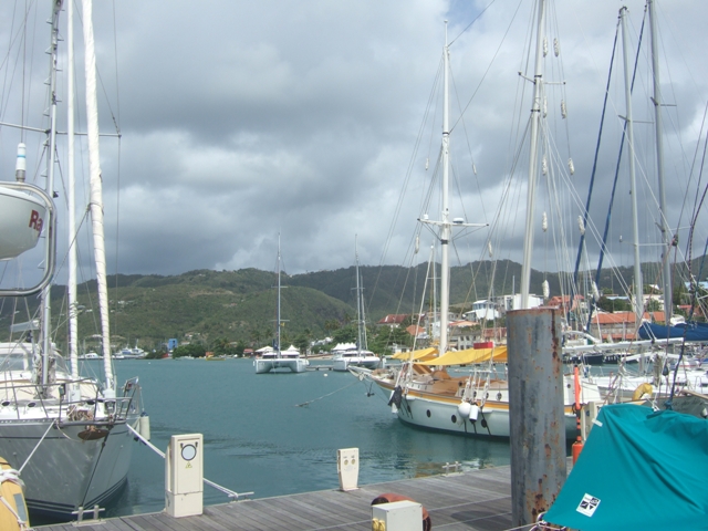
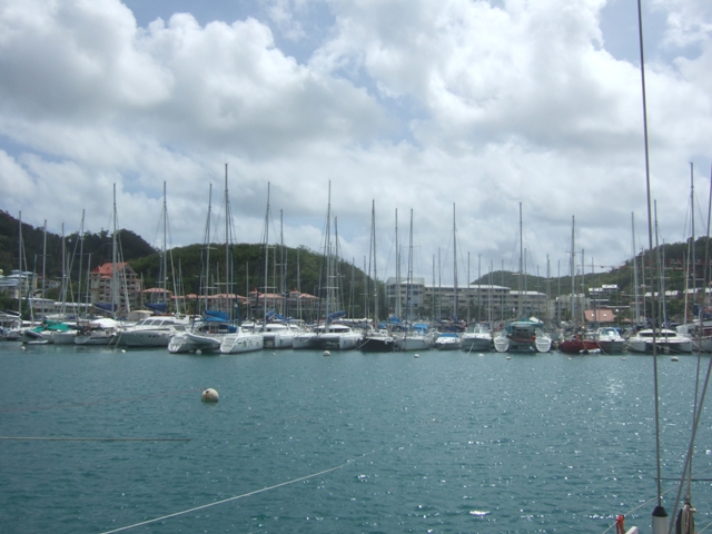 Above and below, views of the big marina at
Marin. We'd never seen so many masts!
Le Marin is the centre of the French yachting industry in this
part of the world. The marina is huge and the base for loads of charter
companies, most of which are chartering catamarans, some very big. Boats are
moored stern to (no finger pontoons) with bow lines out to buoys. Maneuvering
into position with strong winds blowing is definitely a spectator sport
- good when you're watching, not so good when everyone is watching you! We
did it without a mishap, but the bow thruster has never worked harder and the
marina staff did tie our bow line to the buoy, which helped.
  We stayed in the marina a few days to carry out maintenance
work on the generator and then headed south to St Lucia to meet Janice and
Clive, anchoring in Rodney Bay in front of their hotel.
|