South of the Abacos to Little San Salvador, Cat & Long Islands
AJAYA'S CRUISE
Phil & Nikki Hoskins
Fri 12 Mar 2010 21:53
|
After 7 weeks sailing in the Abacos we slipped
out of Little Harbour Cut, sailing into the deep Atlantic once more with the
plan to head south 180 miles to Conception Island, which is part of the Bahamas
National Park and lying in the out-island chain. The forecast was ideal for
getting there and with the wind due to veer into the east or southeast we could
spend a few glorious days anchored near the reef on the west side. The plan
would have worked but Skip miscalculated the speed we would make during the 180
mile trip and despite slowing the boat down we were so much in danger of
arriving in darkness that plan B was conceived, but not before catching a
reasonably sized tuna. In fact we had one on each line we were trolling but King
Neptune must have decided that we were being greedy, so let one
escape.
Plan B was to run down the east side of Eleuthera
Island, over 'The Bridge' a shallow bank that runs 10 miles in an east to
west direction from Little San Salvador to Eleuthera, where the
depths either side are measured in 1000's of feet but only 60 feet on the
shallow ridge. Rather like being on top of a mountain with almost vertical side
slopes. That promised to be interesting!
Pushed by approx 20+ knots of wind (our wind speed
indicator has not functioned properly for some time) we steadily ran southwards,
having already counted one cruise ship, the Noordam, heading in the same
direction and, according to our AIS information, heading for exactly the
same destination - Little San Salvador. A small island 4 miles long by one
mile wide, leased by Holland America Lines for its own and presumably other
cruise liners to use as a tropical island day excursion. Conditions on 'The
Bridge' when we approached were boisterous as the wind was still
blowing somewhat more than we would have liked, so we hunkered down,
shut the cockpit entrance and put on harnesses as we steered our
way through the steep seas banking up over the shallows. We took not one drop of
water onboard but it was not a manoeuvre we would want to make a habit
of doing. A mile later and we were back into deep water, sailing direct
for the anchorage at Half Moon Cay, with not only the Noordam maintaining
position off the beach but a sistership, the Westerdam already at
anchor.
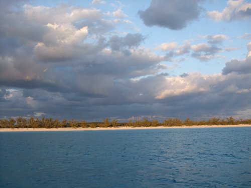
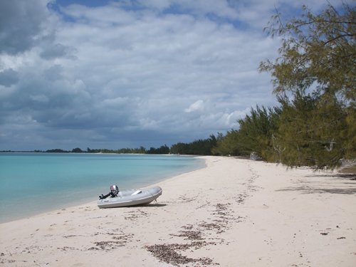
The water in the bay was crystal clear, the beach
typically tropical, with fringing palms, but also with a thousand sun beds laid
out between the trees. There was a steady stream of attendant boats ferrying
passengers back and forth between the quay and the two ships. Ashore there
were couples walking the beach or lying on sun beds, but we suspect that
either the ships were almost devoid of passengers or that relatively few
could be bothered to brave the cool stiff breezes blowing onto the beach. In
some ways the view from ship to shore from a sheltered private balcony was far
better than the opposite perspective.
   Dam cruise ships - the Westerdam &
the
Nordam
The beach at Half Moon Cay - Little San
Salvador
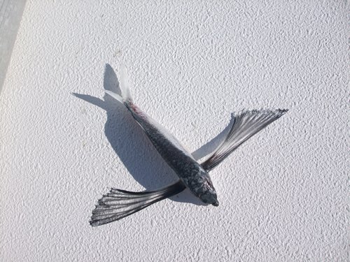
Sad end for a little flying fish - crashed and
burned!
By late afternoon both ships had departed. One
heading for Grand Turk and the other for Florida ready for another turnaround.
The scene afterwards was of frantic activity with beach clearing and
sun bed organising by the shore staff that run the resort full time. It's their
job to make sure all the 'toys' and facilities are ready for the next
cruise ship. As for us - Tuna was on the evening menu. We had also inadvertently
got in the way of two flying fish at some point during the trip - their
stiff bodies baked by the sun, but they were returned from whence they came. As
for the Tuna, best attempts to get the barbecue alight failed in the strong
breeze, so it was into the oven at short notice. It still tasted great
though.
Early next morning a large shape loomed as the
cruise ship 'Carnival Liberty' approached the anchorage ready for her day
at Little San Salvador. It took a good hour to correctly position the ship in
the thin stretch of water that defines where such a monster with almost 30'
draft can anchor. The margin for error is small as the bay is shallow -
with a 300 yard strip that a ship can sensibly lay its anchor before
the ocean floor descends to over 1000'. Getting the anchor down
in the correct place is critical, but any cruise line captain probably
enjoys the challenge it presents.
We left shortly after seeing 'Carnival Liberty'
finally come to a halt, as we were now heading for Cat Island, a distance
of 30 odd miles south-eastwards. As we passed close to the cruise ship Nikki
trained the binos on the bridge and was startled to see one of the officers
looking at her through his binos - so she waved, and he then waved back. We
wonder if he was envious that we could come and go at leisure and not be on a
structured itinerary as he would have been.
We had two early strikes on the trailing lure
but afterwards nothing more. Early afternoon we dropped anchor in New Bight, a
small settlement at the southern end of Cat Island known not only for being
where the highest point in the Bahamas is situated (just 60 metres high) but
where the Hermitage of Father Jerome could be visited on top of that highest
point. In the bay was just one other yacht,a trimaran, the
crew greeted us with enthusiasm as they hadn't seen any cruising
yachts for days.
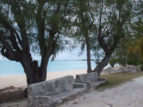
   New Bight on Cat Island - the Hermitage
sits on top of the
hill The beach
at New
Bight
Driftwood of enormous proportions
Farther Jerome was an English Anglican priest who
arrived in the Bahamas in 1908. He subsequently took up the Catholic faith in
Rome, having left the islands for some years, travelling to Canada and
Australia but returned to the Bahamas in 1939. He left an enduring legacy
of reconstructed catholic churches based on Greek Island church architecture,
replacing the vulnerable wooden churches that were prone to the ravages of
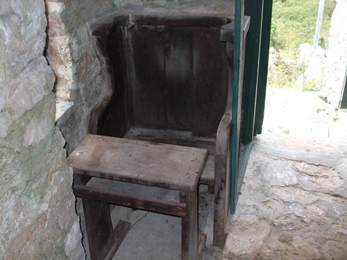
hurricanes. Finally, he constructed his Hermitage which consists of a tiny
church barely 10' by 6' with a single seat and desk for him to worship at.
Attached to the church is his dwelling, no room being much larger than the
church, with his bedroom being a diminutive 6' by 5'. Certainly no
room for guests! Here he lived out the remainder of his life, having achieved
great things for the peoples of these islands.
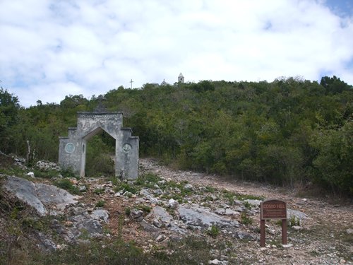  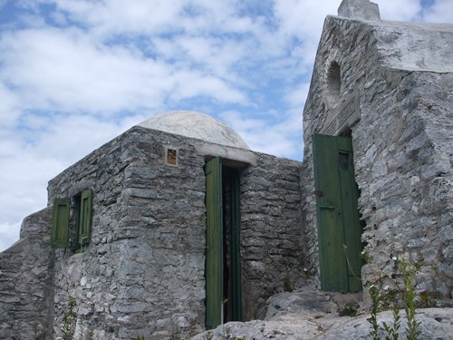 Approach to the
Hermitage
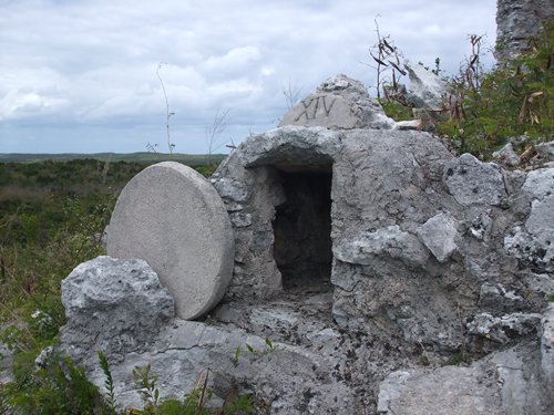
Farther Jerome's depiction of Christ's tomb with the stone rolled
away Chapel on right - living
quarters on the left
 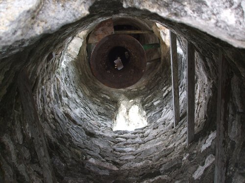  Bell tower next
to chapel
......still with bell
installed
Farther Jerome's prayer seat and desk inside the
chapel
We were lucky to have the site to ourselves which
gave us a wonderful feeling of tranquillity with just butterflies and lizards
around us (although somebody had written in the guest book to be wary of the boa
guarding the entrance - snakes again!) We certainly didn't see one - thankfully.
Further down the hill slope on the eastern side
we came to the cave that Father Jerome lived in whilst building the Hermitage.
We wouldn't have spent a single night in there so our respect for the priest
rose tenfold! Father Jerome died in 1956 and was buried barefoot in a bare
grave (i.e coffin-less!). On the way back down to sea level we passed the ruins
of an old slave plantation house, abandoned many years ago. We were informed
there was a slave cemetery nearby but didn't visit.
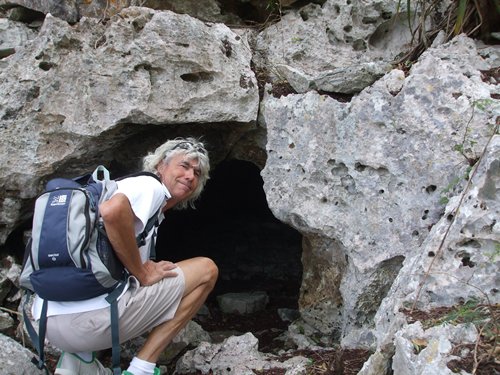 
Phil peers into the cave where Farther Jerome lived whilst building the
Hermitage
Ruined plantation house overlooks the bay at New
Bight
Back at sea level we walked the beach, bought some
bread and were mischievously 'escorted' by 3 small
scheming schoolgirls who had just left their primary school to walk home.
We had previously walked past their school which is situated right on the beach.
What a great place to spend playtime! They chattered non-stop to us and
between themselves until we parted company by our dinghy which was pulled up the
beach. We motored back to the boat, spying a small armada of
yachts approaching the bay. It was getting busy, so time to move on, but
not before another beautiful night where this time the barbecue behaved and it
was grilled Tuna for two!
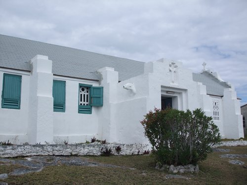  Catholic
church at New Bight - built by Farther Jerome - Nikki loved the fish
gargoyle Stone
seats by the roadside
Next stop on our 'out island' tour was Long Island,
situated around 30 miles from New Bight. We part sailed and part motorsailed
across the deep blue Atlantic seas and continued down to Bains where we anchored
in a large shallow bay. One significant aspect of this leg was that it took
us below the Tropic of Cancer, the line at latitude 23.29.5N. which defines
actually being 'in the tropics'. This was a working stop as the hulls were
beginning to look like a colourful octopus's garden, especially where the sun's
rays had penetrated beneath the water. It was on with the dive suit, plug in the
compressor and spend 3-4 hours under the boat, standing on the sandy seabed
scrubbing the hulls. Fortunately it all came off easily and we can now continue
without taking our scenic garden along with us.
With another front approaching we needed some
shelter and the only place easily accessible on Long Island's west coast is at
Salt Pond in Thompson Bay. Even then the shelter is tenuous, being behind tiny
rocky islets out in the bay, but it would have to do. And so, today the boat is
pitching up and down in 20-25 knot S-SW wind driven seas with another day of it
to come tomorrow when the wind shifts into the northwest with the arrival of the
cold front. We can then hide behind the northern end of the bay where
there is good shelter. We did get ashore yesterday walking the half mile
across the island to the eastern shore where the Atlantic rollers crash onto the
reefs. In the distance we could see a yacht sailing to its destination, in the
scrubby dunes the ruins of a light aircraft that crashed many years ago. On
the beach tons of flotsam washed up from distant shore, most of it plastic - a
reminder of just what a curse the stuff is when it's usefulness
to people on distant shores has expired .
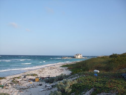 
East coast of Long
Island
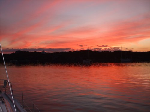
Dramatic cloud formation - pink tinged
From here we head to Georgetown and into the Exumas
Cays where there is more frontal protection available. So they say! But still
beautiful sunset to enjoy of course!
   |