Queen Charlotte Track
The Queen Charlotte Track is a 72km walking and mountain biking track that runs along the peninsula between Kenepuru Sound and Queen Charlotte Sound. It is normally walked over between 3 and 5 days and, as well as campsites, there are lodges along its length with water taxi access. This gives the option of walking with just a day pack, having your overnight bags transported to your lodge by water taxi and having all you meals provided. This made it an attractive proposition so we arranged a marina berth in Picton for Serenity, sorted out dates and accommodation with Wilderness Guides and finally arranged the weather.
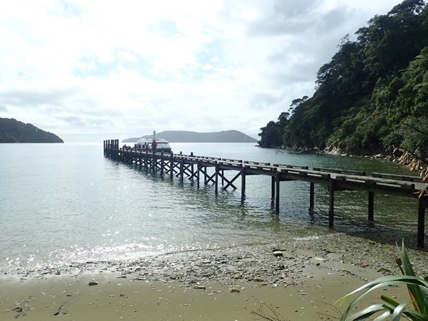
The track runs from Ship Cove at top right on the map to Anikawa at bottom left. The marked route is from our tracker with the different days in different colours Sunday – Ship Cove to Furneaux Lodge: 16km, 637m height gain, 4.5 hours Wilderness Guides collected us from the marina jetty at 8.15 and drove us to their office for a quick briefing before we climbed onboard the ferry for the hour long trip to Ship Cove. It was still raining while we were on the boat but stopped at 10.00 just as we landed and as forecast. Ship Cove was named by James Cook who used it for re-provisioning and repairs five times between 1771 and 1777, with his ships Endeavour and Resolution. The area is also significant in Maori legend, with one tale being that Kupe chased a giant Octopus south from North Island and the sounds were formed where the Octopus held on to the land in their battle. It is also here that Maui fished up the North Island using a special fishhook made from his grandmother’s jawbone.
The ferry drops us off at Ship Cove
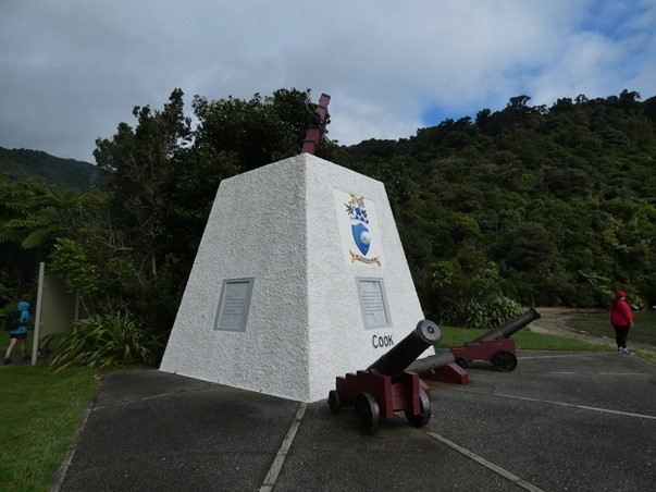
The Cook memorial
Carving depicting Kupe’s battle with the giant octopus We set off last of the eight walkers who had been brought over on the ferry for a steady climb to the Ship Cove lookout with views out of Queen Charlotte Sound towards North Island (not visible today) and to Resolution Cove. We then had to loose all the height we had gained as we walked down to Resolution Cove and around its head. This section of the trail was lovely, through native forest. Many areas of the Sounds have regenerating forest after having been used for agriculture, but this section had never been farmed.
There was the sound of running water everywhere this day as streams tumbled down the hillside to the bays. It even drowned out the ever present sound of cicadas! We had another climb of similar height to the first to the Tawa Bay lookout from where there was a steady descent along the side of Endeavour Inlet to Furneaux Lodge and our first night’s stop, where our bags were waiting for us in our room. The lodge was built in 1910 and the original homestead is the dining room and bar for the resort. Our winter neighbours from Whangarei, Brett and Linda on Seabee, were anchored off and we had a good catch up with them before dinner. Food and accommodation at the lodge were lovely.
Furneaux Lodge, with our room in the black building to the right of the homestead Monday – Furneaux Lodge to Punga Cove: 14.5km, 267m height gain, 4.5 hours This was the easiest day of the track, following the edge of Endeavour Inlet with only short hills. There was a side track at the top of the inlet to disused antimony mines, so we had a look. All there was to see was a sign warning you to stay out of the mine shaft. We got to Punga Cove early in the afternoon so spent a relaxing couple of hours in the sun outside our chalet. Punga felt more like a resort than Furneaux Lodge, with a swimming pool and spa, and was a bit more noisy during the day. We chose to eat early after our last visit when there was a long wait for service – a good move as there was a large guided group in later. The food was very good again.
On the antimony mine track.
Looking out down Endeavour Inlet
One of the chalets at Punga Cove Tuesday – Punga Cove to The Portage: 25km, 994m height gain, 7hours 10 minutes This day is known as The Big Day and starts with a steady climb away from Endeavour Inlet on road to Kenepuru Saddle with views down Kenepuru Sound and then on up on the track proper until, at the top of the climb, there was an optional diversion to Eatwell’s Lookout. This side track was a steep climb taking 30 minutes return and was worth the effort for the view.
Looking down Kenepuru Sound. Our finish point for the day at Portage is behind the island in the middle of the picture
Looking north east along Queen Charlotte Sound from Eatwell’s Lookout. This view made the whole 4 days worthwhile! From the lookout the track follows the ridgeline – switching sides so we were sometimes overlooking Kenepuru Sound and at other times Queen Charlotte, happily never going all the way down to sea level. After a descent towards Bay of Many Coves we climbed back up past a view point and shelter, followed by a long steady descent and a final big climb to Black Rock, overlooking Kumutoto Bay where we had been moored on Friday night, then a final descent following round the headland above Kaipakirikiri Bay (another mooring spot we’ve used) to Torea Saddle. At this point the narrowness of the isthmus and the low saddle made this a favoured crossing point for Maori sailors, hence the name Portage. From the saddle it was a 15 minute walk down the road to The Portage on the shores of Kenepuru Sound.
The track passes Black Rock
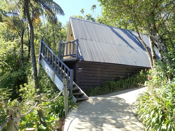
Our chalet at Portage The wind had picked up during the day and it was quite blowy at Portage, but the sun on the sheltered deck outside our room was beautiful. Wednesday – The Portage to Anikiwa: 21.7km, 956m height gain, 6 hours 40 minutes The final day was another long ridge walk with 3 climbs, the first beginning with a return trip up the road to the saddle and then continuing steeply through regenerating forest. This seemed steeper and harder than anything on the big day, but maybe it was just 4 days of walking having their effect. A long descent was followed by what could have been a shorter climb but we chose to do another diversion – an extra half hour return to Onahau Lookout, then after going down to Te Mahia saddle we had a gentle climb along the side of Mistletoe and Onahau Bays and we were on the final stretch. Down to the campsite at Davies Bay then up and down alongside Grove Arm to Anikiwa, at the head of Queen Charlotte Sound. The Coffee Truck was open so we rewarded ourselves with a coffee (Phil) and ice-cream (Sarah) and a swap of tales and impressions with some of our fellow walkers who were also waiting for boats back to Picton.
The last section of track through lovely beech forest alongside Grove Arm
Almost at the end – looking out along the length of Queen Charlotte Sound from the Davies Bay campsite We finished almost an hour and a half before our boat was due, but it arrived early and there were enough passengers there already so the boatman was happy to leave straight away and we were back in Picton and being driven back to Serenity before 3.30pm. It was a good walk and well worth doing, particularly only carrying day sacks. Apart from a blister each we only had slightly aching muscles on Thursday morning, though we decided to give the hill overlooking Picton a miss. |