The Ascent of Mount Hobson. 36:11.S, 175:21.7E
|
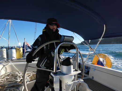
After a week in Whangerai the wind was forecast from the South West, which is a perfect direction for sailing to Great Barrier Island, so we spent a night anchored down river and set off early in the morning to sail the 42 miles south east to the island. The wind turned out to have more south in it than the forecast so we had a boisterous windward sail and needed one short tack to sail into Port Abercrombie where we had to put on the engine and motor the final couple of miles to our anchorage.
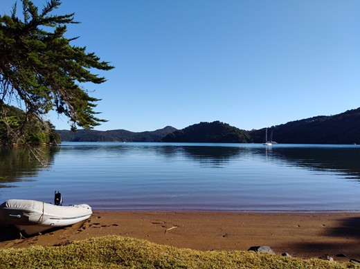
Southerly winds come straight from the Antarctic. We needed all our clothes to keep warm. Great Barrier Island is sparsely populated (Port Abercrombie is just a large bay with no port faciliites). There were half a dozen buildings around Kaiaraara Bay, where we anchored, but we didn’t see any lights from them at night and apart from a catamaran anchored at the far side of the bay we were alone. The first night we saw a bright light on the hills to our east, which turned into a huge full moon rising. We had quiet day, enjoying the peace after a week in town. Then the next day set out for an attempt on the summit of Mount Hobson.
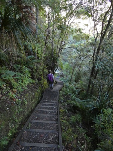
Kaiaraara Bay with Serenity swinging peacefully to her anchor Like many of the walking tracks in New Zealand this was a prepared trail, with gravel paths, swing bridges and steps. This is partly to protect the environment and keep your feet away from ground nesting birds, and sometimes seems like the only way to get a trail up to a summit through the forest. This path was an incredible engineering feat, with long steep stairways winding their way up and down between the trees. And there were steps - lots of them.
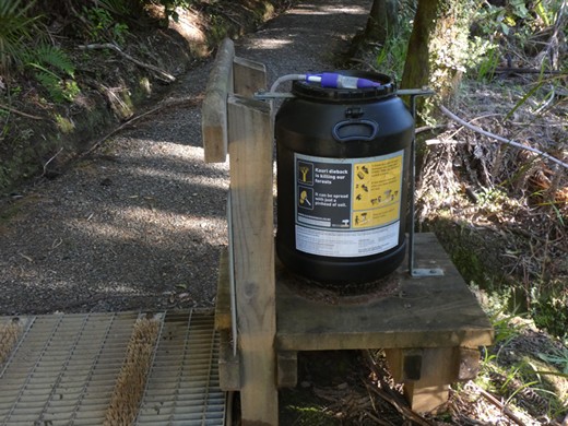
The massive Kauri trees were harvested almost to extinction, and the remaining trees are now
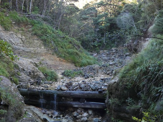
at risk from Kauri Dieback, so footpaths have stations where you can clean and sterilise your boots The trail took us up beside a river to the site of an old Kauri dam. The logging companies would collect felled tree trunks behind the dam and then open the dam to let the water carry the wood down river. Given the size of the trees the water pressure needed to move them must have been immense.
The base of the Kauri dam. The structure was built above this with doors in the middle that
could be opened to let the water and trees through. After the dam we began to climb through the trees, crossing streams on swing bridges
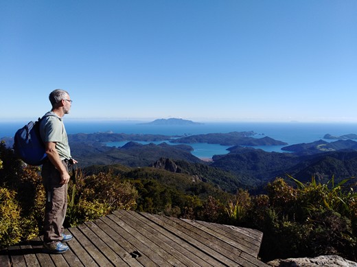
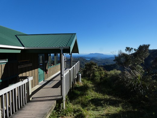
The summit platform on Mount Hobson. We don’t like going back the way we have come, and Phil had seen a map showing a trail that made up a circular walk, so we headed off towards the Mount Heale Hut, down steps that disappeared into the green gloom of the trees. Further down we met a couple who told us the descent had 927 steps. The ‘hut’ is one of many across New Zealand maintained by the Department of Conservation, some only accessible on foot and to let you do multiday walks.
Did I mention that there were lots of steps?
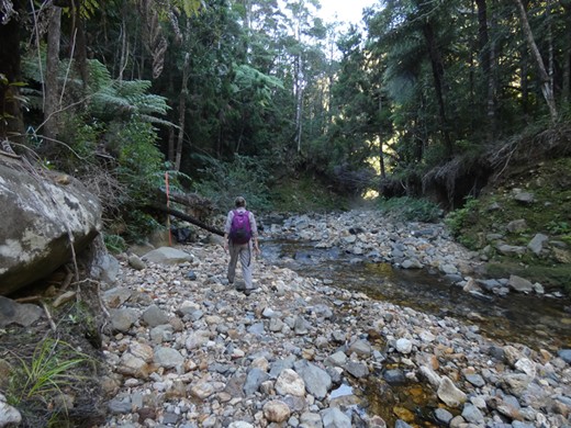
Mount Heale Hut. Imagine sitting on the deck with a beer watching the sun go down. The rest of the route down was enjoyable, with less steps or made up paths than the way up. At one point it followed the bed of a stream (with notices to take care after heavy rain!) and we had half an hour of fun rock hopping our way back and forth down to where the trail went back into the woods.
The sort of trail we prefer
Fun following the stream The forecast was for the next depression to reach North Island at the weekend, so the next day we sailed back to our favourite anchorage at Parua Bay, which we shared with a bright yellow catamaran called ‘Citrus Tart’, and where we spent two days listening to the wind and trying to catch some of the torrential rain to refill our tanks. Then on Monday (a public holiday for the Queen’s birthday) we came back to our berth alongside ‘Serengeti’ in the Town Basin. |