SIRT 3, West Coast and Arthur's Pass. 42:56.3S, 171:33.9E
|
From Able Tasman we drove on down SH6 to the west coast: where the Tasman Sea crashes on to the beaches and rocks of New Zealand. It was an amazinging drive, with forest and mountains to our left and the sea on our right.
You can see the road ahead through the mist from a lookout
The west coast highway runs all along the coast
The waves roll in from the Tasman Sea On the way we stopped at Bullers Gorge where we crossed the longest suspension bridge in New Zealand, built by gold miners to get to the mine, and found a lovely walk on narrow, muddy trails to some rapids higher up the river.
Swing bridge over Bullers Gorge
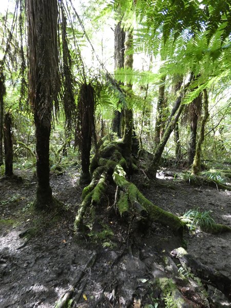
And a lovely muddy woodland walk We stopped at the Paparoa National Park to look at Pancake Rocks, and camped nearby, across the road from the ocean, ready to do a walk in the morning. We decided to check the state of the track we wanted to do, as it had rained all night,
and the young man in the visitor centre told us that all but one of the paths in the park were closed due, to fallen trees resulting from cyclone Gita. The remaining walk was enjoyable, but there were signs of damage everywhere.
Pancake rocks, named because the vertical layers look like a stack of pancakes
Fallen trees had been cleared from the footpath in Paparoa Park Our next stop was Arthur's Pass, on SH73 from Christchurch on the east coast across the centre of the island to the west. Its the northern end of the Southern Alps, and the weather was looking reasonable in a couple of days to tackle Avalanche
Peak. We camped in the DOC campsite in Arthurs Pass Village, just a patch at the end of a car park between the road and the railway, and watched a train with 6 engines come puffing up the hill with 30 freight carriages behind it. Sarah managed to sleep through
the trains and lorries in the night. Arthur's Pass is home to the rare alpine parrot called the Kea, after its screech, there are only 1500 left, but they can be a pest, and the first night we had one around our camp just after dark, too dark to see its colours. We had a short
walk to a waterfall the first day there, returning just before it started to rain, and spent the rest of the day huddled in the car as it didn't stop. Avalanche Peak is 1833 metres high, and we started from 780 metres. We took the 'easier' Scott's Track, and it was soon clear this was not a walk. We were on a trail through the forest, scrambling up a rocky path needing to use hands at
times. When we got out of the trees all that changed was being able to see the drop to the valley.
The mist lifted as we climbed up Scotts Track It had been a misty morning, but it lifted enough that we had great views down the valley, however after three hours of climbing we got close to the cloud and also encountered a rocky ridge which Sarah didn't fancy tackling, particularly
with no chance of a view, so we turned to tackle the descent. On the way down we were treated to the sight of two Kea on a rock beside the track. They weren't concerned by the presence of humans and carried on pecking at the moss even as we were within a couple
of feet of them.
The point at which we turned back
The Kea, one displaying the salmon coloured underside of its wing. By the time we had clambered and climbed back down to the valley we were both ready for coffee and chips in the village cafe. |