Kakadu NP
CuriousOyster
Steve & Trish Brown
Sun 17 Jul 2011 06:39
|
Kakadu NP lies about 75km south of Darwin and
covers about 22,000 sq km.
The park encompasses 6 different landforms, Savanna
Woodlands, Monsoon Forests, Southern Hills and Ridges, Stone Country,Tidal Flats
and Coast as well as the world renouned Floodplains and Billabongs.
Each is different from the other and each provides
habitat for a huge range of plants and animals,
many only found in this area.
The land the park now covers was once home for a
number of different Aboriginal clans, a number of whom have been
wiped out by disease, the impact of being displaced
to the settlements and assimilation into other clans.
The land is once again owned by the Aboriginal
people who manage the park in trust with the Australian NP
authorities.
Patchwork burning of the land has long been used to
control the spread of unwanted plants, clear the soil for new growth to
encourage plants and wildlife that the Aboriginals
harvest for food, to return each year. The European settlers now realise
how important this technique is for controlling the
spread of "hot fires" that not only clear the undergrowth but also burn
large trees and sometimes local
townships.
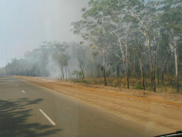 As we are now in the DRY season, much of the land
has been burned off in June and early July. The WET season monsoons
bring torrential rains that cover almost all of the
NP, closing off much of the area and most of the few roads that criss cross the
park.
Flood indicators that show 2m depths are not
unusual and the roads are usually at least a couple of metres above the
surrounding area.
 The Savanna Woodlands are notable for a wide
variety of Termite Mounds of all shapes and sizes, some up to 20ft
high.
 The park also has a number of visitor centres, as
well as Aboriginally run indigenous Culture centres
 |